Enable Location

We need your location to show you interesting places around you

Discover nearby places

Find interesting locations and hidden gems around you

Precise directions

Get accurate directions and distances to places

Your location is never shared with other users. It's only used when you tap the location button.

Pickwick Landing State Park

Log in to your account

Start exploring — it's free

Trusted by 66,042 travelers worldwide

Continue with Google
Continue with Apple
or

We will send you a code to connect

By continuing, you accept our Terms and Conditions and our Privacy Policy

Check your inbox

We've sent a pincode in your inbox. Please enter the code below.

Pickwick Landing State Park
Discussion Reviews 1 Photos
5.3k Popularity

Pickwick Landing State Park, State park on Tennessee River in Hardin County, United States.

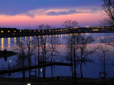
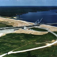
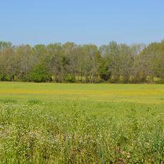
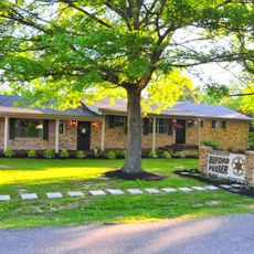
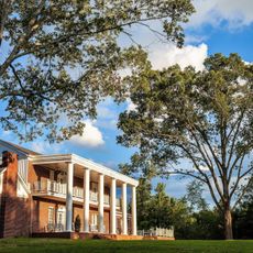
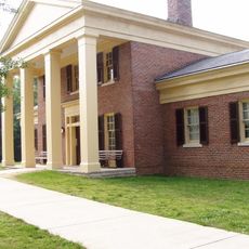
Pickwick Landing State Park is a Tennessee state park in Hardin County, set along Pickwick Lake near the Pickwick Landing Dam and the Tennessee River. The grounds include a lodge, cabins, campgrounds, a golf course, and a marina serving both boaters and anglers.

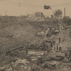
The area served as a key riverboat landing in the 19th century before the dam reshaped the river and the surrounding land. Tennessee took over the site from the Tennessee Valley Authority in 1969 and opened it as a state park.

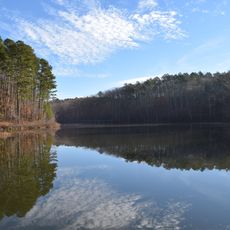
Fishing is part of everyday life here, with families and seasoned anglers returning to Pickwick Lake throughout the year. The boat ramps and docks tend to be busy in the early morning, giving the place a rhythm centered entirely around the water.

The park offers a range of lodging options from campsites to cabins and a guest lodge, so it suits different travel styles. Booking ahead is a good idea in warmer months, as the campgrounds and marina attract steady crowds of anglers and families.

The park sits at the point where Tennessee, Alabama, and Mississippi meet, which means the water conditions can shift noticeably depending on which part of the lake you are on. This geographic crossroads draws several bass species to gather in the same area, something that draws anglers who target specific fish.

The community of curious travelers

AroundUs brings together thousands of curated places, local tips, and hidden gems, enriched daily by 60,000 contributors worldwide.

Start exploring
Location
Inception
1969
GPS coordinates
35.05536,-88.23948
Latest update
March 3, 2026 08:17
Around this place
Woodall Mountain
United States of America

Woodall Mountain

29.8 km
Pickwick Lake
United States of America

Pickwick Lake

4.5 km
Natchez Trace Trail
United States of America

Natchez Trace Trail

45.3 km
Tishomingo State Park
United States of America

Tishomingo State Park

50.3 km
Cherry Mansion
United States of America

Cherry Mansion

19 km
Shiloh Indian Mounds Site
United States of America

Shiloh Indian Mounds Site

12.1 km
Bay Springs Lake
United States of America

Bay Springs Lake

54.4 km
Big Hill Pond State Park
United States of America

Big Hill Pond State Park

44.5 km
Siege and Battle of Corinth Sites
United States of America

Siege and Battle of Corinth Sites

27.9 km
Shiloh National Cemetery
United States of America

Shiloh National Cemetery

12.9 km
Riverton Lock
United States of America

Riverton Lock

23.7 km
Falls Mill
United States of America

Falls Mill

20.1 km
Veranda House
United States of America

Veranda House

28.9 km
Midtown Corinth Historic District
United States of America

Midtown Corinth Historic District

28.6 km
Pocahontas School
United States of America

Pocahontas School

51.5 km
Church of Our Saviour
United States of America

Church of Our Saviour

27.5 km
Bethel Springs Presbyterian Church
United States of America

Bethel Springs Presbyterian Church

38.8 km
United States of America

James Graham House

11.9 km
James Martin House
United States of America

James Martin House

55.7 km
Downtown Corinth Historic District
United States of America

Downtown Corinth Historic District

28.9 km
Downtown Booneville Historic District
United States of America

Downtown Booneville Historic District

53.4 km
Meady White House
United States of America

Meady White House

36 km
Mulberry Creek
United States of America

Mulberry Creek

44.4 km
Buford Pusser Home & Museum
United States of America

Buford Pusser Home & Museum

23.6 km
Shiloh Chennault Bed and Breakfast - Plantation - West Tennessee - Boutique Hotel
United States of America

Shiloh Chennault Bed and Breakfast - Plantation - West Tennessee - Boutique Hotel

28.8 km
Tennessee River Museum
United States of America

Tennessee River Museum

18.9 km
Shiloh National Military Park Visitor Center
United States of America

Shiloh National Military Park Visitor Center

13.1 km
Tishomingo State Park Historic District
United States of America

Tishomingo State Park Historic District

50.6 km
Show the full map
Reviews
Share your experience

No review yet

Discussions
Start a discussion...

No discussion yet

« Pickwick Landing State Park - State park on Tennessee River in Hardin County, United States » is provided by Around Us (aroundus.com). Images and texts are derived from Wikimedia project under a Creative Commons license. You are allowed to copy, distribute, and modify copies of this page, under the conditions set by the license, as long as this note is clearly visible.

Discover hidden gems everywhere you go!

From secret cafés to breathtaking viewpoints, skip the crowded tourist spots and find places that match your style. Our app makes it easy with voice search, smart filtering, route optimization, and insider tips from travelers worldwide. Download now for the complete mobile experience.

Around Us App Screenshot

A unique approach to discovering new places

Le Figaro

All the places worth exploring

France Info

A tailor-made excursion in just a few clicks

20 Minutes

Around Us
Travel Guide & Maps
Download

Send to your phone

QR Code
1

Open the camera app on your mobile.

2

Point at the QR code with your camera. A notification will appear.

3

Tap the notification to open the link.