Enable Location

We need your location to show you interesting places around you

Discover nearby places

Find interesting locations and hidden gems around you

Precise directions

Get accurate directions and distances to places

Your location is never shared with other users. It's only used when you tap the location button.

Bay Springs Lake

Log in to your account

Start exploring — it's free

Trusted by 62,454 travelers worldwide

Continue with Google
Continue with Apple
or

We will send you a code to connect

By continuing, you accept our Terms and Conditions and our Privacy Policy

Check your inbox

We've sent a pincode in your inbox. Please enter the code below.

Bay Springs Lake

Bay Springs Lake, body of water

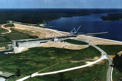
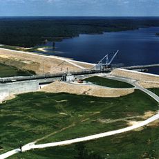
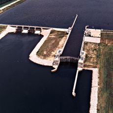
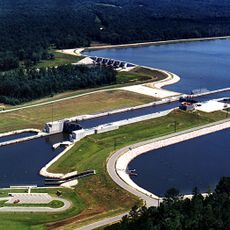
Bay Springs Lake is a large reservoir in Tishomingo County in northeast Mississippi created by the Jamie Whitten Lock and Dam. The lake stretches about 9 miles long and serves as part of the Tennessee-Tombigbee Waterway, with wooded shorelines and calm waters suitable for boating and fishing.

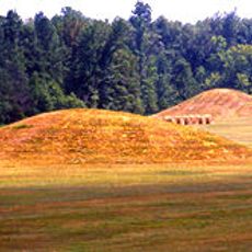
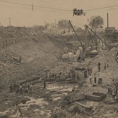
The area has a long industrial past dating to 1862 when the Bay Springs Union factory operated sawmills, gristmills, and textile operations before being destroyed by fire in 1885. The region also held significance for Native Americans, as evidenced by ancient rock shelters used for thousands of years.

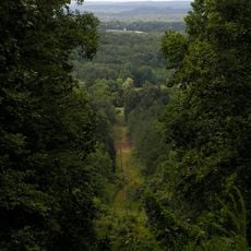
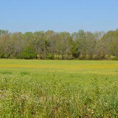
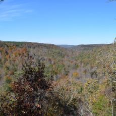
The name Bay Springs refers to the natural springs that feed the water in the region. Visitors come here to experience a quiet setting where water and woodland create a place for outdoor activities and reflection.

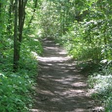
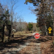
The lake is easily reached from the Natchez Trace Parkway at milepost 293.4 by heading north for less than half a mile. Visitor facilities include a center with information, campgrounds, and parks with boating access, fishing areas, and hiking trails nearby.

Ancient rock shelters used by Native Americans for thousands of years remain visible in the area today. These archaeological sites reveal the deep human history of the place long before the modern reservoir was created.

The community of curious travelers

AroundUs brings together thousands of curated places, local tips, and hidden gems, enriched daily by 60,000 contributors worldwide.

Start exploring
Location
GPS coordinates
34.57100,-88.31600
Latest update
February 7, 2026 11:40
Around this place
Elvis Presley Birthplace
United States of America

Elvis Presley Birthplace

48.1 km
Woodall Mountain
United States of America

Woodall Mountain

25.1 km
Pickwick Lake
United States of America

Pickwick Lake

53.4 km
Natchez Trace Trail
United States of America

Natchez Trace Trail

23.5 km
Tishomingo State Park
United States of America

Tishomingo State Park

12.1 km
Tupelo Automobile Museum
United States of America

Tupelo Automobile Museum

49.3 km
Pharr Mounds
United States of America

Pharr Mounds

14.9 km
Siege and Battle of Corinth Sites
United States of America

Siege and Battle of Corinth Sites

46.5 km
Tombigbee State Park
United States of America

Tombigbee State Park

46.8 km
Jamie Whitten Lock and Dam
United States of America

Jamie Whitten Lock and Dam

5.5 km
Cane Creek Canyon Nature Preserve
United States of America

Cane Creek Canyon Nature Preserve

48.1 km
Riverton Lock
United States of America

Riverton Lock

42.9 km
Fairpark
United States of America

Fairpark

49.7 km
Veranda House
United States of America

Veranda House

44.8 km
Overton Farm
United States of America

Overton Farm

38.8 km
Fulton Lock
United States of America

Fulton Lock

36.3 km
Midtown Corinth Historic District
United States of America

Midtown Corinth Historic District

44.7 km
G. V. Montgomery Lock
United States of America

G. V. Montgomery Lock

12.8 km
Church of Our Saviour
United States of America

Church of Our Saviour

29.2 km
North Broadway Historic District
United States of America

North Broadway Historic District

49.8 km
First Methodist Church
United States of America

First Methodist Church

50.1 km
Downtown Corinth Historic District
United States of America

Downtown Corinth Historic District

44.5 km
Downtown Booneville Historic District
United States of America

Downtown Booneville Historic District

24.5 km
Stewart-Anderson House
United States of America

Stewart-Anderson House

49.8 km
Mulberry Creek
United States of America

Mulberry Creek

44.8 km
Tammy Wynette Legacy Center
United States of America

Tammy Wynette Legacy Center

37.7 km
Downtown Tupelo Historic District
United States of America

Downtown Tupelo Historic District

50.1 km
Tishomingo State Park Historic District
United States of America

Tishomingo State Park Historic District

12.8 km
Show the full map
« Bay Springs Lake - body of water » is provided by Around Us (aroundus.com). Images and texts are derived from Wikimedia project under a Creative Commons license. You are allowed to copy, distribute, and modify copies of this page, under the conditions set by the license, as long as this note is clearly visible.

Discover hidden gems everywhere you go!

From secret cafés to breathtaking viewpoints, skip the crowded tourist spots and find places that match your style. Our app makes it easy with voice search, smart filtering, route optimization, and insider tips from travelers worldwide. Download now for the complete mobile experience.

Around Us App Screenshot

A unique approach to discovering new places

Le Figaro

All the places worth exploring

France Info

A tailor-made excursion in just a few clicks

20 Minutes

Around Us
Travel Guide & Maps
Download

Send to your phone

QR Code
1

Open the camera app on your mobile.

2

Point at the QR code with your camera. A notification will appear.

3

Tap the notification to open the link.