Enable Location

We need your location to show you interesting places around you

Discover nearby places

Find interesting locations and hidden gems around you

Precise directions

Get accurate directions and distances to places

Your location is never shared with other users. It's only used when you tap the location button.

Jamie Whitten Lock and Dam

Log in to your account

Start exploring — it's free

Trusted by 61,867 travelers worldwide

Continue with Google
Continue with Apple
or

We will send you a code to connect

By continuing, you accept our Terms and Conditions and our Privacy Policy

Check your inbox

We've sent a pincode in your inbox. Please enter the code below.

Jamie Whitten Lock and Dam

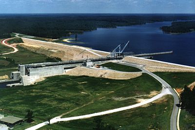
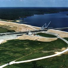
Jamie Whitten Lock and Dam, Navigation lock and dam in Tishomingo County, United States.

Description

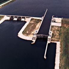
The Jamie Whitten Lock and Dam is a major water control structure on the Tennessee-Tombigbee Waterway that helps vessels navigate significant elevation changes. The lock chamber itself is enormous, allowing large cargo ships to move through these navigation routes.

History

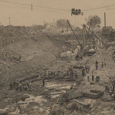
The structure was completed in 1983 as part of a major project to improve shipping in the Southeast. It was named after Congressman Jamie Whitten, who had represented Mississippi for many years.

Culture

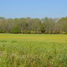
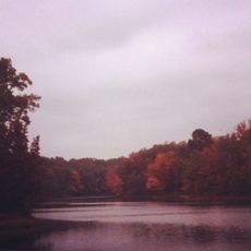
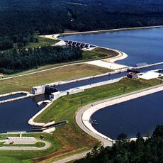
The dam created Bay Springs Lake, a reservoir that draws locals and visitors who come to fish, boat, or spend time along the water. The lake has become central to how people in the region enjoy their free time.

Practical

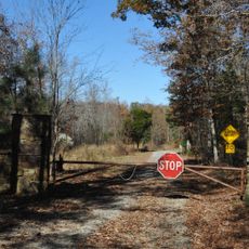
The site is best explored from public viewpoints around the structure, which offer free access to observe operations. Weekday visits tend to be calmer, giving you a better chance to watch the lock work without heavy traffic activity.

Did you know?

The lock uses a single lift system that ranks among the highest in the country, raising and lowering vessels in one motion over tremendous elevation differences. This engineering feat remains little known despite being a remarkable technical accomplishment.

Elevation above the sea
114 m
GPS coordinates
34.52167,-88.32389
Latest update
December 13, 2025 11:46

AroundUs brings together thousands of curated places, local tips, and hidden gems, enriched daily by 60,000 contributors worldwide. Discover all places nearby (Tishomingo County).

Around this place
Elvis Presley Birthplace
United States of America

Elvis Presley Birthplace

43.8 km
Woodall Mountain
United States of America

Woodall Mountain

30.6 km
Natchez Trace Trail
United States of America

Natchez Trace Trail

27 km
Tishomingo State Park
United States of America

Tishomingo State Park

15.4 km
Pharr Mounds
United States of America

Pharr Mounds

10.5 km
Barton Hall
United States of America

Barton Hall

39 km
Bay Springs Lake
United States of America

Bay Springs Lake

5.5 km
Tupelo Buffalo Park and Zoo
United States of America

Tupelo Buffalo Park and Zoo

48.5 km
Siege and Battle of Corinth Sites
United States of America

Siege and Battle of Corinth Sites

51.3 km
Tombigbee State Park
United States of America

Tombigbee State Park

42.1 km
Cane Creek Canyon Nature Preserve
United States of America

Cane Creek Canyon Nature Preserve

49.7 km
Riverton Lock
United States of America

Riverton Lock

48 km
Fairpark
United States of America

Fairpark

45.5 km
Veranda House
United States of America

Veranda House

49.6 km
Overton Farm
United States of America

Overton Farm

36.9 km
Fulton Lock
United States of America

Fulton Lock

30.8 km
Midtown Corinth Historic District
United States of America

Midtown Corinth Historic District

49.4 km
G. V. Montgomery Lock
United States of America

G. V. Montgomery Lock

7.5 km
Church of Our Saviour
United States of America

Church of Our Saviour

34.6 km
North Broadway Historic District
United States of America

North Broadway Historic District

45.6 km
First Methodist Church
United States of America

First Methodist Church

45.9 km
Downtown Corinth Historic District
United States of America

Downtown Corinth Historic District

49.3 km
Downtown Booneville Historic District
United States of America

Downtown Booneville Historic District

26.5 km
Stewart-Anderson House
United States of America

Stewart-Anderson House

45.7 km
Mulberry Creek
United States of America

Mulberry Creek

48.5 km
Red Bay Water Park
United States of America

Red Bay Water Park

18.6 km
Tammy Wynette Legacy Center
United States of America

Tammy Wynette Legacy Center

32.4 km
Downtown Tupelo Historic District
United States of America

Downtown Tupelo Historic District

45.9 km
Show the full map
« Jamie Whitten Lock and Dam - Navigation lock and dam in Tishomingo County, United States » is provided by Around Us (aroundus.com). Images and texts are derived from Wikimedia project under a Creative Commons license. You are allowed to copy, distribute, and modify copies of this page, under the conditions set by the license, as long as this note is clearly visible.

Discover hidden gems everywhere you go!

From secret cafés to breathtaking viewpoints, skip the crowded tourist spots and find places that match your style. Our app makes it easy with voice search, smart filtering, route optimization, and insider tips from travelers worldwide. Download now for the complete mobile experience.

Around Us App Screenshot

A unique approach to discovering new places

Le Figaro

All the places worth exploring

France Info

A tailor-made excursion in just a few clicks

20 Minutes

Around Us
Travel Guide & Maps
Download

Send to your phone

QR Code
1

Open the camera app on your mobile.

2

Point at the QR code with your camera. A notification will appear.

3

Tap the notification to open the link.