Tishomingo County

Log in to your account

AroundUs is a community-driven map of interesting places, built by curious explorers like you. It grows with every review, story, and photo you share.
Connect to save your favorite spots, contribute locations, and create personalized routes.
By continuing, you accept our Terms and Conditions and our Privacy Policy
Add to collection
Map
Suggest a change
Share

Tishomingo County, County seat in northeastern Mississippi, United States

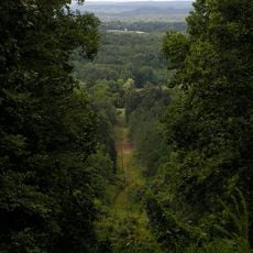
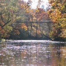
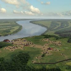
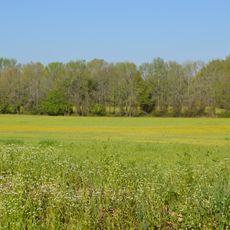
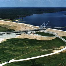
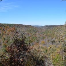
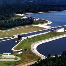
Tishomingo County is located in northeastern Mississippi and spans varied terrain with rolling hills and dense forests throughout. The Tennessee River and Pickwick Lake border the region, shaping both its landscape and water access.

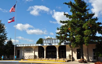
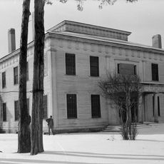
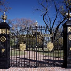
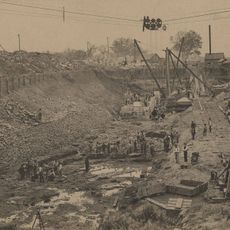
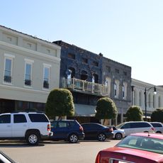
The county was established on February 9, 1836, as settlement expanded into northern Mississippi. Its seat, Iuka, became strategically important during the Civil War, particularly after the 1862 battle fought there.

The territory maintains strong ties to the Chickasaw Nation. The name Iuka comes from a prominent Chickasaw village leader, and visitors can see how this heritage remains woven into local stories and community identity today.

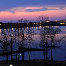
The region offers waterfront access at three marinas along the Tennessee River: Aqua Yacht Harbor, Mill Creek Marina, and Eastport Marina. These facilities provide boat services and water recreation opportunities throughout the year.

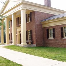
The mineral springs in Iuka gained recognition at the 1904 World's Fair in St. Louis for water purity. This award drew visitors seeking the springs' reputation for therapeutic qualities during that era.

Location: Mississippi

Inception: February 9, 1836

Capital city: Iuka

Shares border with: Hardin County, Lauderdale County, Colbert County, Franklin County, Itawamba County, Prentiss County, Alcorn County

Website: https://co.tishomingo.ms.us

GPS coordinates: 34.74000,-88.24000

Latest update: December 7, 2025 10:06

Photos
Around this place
Woodall Mountain
United States of America

Woodall Mountain

5.3 km
Pickwick Lake
United States of America

Pickwick Lake

33.7 km
Natchez Trace Trail
United States of America

Natchez Trace Trail

16 km
Tishomingo State Park
United States of America

Tishomingo State Park

15.7 km
Forks of Cypress
United States of America

Forks of Cypress

48.5 km
Shiloh Indian Mounds Site
United States of America

Shiloh Indian Mounds Site

45.2 km
Pickwick Landing State Park
United States of America

Pickwick Landing State Park

35.1 km
Pharr Mounds
United States of America

Pharr Mounds

34.5 km
Barton Hall
United States of America

Barton Hall

21.7 km
Bay Springs Lake
United States of America

Bay Springs Lake

20.1 km
Siege and Battle of Corinth Sites
United States of America

Siege and Battle of Corinth Sites

34.9 km
Jamie Whitten Lock and Dam
United States of America

Jamie Whitten Lock and Dam

25.5 km
Shiloh National Cemetery
United States of America

Shiloh National Cemetery

46.3 km
Cane Creek Canyon Nature Preserve
United States of America

Cane Creek Canyon Nature Preserve

42.7 km
Riverton Lock
United States of America

Riverton Lock

23.7 km
Falls Mill
United States of America

Falls Mill

43.9 km
Veranda House
United States of America

Veranda House

33.8 km
Overton Farm
United States of America

Overton Farm

47.2 km
Midtown Corinth Historic District
United States of America

Midtown Corinth Historic District

33.5 km
G. V. Montgomery Lock
United States of America

G. V. Montgomery Lock

32.9 km
Church of Our Saviour
United States of America

Church of Our Saviour

9.2 km
James Graham House
United States of America

James Graham House

46.9 km
Downtown Corinth Historic District
United States of America

Downtown Corinth Historic District

33.5 km
Downtown Booneville Historic District
United States of America

Downtown Booneville Historic District

31 km
Mulberry Creek
United States of America

Mulberry Creek

31.9 km
Red Bay Water Park
United States of America

Red Bay Water Park

33.7 km
Shiloh National Military Park Visitor Center
United States of America

Shiloh National Military Park Visitor Center

46.4 km
Tishomingo State Park Historic District
United States of America

Tishomingo State Park Historic District

16.1 km
Show the full map
Reviews

Visited this place? Tap the stars to rate it and share your experience / photos with the community! Try now! You can cancel it anytime.

Administrative divisions
« Tishomingo County - County seat in northeastern Mississippi, United States » is provided by Around Us (aroundus.com). Images and texts are derived from Wikimedia project under a Creative Commons license. You are allowed to copy, distribute, and modify copies of this page, under the conditions set by the license, as long as this note is clearly visible.

Discover hidden gems everywhere you go!

From secret cafés to breathtaking viewpoints, skip the crowded tourist spots and find places that match your style. Our app makes it easy with voice search, smart filtering, route optimization, and insider tips from travelers worldwide. Download now for the complete mobile experience.

Around Us App Screenshot

A unique approach to discovering new places

Le Figaro

All the places worth exploring

France Info

A tailor-made excursion in just a few clicks

20 Minutes