Chest opened
+${chestReward.xp} XP
Explorer
NOUVEAU ×${chestReward.collectible.quantity}
tapez pour fermer
Chest locked

Open chests in the app

Around Us is built for your phone — chests unlock when you walk, explore and capture nearby places.

Enable Location

We need your location to show you interesting places around you

Discover nearby places

Find interesting locations and hidden gems around you

Precise directions

Get accurate directions and distances to places

Your location is never shared with other users. It's only used when you tap the location button.

Log in to your account

Start exploring — it's free

Trusted by 72,880 travelers worldwide

Continue with Google
Continue with Apple
or

We will send you a code to connect

By continuing, you accept our Terms and Conditions and our Privacy Policy

Check your inbox

We've sent a pincode in your inbox. Please enter the code below.

Raceland
Discussion Reviews Photo
1.6k Popularity

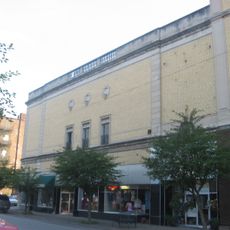
Raceland, Railway town in Greenup County, Kentucky, United States.

Raceland is a small town in eastern Kentucky located in the Ohio River valley, positioned between other nearby communities. The settlement developed along railroad corridors that shaped its layout and growth over time.

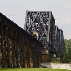
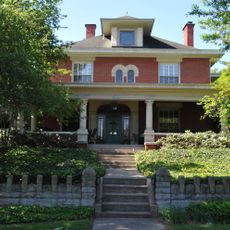
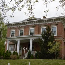
The town originated from a land grant during the Revolutionary War period, which was later subdivided and developed by successive owners. Railroad construction in the 1800s brought economic growth and established it as a transportation hub.

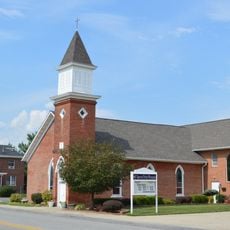
The local school district manages Campbell Elementary, Raceland-Worthington Middle School, and Raceland-Worthington High School, serving the educational needs of the community.

Route 23 runs through town and connects it to larger cities in both directions. The main road makes navigation straightforward, as it passes directly through and links clearly to surrounding communities.

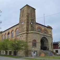
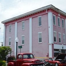
The town housed one of the nation's largest railroad repair shops, built in the 1920s and providing employment for decades. This facility became the economic heart of the community and drew workers from across the region.

The community of curious travelers

AroundUs brings together thousands of curated places, local tips, and hidden gems, enriched daily by 60,000 contributors worldwide.

Start exploring
GPS coordinates
38.54310,-82.74920
Latest update
December 14, 2025 14:26
Around this place
Paramount Arts Center
United States of America

Paramount Arts Center

11.6 km
Ironton–Russell Bridge
United States of America

Ironton–Russell Bridge

5.4 km
Greenup Lock and Dam
United States of America

Greenup Lock and Dam

15 km
Greenbo Lake
United States of America

Greenbo Lake

11.7 km
Ben Williamson Memorial Bridge
United States of America

Ben Williamson Memorial Bridge

11.5 km
Highlands Museum and Discovery Center
United States of America

Highlands Museum and Discovery Center

12 km
Simeon Willis Memorial Bridge
United States of America

Simeon Willis Memorial Bridge

11.6 km
Jesse Stuart Memorial Bridge
United States of America

Jesse Stuart Memorial Bridge

15 km
Norfolk Southern Bridge
United States of America

Norfolk Southern Bridge

21.7 km
Downtown Ironton Historic District
United States of America

Downtown Ironton Historic District

5.7 km
Lawrence County Courthouse
United States of America

Lawrence County Courthouse

5.8 km
St. Paul's Lutheran Church
United States of America

St. Paul's Lutheran Church

11.7 km
Catlett House
United States of America

Catlett House

15.5 km
Bennett's Mill Covered Bridge
United States of America

Bennett's Mill Covered Bridge

18.3 km
Grand Army of the Republic Memorial Hall
United States of America

Grand Army of the Republic Memorial Hall

5.6 km
First Presbyterian Church
United States of America

First Presbyterian Church

12 km
Oldtown Covered Bridge
United States of America

Oldtown Covered Bridge

17.8 km
First United Methodist Church
United States of America

First United Methodist Church

20.1 km
First Christian Church
United States of America

First Christian Church

12 km
St. James AME Church
United States of America

St. James AME Church

11.5 km
Ashland Commercial Historic District
United States of America

Ashland Commercial Historic District

11.9 km
Wurtland Union Church
United States of America

Wurtland Union Church

2.9 km
Bath Avenue Historic District
United States of America

Bath Avenue Historic District

11.9 km
Culbertson House
United States of America

Culbertson House

11.9 km
Greenup Masonic Lodge
United States of America

Greenup Masonic Lodge

8.5 km
Methodist Episcopal Church South
United States of America

Methodist Episcopal Church South

8.3 km
Marlow Theater
United States of America

Marlow Theater

5.7 km
Hopewell Bridge
United States of America

Hopewell Bridge

20.3 km
Show the full map
Reviews
Share your experience

No review yet

Discussions
Start a discussion...

No discussion yet

« Raceland - Railway town in Greenup County, Kentucky, United States » is provided by Around Us (aroundus.com). Images and texts are derived from Wikimedia project under a Creative Commons license. You are allowed to copy, distribute, and modify copies of this page, under the conditions set by the license, as long as this note is clearly visible.

Discover hidden gems everywhere you go!

From secret cafés to breathtaking viewpoints, skip the crowded tourist spots and find places that match your style. Our app makes it easy with voice search, smart filtering, route optimization, and insider tips from travelers worldwide. Download now for the complete mobile experience.

Around Us App Screenshot

A unique approach to discovering new places

Le Figaro

All the places worth exploring

France Info

A tailor-made excursion in just a few clicks

20 Minutes

Around Us
Travel Guide & Maps
Download

Send to your phone

QR Code
1

Open the camera app on your mobile.

2

Point at the QR code with your camera. A notification will appear.

3

Tap the notification to open the link.