Saylorville Lake

Log in to your account

AroundUs is a community-driven map of interesting places, built by curious explorers like you. It grows with every review, story, and photo you share.
Connect to save your favorite spots, contribute locations, and create personalized routes.
By continuing, you accept our Terms and Conditions and our Privacy Policy
Add to collection
Map
Suggest a change
Share

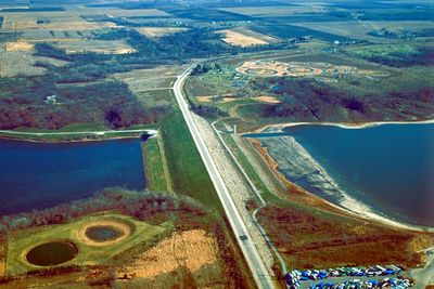
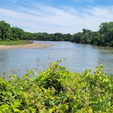
Saylorville Lake, Recreational reservoir in Polk County, Iowa, US.
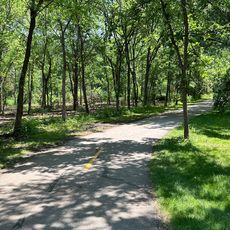
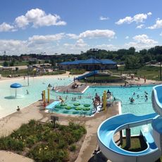
The Saylorville Lake stretches over 50 miles along the Des Moines River Valley, covering 26,000 acres of water surface in central Iowa.

The United States Congress authorized the construction of Saylorville Dam in 1958, and the facility became fully operational in September 1977.

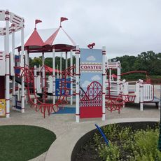
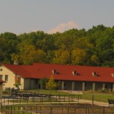
The reservoir hosts multiple recreational areas including Acorn Valley, Bob Shetler, and Cherry Glen Campground, drawing visitors throughout the year.

A 24-mile paved trail system surrounds the lake, connecting multiple access points and recreation areas for walking, biking, and skating activities.

During the notable flood of 1993, Saylorville Lake reached its highest recorded water level at 892.03 feet above sea level.

Location: Iowa

GPS coordinates: 41.75547,-93.69885

Latest update: May 12, 2025 07:46

Around this place
Show the full map
Riverview Park (Iowa)
United States of America

Riverview Park (Iowa)

16 km
Paul J. and Ida Trier House
United States of America

Paul J. and Ida Trier House

7.8 km
KCCI Tower
United States of America

KCCI Tower

8.8 km
Highland Park Historic Business District at Euclid and Sixth Avenues
United States of America

Highland Park Historic Business District at Euclid and Sixth Avenues

15.5 km
Hindu Temple & Cultural Center of Iowa
United States of America

Hindu Temple & Cultural Center of Iowa

11.7 km
Camp Dodge Pool District
United States of America

Camp Dodge Pool District

5.9 km
WOI Tower
United States of America

WOI Tower

9.2 km
Chautauqua Park Historic District
United States of America

Chautauqua Park Historic District

16.7 km
Flynn Farm, Mansion, and Barn
United States of America

Flynn Farm, Mansion, and Barn

16.2 km
Hazen Water Tower
United States of America

Hazen Water Tower

15.8 km
Prospect Park Second Plat Historic District
United States of America

Prospect Park Second Plat Historic District

17 km
Ashby Manor Historic District
United States of America

Ashby Manor Historic District

14.7 km
James Sansom Carpenter House
United States of America

James Sansom Carpenter House

16.5 km
Humphrey Center
United States of America

Humphrey Center

16.9 km
Big Creek Bridge 2
United States of America

Big Creek Bridge 2

15.8 km
Living History Farms
United States of America

Living History Farms

16.5 km
Sheldahl First Norwegian Evangelical Lutheran Church
United States of America

Sheldahl First Norwegian Evangelical Lutheran Church

12.3 km
Trent-Beaver House
United States of America

Trent-Beaver House

16.5 km
Big Creek Schoolhouse
United States of America

Big Creek Schoolhouse

2.2 km
Herrold Bridge
United States of America

Herrold Bridge

5.7 km
Olmsted Family Farmhouse
United States of America

Olmsted Family Farmhouse

13.6 km
College Corner Commercial Historic Business District
United States of America

College Corner Commercial Historic Business District

15.7 km
Carl and Ulrika Dalander Cassel House
United States of America

Carl and Ulrika Dalander Cassel House

17 km
Richard L. and Verda M. Alleman Farm Historic District
United States of America

Richard L. and Verda M. Alleman Farm Historic District

11.2 km
Prairie Ridge Aquatic Center
United States of America

Prairie Ridge Aquatic Center

7 km
Northwest Aquatic Center
United States of America

Northwest Aquatic Center

13.6 km
Sycamore Trail
United States of America

Sycamore Trail

8.7 km
Clive Greenbelt Trail
United States of America

Clive Greenbelt Trail

16.9 km
Show the full map

Reviews

Visited this place? Tap the stars to rate it and share your experience / photos with the community! Try now! You can cancel it anytime.

« Saylorville Lake - Recreational reservoir in Polk County, Iowa, US » is provided by Around Us (aroundus.com). Images and texts are derived from Wikimedia project under a Creative Commons license. You are allowed to copy, distribute, and modify copies of this page, under the conditions set by the license, as long as this note is clearly visible.

Discover hidden gems everywhere you go!

From secret cafés to breathtaking viewpoints, skip the crowded tourist spots and find places that match your style. Our app makes it easy with voice search, smart filtering, route optimization, and insider tips from travelers worldwide. Download now for the complete mobile experience.

Around Us App Screenshot

A unique approach to discovering new places

Le Figaro

All the places worth exploring

France Info

A tailor-made excursion in just a few clicks

20 Minutes