Enable Location

We need your location to show you interesting places around you

Discover nearby places

Find interesting locations and hidden gems around you

Precise directions

Get accurate directions and distances to places

Your location is never shared with other users. It's only used when you tap the location button.

Schoharie Reservoir

Log in to your account

Start exploring — it's free

Trusted by 62,291 travelers worldwide

Continue with Google
Continue with Apple
or

We will send you a code to connect

By continuing, you accept our Terms and Conditions and our Privacy Policy

Check your inbox

We've sent a pincode in your inbox. Please enter the code below.

Schoharie Reservoir

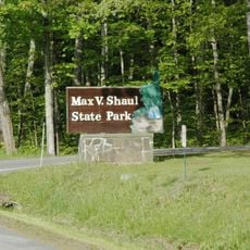
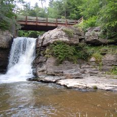
Schoharie Reservoir, body of water

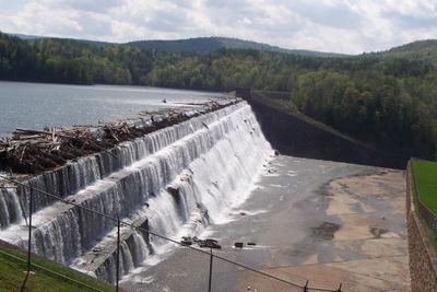
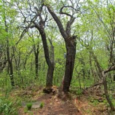
Schoharie Reservoir is a large water body in upstate New York's Catskill Mountains, created by damming Schoharie Creek and spanning about 6 miles in length. The water can hold roughly 17.6 billion gallons when full, surrounded by forested hills and a natural landscape that remains mostly undisturbed.

Schoharie Reservoir was built in 1926 by damming Schoharie Creek to create a major water supply source. The water flows through the Shandaken Tunnel and continues through multiple reservoirs and aqueducts to eventually reach New York City.

The Schoharie Reservoir is named after Schoharie Creek, which feeds it as part of New York's water system for distant cities. The place reflects how rural landscapes serve larger populations, blending natural surroundings with practical water management.

Visitors need a permit from the NYC Department of Environmental Protection to access the reservoir through designated launch points. Small non-motorized boats such as canoes, kayaks, and rowboats are allowed with proper cleaning and permits, and boating is limited to daylight hours between May and October.

Water moves quickly through the nearly 19-mile Shandaken Tunnel flowing eastward rather than lingering in the basin for long storage. It travels through a complex system of tunnels and aqueducts that eventually carries it over 90 miles beneath the Hudson River to reach New York City.

The community of curious travelers

AroundUs brings together thousands of curated places, local tips, and hidden gems, enriched daily by 60,000 contributors worldwide.

Start exploring
Location
GPS coordinates
42.37120,-74.43980
Latest update
February 7, 2026 11:01
Around this place
Old Blenheim Bridge
United States of America

Old Blenheim Bridge

11.3 km
Pratt Rock
United States of America

Pratt Rock

7 km
Woodchuck Lodge
United States of America

Woodchuck Lodge

14.5 km
Max V. Shaul State Park
United States of America

Max V. Shaul State Park

19.8 km
Lansing Manor House
United States of America

Lansing Manor House

9.1 km
Vly Mountain
United States of America

Vly Mountain

14 km
Main Street Historic District
United States of America

Main Street Historic District

13.6 km
Parker 13-Sided Barn
United States of America

Parker 13-Sided Barn

18.2 km
Union Chapel
United States of America

Union Chapel

16.1 km
Zadock Pratt House
United States of America

Zadock Pratt House

6.3 km
Centre Presbyterian Church
United States of America

Centre Presbyterian Church

17 km
Trinity Episcopal Church
United States of America

Trinity Episcopal Church

14.2 km
Second Old School Baptist Church of Roxbury
United States of America

Second Old School Baptist Church of Roxbury

17.4 km
St. Francis de Sales Catholic Church
United States of America

St. Francis de Sales Catholic Church

16.1 km
Allan Teator Road Stone Arch Bridge
United States of America

Allan Teator Road Stone Arch Bridge

18.5 km
Brand Hollow Road Stone Arch Bridge
United States of America

Brand Hollow Road Stone Arch Bridge

16.9 km
Hardenburgh Falls
United States of America

Hardenburgh Falls

3.8 km
West Settlement Methodist Church
United States of America

West Settlement Methodist Church

7.2 km
Livingstonville Community Church
United States of America

Livingstonville Community Church

19.3 km
Breakabeen Historic District
United States of America

Breakabeen Historic District

17.6 km
North Settlement Methodist Church
United States of America

North Settlement Methodist Church

12.4 km
Elijah Strong House
United States of America

Elijah Strong House

11 km
North Blenheim Historic District
United States of America

North Blenheim Historic District

11.1 km
Mine Kill State Park
United States of America

Mine Kill State Park

7.4 km
New York Power Authority Blenheim-Gilboa Visitors Center
United States of America

New York Power Authority Blenheim-Gilboa Visitors Center

8.9 km
Lansing Manor House
United States of America

Lansing Manor House

9 km
Old Episcopal Manse
United States of America

Old Episcopal Manse

6.4 km
Morss Homestead/Federal City Homestead
United States of America

Morss Homestead/Federal City Homestead

7.7 km
Show the full map
« Schoharie Reservoir - body of water » is provided by Around Us (aroundus.com). Images and texts are derived from Wikimedia project under a Creative Commons license. You are allowed to copy, distribute, and modify copies of this page, under the conditions set by the license, as long as this note is clearly visible.

Discover hidden gems everywhere you go!

From secret cafés to breathtaking viewpoints, skip the crowded tourist spots and find places that match your style. Our app makes it easy with voice search, smart filtering, route optimization, and insider tips from travelers worldwide. Download now for the complete mobile experience.

Around Us App Screenshot

A unique approach to discovering new places

Le Figaro

All the places worth exploring

France Info

A tailor-made excursion in just a few clicks

20 Minutes

Around Us
Travel Guide & Maps
Download

Send to your phone

QR Code
1

Open the camera app on your mobile.

2

Point at the QR code with your camera. A notification will appear.

3

Tap the notification to open the link.