Root Road Covered Bridge

Log in to your account

AroundUs is a community-driven map of interesting places, built by curious explorers like you. It grows with every review, story, and photo you share.
Connect to save your favorite spots, contribute locations, and create personalized routes.
By continuing, you accept our Terms and Conditions and our Privacy Policy
Add to collection
Map
Suggest a change
Share

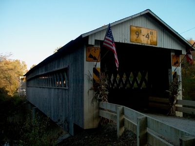
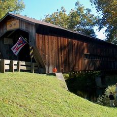
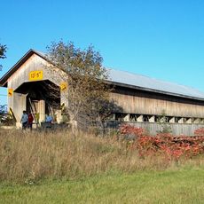
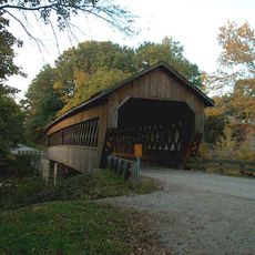
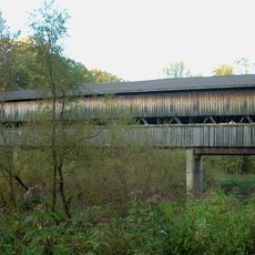
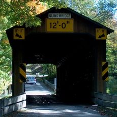
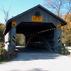
Root Road Covered Bridge, Covered bridge in Ashtabula County, United States
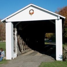
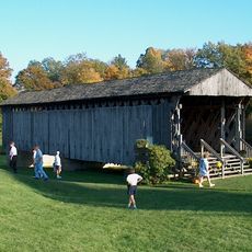
The Root Road Covered Bridge spans 107 feet across the west branch of the Ashtabula River, featuring a Town lattice truss design with wooden construction.

Built in 1868, this bridge underwent substantial renovation in 1982, when workers raised the structure by 18 inches and added a concrete center pier for support.

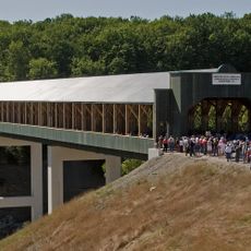
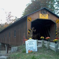
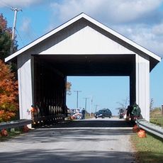
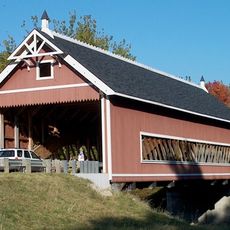
The bridge stands as one of 19 covered bridges in Ashtabula County, representing the engineering methods and construction techniques of 19th-century American infrastructure.

Located 6.3 miles southeast of North Kingsville, the bridge maintains an overhead clearance of 9 feet 4 inches and accommodates vehicle traffic.

The structure bears the name of Herbert Root, whose connection to local road construction influenced the development of transportation routes in the region.

Location: Ashtabula County

GPS coordinates: 41.83330,-80.62000

Latest update: September 23, 2025 16:46

Hidden Treasures of Ohio: Natural Parks, Historic Sites, and Reserves

Ohio reveals an unrecognized natural and cultural heritage worth exploring. Cuyahoga Valley National Park features the Brandywine Falls, plunging 20 meters, while Grand Serpent Mound reflects a fascinating prehistoric past with its 411-meter long earthwork dating back 900 years. Loveland Castle, built in 1929, evokes medieval European architecture, and Marblehead Lighthouse has guided ships on Lake Erie since 1822. The state's diverse geography offers discoveries for all interests. Hocking Gorges features the Old Man's Cave, Glen Helen Nature Preserve has 32 kilometers of trails through forests and springs, and Clifton Gorge reveals a 40-meter fault carved by the Little Miami River. The Wilds transforms an old mining site into a 4,000-hectare sanctuary for endangered species, while Headlands Beach extends 2.5 kilometers of sand along Lake Erie. SunWatch Indian Village allows visitors to explore a reconstructed Fort Ancient settlement from the 13th century on its original foundations.

Around this place
Show the full map
Smolen–Gulf Bridge
United States of America

Smolen–Gulf Bridge

12 km
Ashtabula lift bridge
United States of America

Ashtabula lift bridge

16.5 km
Benetka Road Covered Bridge
United States of America

Benetka Road Covered Bridge

6 km
Ashtabula Harbor Light
United States of America

Ashtabula Harbor Light

17.4 km
Caine Road Covered Bridge
United States of America

Caine Road Covered Bridge

7.6 km
State Road Covered Bridge
United States of America

State Road Covered Bridge

5.9 km
Mother of Sorrows Church
United States of America

Mother of Sorrows Church

16.7 km
Middle Road Covered Bridge
United States of America

Middle Road Covered Bridge

9.7 km
Ashtabula County Courthouse Group
United States of America

Ashtabula County Courthouse Group

16.3 km
Olin's Covered Bridge
United States of America

Olin's Covered Bridge

9 km
Joshua Reed Giddings Law Office
United States of America

Joshua Reed Giddings Law Office

16.1 km
Ashtabula Harbour Commercial District
United States of America

Ashtabula Harbour Commercial District

16.6 km
Creek Road Covered Bridge
United States of America

Creek Road Covered Bridge

9.7 km
Doyle Road Covered Bridge
United States of America

Doyle Road Covered Bridge

16.2 km
David Cummins Octagon House
United States of America

David Cummins Octagon House

13.1 km
Giddings Road Covered Bridge
United States of America

Giddings Road Covered Bridge

12.1 km
Netcher Road Covered Bridge
United States of America

Netcher Road Covered Bridge

14.2 km
South Denmark Road Covered Bridge
United States of America

South Denmark Road Covered Bridge

14.2 km
Graham Road Covered Bridge
United States of America

Graham Road Covered Bridge

5.8 km
Harrington Covered Bridge
United States of America

Harrington Covered Bridge

16.3 km
Riverview Covered Bridge
United States of America

Riverview Covered Bridge

12 km
Eliphalet Austin House
United States of America

Eliphalet Austin House

20.6 km
Griggs Grange No. 1467
United States of America

Griggs Grange No. 1467

9.2 km
Conneaut Harbor Light
United States of America

Conneaut Harbor Light

17.1 km
Ashtabula Maritime & Surface Transportation Museum
United States of America

Ashtabula Maritime & Surface Transportation Museum

16.7 km
Camp Lambec
United States of America

Camp Lambec

22.7 km
Benjamin F. Wade House
United States of America

Benjamin F. Wade House

16.2 km
Ashtabula Train Disaster December 29, 1876
United States of America

Ashtabula Train Disaster December 29, 1876

15.3 km
Show the full map

Reviews

Visited this place? Tap the stars to rate it and share your experience / photos with the community! Try now! You can cancel it anytime.

« Root Road Covered Bridge: Covered bridge in Ashtabula County, United States » is provided by Around Us (aroundus.com). Images and texts are derived from Wikimedia project under a Creative Commons license. You are allowed to copy, distribute, and modify copies of this page, under the conditions set by the license, as long as this note is clearly visible.

Discover hidden gems everywhere you go!

From secret cafés to breathtaking viewpoints, skip the crowded tourist spots and find places that match your style. Our app makes it easy with voice search, smart filtering, route optimization, and insider tips from travelers worldwide. Download now for the complete mobile experience.

Around Us App Screenshot

A unique approach to discovering new places

Le Figaro

All the places worth exploring

France Info

A tailor-made excursion in just a few clicks

20 Minutes