Enable Location

We need your location to show you interesting places around you

Discover nearby places

Find interesting locations and hidden gems around you

Precise directions

Get accurate directions and distances to places

Your location is never shared with other users. It's only used when you tap the location button.

Log in to your account

Start exploring — it's free

Trusted by 62,478 travelers worldwide

Continue with Google
Continue with Apple
or

We will send you a code to connect

By continuing, you accept our Terms and Conditions and our Privacy Policy

Check your inbox

We've sent a pincode in your inbox. Please enter the code below.

Rock Springs Park

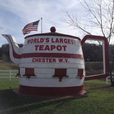
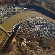
Rock Springs Park, Former amusement park in Chester, West Virginia, United States.

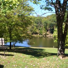
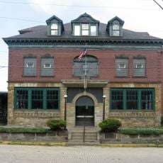
Rock Springs Park was an amusement destination near the Ohio River in Chester that operated with multiple attractions and entertainment facilities. The site featured rides, pavilions, picnic areas, and gardens spread across spacious grounds for visitors to enjoy.

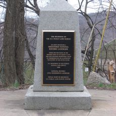
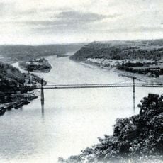
The park started in 1897 as Rock Springs Grove before J.E. McDonald transformed it into a major entertainment destination. It operated successfully for over 70 years until the property was cleared in the early 1970s to make way for highway infrastructure.

The location held special meaning for Archaic Indians who considered the area a sacred hunting ground 4,000 years before the park's establishment.

The former site is located in Chester and is no longer open for visits since the grounds have been cleared. Visitors interested in the park's history can find information through local historical records and community resources.

The mineral springs that gave the park its name remain accessible today, preserving a natural element from this former entertainment venue. These springs attracted visitors for generations before the park itself was even established.

The community of curious travelers

AroundUs brings together thousands of curated places, local tips, and hidden gems, enriched daily by 60,000 contributors worldwide.

Start exploring
Location
GPS coordinates
40.61280,-80.56280
Latest update
December 12, 2025 14:27
Around this place
Beginning Point of the U.S. Public Land Survey
United States of America

Beginning Point of the U.S. Public Land Survey

5 km
Chester teapot
United States of America

Chester teapot

592 m
Tomlinson Run State Park
United States of America

Tomlinson Run State Park

7.6 km
Jennings Randolph Bridge
United States of America

Jennings Randolph Bridge

730 m
Newell Toll Bridge
United States of America

Newell Toll Bridge

2.3 km
Richard L. Cawood Residence
United States of America

Richard L. Cawood Residence

3.6 km
Museum of Ceramics
United States of America

Museum of Ceramics

1.4 km
New Cumberland Locks and Dam
United States of America

New Cumberland Locks and Dam

10.8 km
Carnegie Public Library
United States of America

Carnegie Public Library

1.4 km
Shippingport Bridge
United States of America

Shippingport Bridge

11.1 km
Cassius Clark Thompson House
United States of America

Cassius Clark Thompson House

1.2 km
Diamond Historic District
United States of America

Diamond Historic District

1.3 km
Ikirt House
United States of America

Ikirt House

1.8 km
Salem Downtown Historic District
United States of America

Salem Downtown Historic District

3.6 km
Mary A. Patterson Memorial
United States of America

Mary A. Patterson Memorial

1.4 km
Potters National Bank
United States of America

Potters National Bank

1.3 km
William E. Wells House
United States of America

William E. Wells House

3.2 km
YMCA
United States of America

YMCA

1.5 km
Episcopal Church of the Ascension and Manse
United States of America

Episcopal Church of the Ascension and Manse

7.5 km
Potters Savings and Loan
United States of America

Potters Savings and Loan

1.5 km
East Fifth Street Historic District
United States of America

East Fifth Street Historic District

1.5 km
Elks Club
United States of America

Elks Club

1.8 km
City Hall
United States of America

City Hall

1.7 km
Daniel McBean Farmstead
United States of America

Daniel McBean Farmstead

12.6 km
Godwin-Knowles House
United States of America

Godwin-Knowles House

1.3 km
Homer Laughlin House
United States of America

Homer Laughlin House

1.3 km
First National Bank
United States of America

First National Bank

13.3 km
Chester Bridge
United States of America

Chester Bridge

871 m
Show the full map
« Rock Springs Park - Former amusement park in Chester, West Virginia, United States » is provided by Around Us (aroundus.com). Images and texts are derived from Wikimedia project under a Creative Commons license. You are allowed to copy, distribute, and modify copies of this page, under the conditions set by the license, as long as this note is clearly visible.

Discover hidden gems everywhere you go!

From secret cafés to breathtaking viewpoints, skip the crowded tourist spots and find places that match your style. Our app makes it easy with voice search, smart filtering, route optimization, and insider tips from travelers worldwide. Download now for the complete mobile experience.

Around Us App Screenshot

A unique approach to discovering new places

Le Figaro

All the places worth exploring

France Info

A tailor-made excursion in just a few clicks

20 Minutes

Around Us
Travel Guide & Maps
Download

Send to your phone

QR Code
1

Open the camera app on your mobile.

2

Point at the QR code with your camera. A notification will appear.

3

Tap the notification to open the link.