Enable Location

We need your location to show you interesting places around you

Discover nearby places

Find interesting locations and hidden gems around you

Precise directions

Get accurate directions and distances to places

Your location is never shared with other users. It's only used when you tap the location button.

Schuylkill Expressway Bridge

Log in to your account

Start exploring — it's free

Trusted by 61,665 travelers worldwide

Continue with Google
Continue with Apple
or

We will send you a code to connect

By continuing, you accept our Terms and Conditions and our Privacy Policy

Check your inbox

We've sent a pincode in your inbox. Please enter the code below.

Schuylkill Expressway Bridge

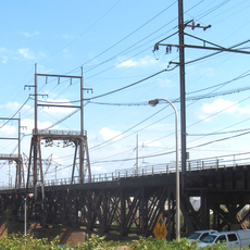
Schuylkill Expressway Bridge, Road bridge in Philadelphia, United States

Description

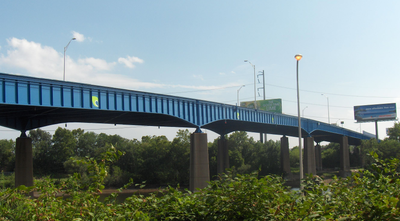
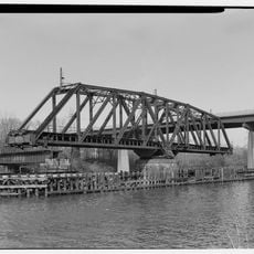
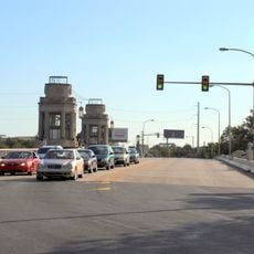
The Schuylkill Expressway Bridge is a road bridge carrying traffic across the Schuylkill River in Philadelphia with a steel and concrete structure. It features four lanes accommodating traffic flow between West Philadelphia and the Grays Ferry area.

History

The structure was completed in 1956 as the Pennsylvania Department of Transportation expanded the interstate highway system through the city. This was part of a broader effort to modernize transportation connections across Philadelphia during the mid-20th century.

Culture

The bridge connects residential areas and serves as a daily passage for thousands of commuters moving between neighborhoods. It shapes how people experience movement through the city and reflects the practical needs of urban living.

Practical

The bridge carries heavy traffic daily and provides a main route through the city for vehicles traveling between these neighborhoods. Travel is smoothest during off-peak hours when congestion is lighter.

Did you know?

The bridge received a distinctive blue paint during its 2010 reconstruction, making it visibly stand out from the surrounding landscape. This color choice helps the structure serve as a recognizable landmark when viewed from along the river.

Location
Official opening
1956
GPS coordinates
39.94180,-75.19420
Latest update
December 14, 2025 14:23

AroundUs brings together thousands of curated places, local tips, and hidden gems, enriched daily by 60,000 contributors worldwide. Discover all places nearby (Pennsylvania).

Around this place
Franklin Field
United States of America

Franklin Field

981 m
University of Pennsylvania Museum of Archaeology and Anthropology
United States of America

University of Pennsylvania Museum of Archaeology and Anthropology

844 m
Richards Medical Research Laboratories
United States of America

Richards Medical Research Laboratories

941 m
College Hall
United States of America

College Hall

1.1 km
The Woodlands
United States of America

The Woodlands

948 m
Institute of Contemporary Art, Philadelphia
United States of America

Institute of Contemporary Art, Philadelphia

1.4 km
Houston Hall
United States of America

Houston Hall

1 km
Irvine Auditorium
United States of America

Irvine Auditorium

1 km
University of Pennsylvania Campus Historic District
United States of America

University of Pennsylvania Campus Historic District

820 m
Gray's Ferry Bridge
United States of America

Gray's Ferry Bridge

925 m
South Street Bridge
United States of America

South Street Bridge

846 m
Statue of Benjamin Franklin
United States of America

Statue of Benjamin Franklin

1.1 km
Statue of George Whitefield
United States of America

Statue of George Whitefield

1 km
United States of America

Meyerson Hall

1.2 km
Curtis Organ
United States of America

Curtis Organ

1 km
University Avenue Bridge
United States of America

University Avenue Bridge

306 m
B&O Railroad Bridge
United States of America

B&O Railroad Bridge

1.2 km
Newkirk Viaduct Monument
United States of America

Newkirk Viaduct Monument

1.1 km
United States of America

Gray's Ferry Tavern

1.1 km
Philadelphia, Wilmington and Baltimore Railroad Bridge No. 1
United States of America

Philadelphia, Wilmington and Baltimore Railroad Bridge No. 1

931 m
Schuylkill Arsenal Railroad Bridge
United States of America

Schuylkill Arsenal Railroad Bridge

271 m
Pennsylvania Railroad Freight Building
United States of America

Pennsylvania Railroad Freight Building

1.4 km
Grays Road Recreation Center
United States of America

Grays Road Recreation Center

786 m
Hamilton Family Estate
United States of America

Hamilton Family Estate

1.3 km
Schuylkill River Park Community Garden
United States of America

Schuylkill River Park Community Garden

1.4 km
Ramcat Historic District
United States of America

Ramcat Historic District

1.3 km
Drexel Development Historic District
United States of America

Drexel Development Historic District

1.2 km
John Morgan Building
United States of America

John Morgan Building

891 m
Show the full map
« Schuylkill Expressway Bridge - Road bridge in Philadelphia, United States » is provided by Around Us (aroundus.com). Images and texts are derived from Wikimedia project under a Creative Commons license. You are allowed to copy, distribute, and modify copies of this page, under the conditions set by the license, as long as this note is clearly visible.

Discover hidden gems everywhere you go!

From secret cafés to breathtaking viewpoints, skip the crowded tourist spots and find places that match your style. Our app makes it easy with voice search, smart filtering, route optimization, and insider tips from travelers worldwide. Download now for the complete mobile experience.

Around Us App Screenshot

A unique approach to discovering new places

Le Figaro

All the places worth exploring

France Info

A tailor-made excursion in just a few clicks

20 Minutes

Around Us
Travel Guide & Maps
Download

Send to your phone

QR Code
1

Open the camera app on your mobile.

2

Point at the QR code with your camera. A notification will appear.

3

Tap the notification to open the link.