Enable Location

We need your location to show you interesting places around you

Discover nearby places

Find interesting locations and hidden gems around you

Precise directions

Get accurate directions and distances to places

Your location is never shared with other users. It's only used when you tap the location button.

Shelbyville High School

Log in to your account

Start exploring — it's free

Trusted by 64,684 travelers worldwide

Continue with Google
Continue with Apple
or

We will send you a code to connect

By continuing, you accept our Terms and Conditions and our Privacy Policy

Check your inbox

We've sent a pincode in your inbox. Please enter the code below.

Discussion Reviews 1 Photos
1.4k Popularity

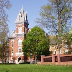
Shelbyville High School, high school in Indiana, United States

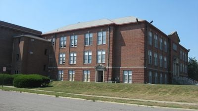
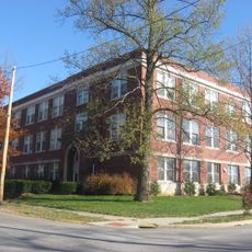
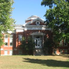
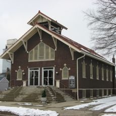
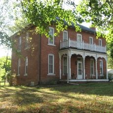
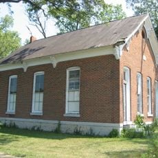
Shelbyville High School is a large school building in Indiana located at the corner of Second and Tompkins Streets in Shelbyville. The brick complex began construction in 1911 and now includes the main two-story structure, a junior high building added in 1917, and a gymnasium constructed in 1922.

The building was designed in 1911 by architect William Butts Ittner in the neoclassical style to create a dignified learning environment. Additional expansions followed: a junior high building in 1917, a gymnasium in 1922, and a shop addition in 1942, establishing its importance in local history. It was officially listed on the National Register of Historic Places in 1996.

This school served as a gathering place for generations of students and community members throughout its long history. The building reflects early 20th-century values that treated school structures as symbols of stability and educational purpose for the local population.

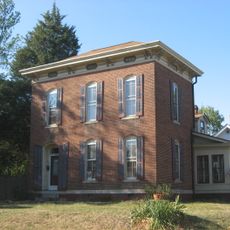
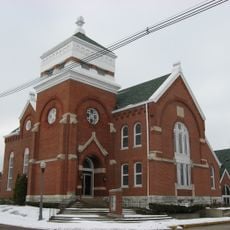
The building is located at an easily accessible corner in downtown Shelbyville and is surrounded by other historic structures. You can view the architecture from the street and explore the neighborhood with its older buildings that show the town's development over time.

The building was originally used as a school but now functions as an apartment complex, while the gymnasium continues to serve the community for sports and gatherings. This adaptive reuse demonstrates how historic structures can continue to play active roles in modern community life.

The community of curious travelers

AroundUs brings together thousands of curated places, local tips, and hidden gems, enriched daily by 60,000 contributors worldwide.

Start exploring
Location
GPS coordinates
39.51500,-85.77970
Latest update
February 9, 2026 08:18
Around this place
Johnson County Museum of History
United States of America

Johnson County Museum of History

23.9 km
Moscow Covered Bridge
United States of America

Moscow Covered Bridge

19.6 km
Johnson County Courthouse Square
United States of America

Johnson County Courthouse Square

24 km
Porter Pool Bathhouse
United States of America

Porter Pool Bathhouse

1.6 km
Offutt Covered Bridge
United States of America

Offutt Covered Bridge

26.2 km
Grover Museum
United States of America

Grover Museum

895 m
County Line Bridge
United States of America

County Line Bridge

25.1 km
John Hamilton House
United States of America

John Hamilton House

1.1 km
Forsythe Covered Bridge
United States of America

Forsythe Covered Bridge

21.4 km
Franklin Senior High School
United States of America

Franklin Senior High School

23.4 km
Lora B. Pearson School
United States of America

Lora B. Pearson School

294 m
Shelby County Courthouse
United States of America

Shelby County Courthouse

700 m
Franklin Commercial Historic District
United States of America

Franklin Commercial Historic District

24 km
Old Main
United States of America

Old Main

23.3 km
Franklin College Library
United States of America

Franklin College Library

23.4 km
August Zeppenfeld House
United States of America

August Zeppenfeld House

24.3 km
South Walnut Street Historic District
United States of America

South Walnut Street Historic District

24.3 km
Pugh Ford Bridge
United States of America

Pugh Ford Bridge

21.5 km
Furnas Mill Bridge
United States of America

Furnas Mill Bridge

23.9 km
Shelbyville Commercial Historic District
United States of America

Shelbyville Commercial Historic District

1.1 km
West Side Historic District
United States of America

West Side Historic District

1.2 km
Toner Historic District
United States of America

Toner Historic District

23.6 km
Herriott House
United States of America

Herriott House

24 km
Liberty Township Schoolhouse No. 2
United States of America

Liberty Township Schoolhouse No. 2

9.8 km
Champ's Ford Bridge
United States of America

Champ's Ford Bridge

23.5 km
Martin Place Historic District
United States of America

Martin Place Historic District

23.8 km
George Rudicel Polygonal Barn
United States of America

George Rudicel Polygonal Barn

12.1 km
Cooper-Alley House
United States of America

Cooper-Alley House

13.9 km
Show the full map
Reviews
Share your experience

No review yet

Discussions
Start a discussion...

No discussion yet

« Shelbyville High School - high school in Indiana, United States » is provided by Around Us (aroundus.com). Images and texts are derived from Wikimedia project under a Creative Commons license. You are allowed to copy, distribute, and modify copies of this page, under the conditions set by the license, as long as this note is clearly visible.

Discover hidden gems everywhere you go!

From secret cafés to breathtaking viewpoints, skip the crowded tourist spots and find places that match your style. Our app makes it easy with voice search, smart filtering, route optimization, and insider tips from travelers worldwide. Download now for the complete mobile experience.

Around Us App Screenshot

A unique approach to discovering new places

Le Figaro

All the places worth exploring

France Info

A tailor-made excursion in just a few clicks

20 Minutes

Around Us
Travel Guide & Maps
Download

Send to your phone

QR Code
1

Open the camera app on your mobile.

2

Point at the QR code with your camera. A notification will appear.

3

Tap the notification to open the link.