Enable Location

We need your location to show you interesting places around you

Discover nearby places

Find interesting locations and hidden gems around you

Precise directions

Get accurate directions and distances to places

Your location is never shared with other users. It's only used when you tap the location button.

Shining Rock

Log in to your account

Join the adventure

Create your free account and start exploring (like 60k+ others)

We will send you a code to connect

or
Continue with Google
Continue with Apple
By continuing, you accept our Terms and Conditions and our Privacy Policy

Check your inbox

We've sent a pincode in your inbox. Please enter the code below.

Shining Rock

Shining Rock, Mountain summit in Haywood County, North Carolina, US

Description

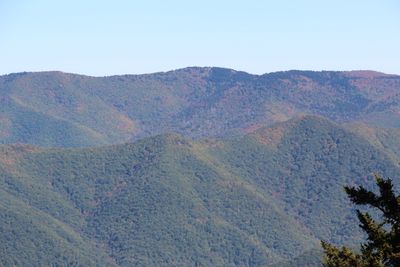
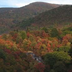
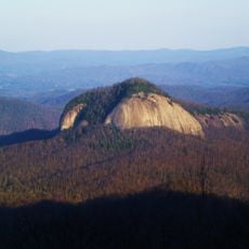
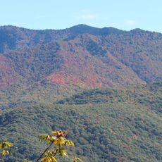
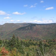
Shining Rock is a mountain summit in the Great Balsam Mountains range that rises to 6,040 feet (1,840 m) and dominates the landscape northwest of the Blue Ridge Parkway. Large white quartzite formations cover the peak area and give the mountain its distinctive appearance.

History

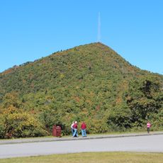
The mountain gained protected status in 1964 when it became part of the National Wilderness System as the centerpiece of North Carolina's largest wilderness area. This designation marked a turning point for conservation in the region.

Culture

The Cherokee name Datsu'nălâsgûñ'yĭ reflects stories about mythological figures whose footprints are believed to mark this place. This naming shows how the mountain holds spiritual meaning in local traditions.

Practical

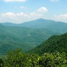
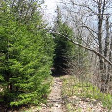
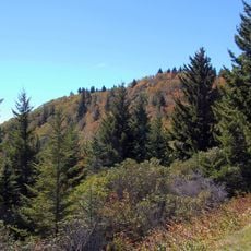
Hikers access the peak via the Art Loeb Trail starting from milepost 420 of the Blue Ridge Parkway, which crosses challenging terrain at high elevation. Visitors should prepare with sturdy gear and good physical fitness for this hike.

Did you know?

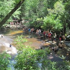
Three separate trailheads provide access to the wilderness area: Black Balsam, Big East Fork Pigeon River, and Camp Daniel Boone at Cold Mountain. This variety of entry points allows hikers to choose different routes and experience distinct parts of the landscape.

Location
GPS coordinates
35.36816,-82.86235
Latest update
December 11, 2025 18:05

AroundUs brings together thousands of curated places, local tips, and hidden gems, enriched daily by 60,000 contributors worldwide. Discover all places nearby (North Carolina).

Around this place
Sliding Rock
United States of America

Sliding Rock

9.4 km
Cold Mountain
United States of America

Cold Mountain

4.6 km
Looking Glass Falls
United States of America

Looking Glass Falls

11.7 km
Black Balsam Knob
United States of America

Black Balsam Knob

4.6 km
Art Loeb Trail
United States of America

Art Loeb Trail

10 km
Looking Glass Rock
United States of America

Looking Glass Rock

9.5 km
Mount Pisgah
United States of America

Mount Pisgah

11.5 km
Shining Rock Wilderness
United States of America

Shining Rock Wilderness

2.2 km
Richland Balsam
United States of America

Richland Balsam

11.6 km
Moore Cove Falls
United States of America

Moore Cove Falls

9.9 km
Courthouse Falls
United States of America

Courthouse Falls

11.1 km
Slick Rock Falls
United States of America

Slick Rock Falls

10.2 km
Middle Prong Wilderness
United States of America

Middle Prong Wilderness

7.5 km
Tanasee Bald
United States of America

Tanasee Bald

9.9 km
Log Hollow Falls
United States of America

Log Hollow Falls

7 km
Robinson Rock House Ruin and Plantation Site
United States of America

Robinson Rock House Ruin and Plantation Site

16.7 km
Cedar Rock Falls
United States of America

Cedar Rock Falls

11.5 km
Francis Grist Mill
United States of America

Francis Grist Mill

14.7 km
Dr. J. Howell Way House
United States of America

Dr. J. Howell Way House

17.6 km
Cradle of Forestry in America
United States of America

Cradle of Forestry in America

7.8 km
Masonic Hall
United States of America

Masonic Hall

17.7 km
Charles and Annie Quinlan House
United States of America

Charles and Annie Quinlan House

17.6 km
Shelton House
United States of America

Shelton House

17.1 km
Haywood County Courthouse
United States of America

Haywood County Courthouse

17.9 km
Alden and Thomasene Howell House
United States of America

Alden and Thomasene Howell House

17.7 km
Former Citizens Bank and Trust Company Building
United States of America

Former Citizens Bank and Trust Company Building

17.7 km
William Deaver House
United States of America

William Deaver House

17.8 km
Richland Balsam Overlook
United States of America

Richland Balsam Overlook

11.8 km
Show the full map
« Shining Rock - Mountain summit in Haywood County, North Carolina, US » is provided by Around Us (aroundus.com). Images and texts are derived from Wikimedia project under a Creative Commons license. You are allowed to copy, distribute, and modify copies of this page, under the conditions set by the license, as long as this note is clearly visible.

Discover hidden gems everywhere you go!

From secret cafés to breathtaking viewpoints, skip the crowded tourist spots and find places that match your style. Our app makes it easy with voice search, smart filtering, route optimization, and insider tips from travelers worldwide. Download now for the complete mobile experience.

Around Us App Screenshot

A unique approach to discovering new places

Le Figaro

All the places worth exploring

France Info

A tailor-made excursion in just a few clicks

20 Minutes

Around Us
Travel Guide & Maps
Download

Send to your phone

QR Code
1

Open the camera app on your mobile.

2

Point at the QR code with your camera. A notification will appear.

3

Tap the notification to open the link.