Shenipsit State Forest

Log in to your account

AroundUs is a community-driven map of interesting places, built by curious explorers like you. It grows with every review, story, and photo you share.
Connect to save your favorite spots, contribute locations, and create personalized routes.
Continue with Google
Continue with Apple
Continue with X
Continue with Facebook
Continue with email
By continuing, you accept our Terms and Conditions and our Privacy Policy
Create an account
Add to collection
Map
Suggest a change
Share

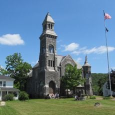
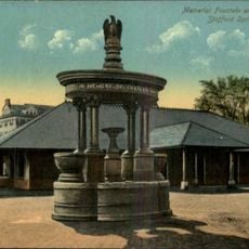
Shenipsit State Forest, Forest and protected area in northeastern Connecticut, United States.

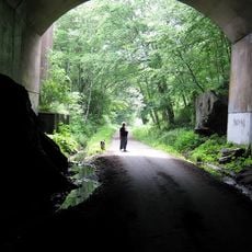
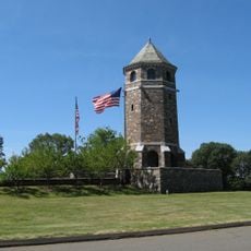
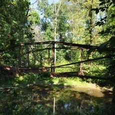
Shenipsit State Forest is a protected forest spanning roughly 7,000 acres across three towns and features a mix of wooded slopes, open meadows, and rock formations. The property contains multiple marked trails of varying difficulty, a lookout tower atop a mountain, and open spaces suitable for different recreational pursuits.

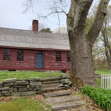
The forest was established in 1927 and developed through a New Deal program that employed workers during the economic crisis and carried out conservation work across the region. A museum located within the forest preserves artifacts and records from that era, documenting how these workers shaped the land we see today.

The name Shenipsit comes from the Mohegan language and means "between two waters," reflecting the forest's geographic position between waterways. Visitors sense this historical connection while walking the trails and viewing the landscape from high points, which reveal how the land shaped both indigenous life and settlement patterns.

The forest is open daily from sunrise to sunset and welcomes visitors on well-marked trails of various lengths. Visitors should wear sturdy footwear, bring water, and carry a map or GPS device for longer hikes to stay oriented on the network of paths.

The forest floor is scattered with large boulders left behind during the last ice age, creating a distinctive rocky character throughout the landscape. The observation tower stands as the only structure of its kind in the entire northeastern region, offering visitors an uncommon vantage point across an expansive territory.

Location: Connecticut

Elevation above the sea: 270 m

GPS coordinates: 41.97560,-72.38670

Latest update: December 13, 2025 12:25

Photos
Around this place
Hop River State Park Trail
United States of America

Hop River State Park Trail

2.7 km
Daniel Benton Homestead
United States of America

Daniel Benton Homestead

13.8 km
The Tower on Fox Hill
United States of America

The Tower on Fox Hill

13.4 km
St. Bernard Church
United States of America

St. Bernard Church

13 km
Enfield Shakers Historic District
United States of America

Enfield Shakers Historic District

11.4 km
Congregation Knesseth Israel
United States of America

Congregation Knesseth Israel

11.6 km
Hazardville Historic District
United States of America

Hazardville Historic District

12 km
Tolland County Courthouse
United States of America

Tolland County Courthouse

11.7 km
Omega Metal Processing
United States of America

Omega Metal Processing

14 km
Thornton W. Burgess House
United States of America

Thornton W. Burgess House

9.9 km
Tolland Green Historic District
United States of America

Tolland Green Historic District

11.8 km
Somersville Historic District
United States of America

Somersville Historic District

8.6 km
Florence Mill
United States of America

Florence Mill

13.6 km
Enfield Town Meetinghouse
United States of America

Enfield Town Meetinghouse

17 km
Saxony Mill
United States of America

Saxony Mill

13.8 km
Somers Historic District
United States of America

Somers Historic District

5.1 km
Memorial Town Hall
United States of America

Memorial Town Hall

14.9 km
William Norcross House
United States of America

William Norcross House

15 km
Academy Historic District
United States of America

Academy Historic District

17 km
Elijah Burt House
United States of America

Elijah Burt House

13.8 km
John Cady House
United States of America

John Cady House

16.2 km
Holt Memorial Fountain
United States of America

Holt Memorial Fountain

7.3 km
Minterburn Mill
United States of America

Minterburn Mill

12.6 km
Ellington Center Historic District
United States of America

Ellington Center Historic District

10.6 km
Swetland-Pease House
United States of America

Swetland-Pease House

11.7 km
Melrose Road Bridge
United States of America

Melrose Road Bridge

13.9 km
Willington Common Historic District
United States of America

Willington Common Historic District

15.1 km
Rockville Historic District
United States of America

Rockville Historic District

13.5 km
Show the full map
Reviews

Visited this place? Tap the stars to rate it and share your experience / photos with the community! Try now! You can cancel it anytime.

« Shenipsit State Forest - Forest and protected area in northeastern Connecticut, United States » is provided by Around Us (aroundus.com). Images and texts are derived from Wikimedia project under a Creative Commons license. You are allowed to copy, distribute, and modify copies of this page, under the conditions set by the license, as long as this note is clearly visible.

Discover hidden gems everywhere you go!

From secret cafés to breathtaking viewpoints, skip the crowded tourist spots and find places that match your style. Our app makes it easy with voice search, smart filtering, route optimization, and insider tips from travelers worldwide. Download now for the complete mobile experience.

Around Us App Screenshot

A unique approach to discovering new places

Le Figaro

All the places worth exploring

France Info

A tailor-made excursion in just a few clicks

20 Minutes