Hop River State Park Trail, Rail trail in Connecticut, United States
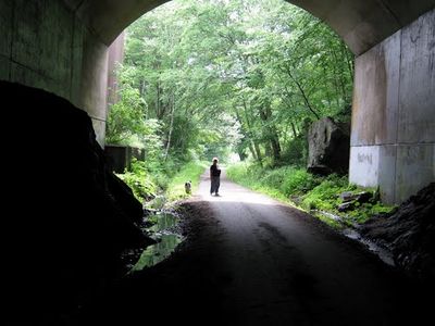
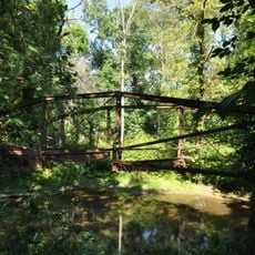
The Hop River State Park Trail is a rail trail in Connecticut that runs through forested land along a former railroad corridor, passing through three tunnels and a covered bridge. It links several towns from Manchester in the west to Columbia in the east.
The path follows the route of the Hartford, Providence and Fishkill Railroad, laid through this part of Connecticut in the late 1800s. Freight and passenger traffic eventually stopped in the 20th century, and the state converted the corridor into a public trail.
Walkers, cyclists, and joggers from nearby towns use the path regularly, giving it the feel of a long green corridor connecting neighborhoods. On weekends, families and dog owners tend to gather along the quieter stretches between Bolton and Columbia.
The trail has several entry points with parking, including Bolton Notch State Park and spots along Colonial Road in Manchester. It is worth choosing your starting point in advance, since each section offers a different mix of terrain and surroundings.
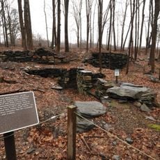
Original telegraph poles from the railroad era are still standing along certain sections, left in place rather than removed. An old locomotive turning area has also survived and marks the spot where trains once reversed direction before heading back along the line.
The community of curious travelers
AroundUs brings together thousands of curated places, local tips, and hidden gems, enriched daily by 60,000 contributors worldwide.