Enable Location

We need your location to show you interesting places around you

Discover nearby places

Find interesting locations and hidden gems around you

Precise directions

Get accurate directions and distances to places

Your location is never shared with other users. It's only used when you tap the location button.

Log in to your account

Start exploring — it's free

Trusted by 69,455 travelers worldwide

Continue with Google
Continue with Apple
or

We will send you a code to connect

By continuing, you accept our Terms and Conditions and our Privacy Policy

Check your inbox

We've sent a pincode in your inbox. Please enter the code below.

Southwest Philadelphia
Discussion Reviews Photo
18.4k Popularity

Southwest Philadelphia, Residential neighborhood in western Philadelphia, USA

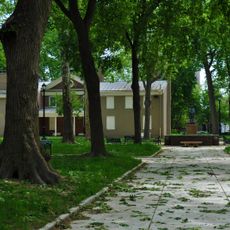
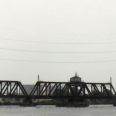
Southwest Philadelphia stretches from the Schuylkill River to the city edges, mixing homes with industrial areas throughout. This neighborhood forms a significant section of western Philadelphia with varied residential blocks and commercial zones.

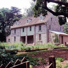
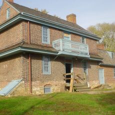
The area began as Kingsessing Township following William Penn's land acquisition, with Swedish settlers establishing the village of Kingsessing in 1646. It evolved from rural land into an urban neighborhood with mixed uses over the following centuries.

The neighborhood reflects the heritage of different communities who have made it home over time. Today, African American and West African residents shape the area's character, with Liberian immigrants having established a strong presence here.

The neighborhood connects to downtown Philadelphia through multiple SEPTA lines, including subway and trolley routes 11, 13, 34, and 36. Visitors should plan their route ahead since the area covers a large expanse with different sections to explore.

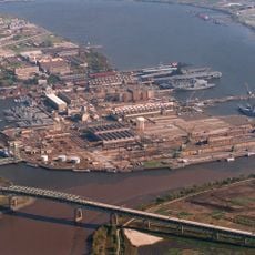
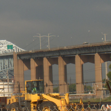
Philadelphia International Airport sits on the former Hog Island site, marking a shift from shipbuilding to aviation. The airport grounds were once a major industrial center for warship production.

The community of curious travelers

AroundUs brings together thousands of curated places, local tips, and hidden gems, enriched daily by 60,000 contributors worldwide.

Start exploring
Location
GPS coordinates
39.89830,-75.23620
Latest update
March 5, 2026 21:06
Around this place
Philadelphia Naval Shipyard
United States of America

Philadelphia Naval Shipyard

4.9 km
United States of America

Fort Mifflin

3.2 km
Bartram's Garden
United States of America

Bartram's Garden

4.1 km
John Bartram High School
United States of America

John Bartram High School

2.6 km
Simeone Foundation Automotive Museum
United States of America

Simeone Foundation Automotive Museum

1.6 km
Red Bank Battlefield
United States of America

Red Bank Battlefield

5 km
American Swedish Historical Museum
United States of America

American Swedish Historical Museum

4.8 km
Girard Point Bridge
United States of America

Girard Point Bridge

3.4 km
Eden Cemetery
United States of America

Eden Cemetery

4.1 km
George C. Platt Bridge
United States of America

George C. Platt Bridge

2.1 km
Stephen Girard Park
United States of America

Stephen Girard Park

5.2 km
Morton Morton House
United States of America

Morton Morton House

5.1 km
Commandant's Quarters
United States of America

Commandant's Quarters

5 km
B&O Railroad Bridge
United States of America

B&O Railroad Bridge

4.9 km
Joseph W. Catharine School
United States of America

Joseph W. Catharine School

3.3 km
Passyunk Avenue Bridge
United States of America

Passyunk Avenue Bridge

3.8 km
Hardy Williams Academy
United States of America

Hardy Williams Academy

4.9 km
Darby Free Library
United States of America

Darby Free Library

3.4 km
John M. Patterson School
United States of America

John M. Patterson School

2 km
Darby Meeting
United States of America

Darby Meeting

3.4 km
Charles Y. Audenried Junior High School
United States of America

Charles Y. Audenried Junior High School

5 km
Universal Alcorn Charter Elementary School
United States of America

Universal Alcorn Charter Elementary School

5.2 km
Edgar Allan Poe School
United States of America

Edgar Allan Poe School

5.2 km
George Wolf School
United States of America

George Wolf School

171 m
Regent-Rennoc Court
United States of America

Regent-Rennoc Court

5 km
John Heinz National Wildlife Refuge at Tinicum
United States of America

John Heinz National Wildlife Refuge at Tinicum

2.6 km
S. Weir Mitchell School
United States of America

S. Weir Mitchell School

4.4 km
William T. Tilden Middle School
United States of America

William T. Tilden Middle School

2.6 km
Show the full map
Reviews
Share your experience

No review yet

Discussions
Start a discussion...

No discussion yet

« Southwest Philadelphia - Residential neighborhood in western Philadelphia, USA » is provided by Around Us (aroundus.com). Images and texts are derived from Wikimedia project under a Creative Commons license. You are allowed to copy, distribute, and modify copies of this page, under the conditions set by the license, as long as this note is clearly visible.

Discover hidden gems everywhere you go!

From secret cafés to breathtaking viewpoints, skip the crowded tourist spots and find places that match your style. Our app makes it easy with voice search, smart filtering, route optimization, and insider tips from travelers worldwide. Download now for the complete mobile experience.

Around Us App Screenshot

A unique approach to discovering new places

Le Figaro

All the places worth exploring

France Info

A tailor-made excursion in just a few clicks

20 Minutes

Around Us
Travel Guide & Maps
Download

Send to your phone

QR Code
1

Open the camera app on your mobile.

2

Point at the QR code with your camera. A notification will appear.

3

Tap the notification to open the link.