Chest opened
+${chestReward.xp} XP
Explorer
NOUVEAU ×${chestReward.collectible.quantity}
tapez pour fermer

See the monuments around you in AR Open chests in the app

Around Us is built for your phone — point your camera at the streets and discover the monuments and places around you in augmented reality. Around Us is built for your phone — chests unlock when you walk, explore and capture nearby places.

Enable Location

We need your location to show you interesting places around you

Discover nearby places

Find interesting locations and hidden gems around you

Precise directions

Get accurate directions and distances to places

Your location is never shared with other users. It's only used when you tap the location button.

Stark Covered Bridge

Log in to your account

Start exploring — it's free

Trusted by 86,334 travelers worldwide

Continue with Google
Continue with Apple
or

We will send you a code to connect

By continuing, you accept our Terms and Conditions and our Privacy Policy

Check your inbox

We've sent a pincode in your inbox. Please enter the code below.

Discussion Reviews 1 Photos
1.4k Popularity

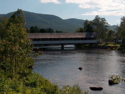
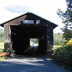
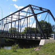
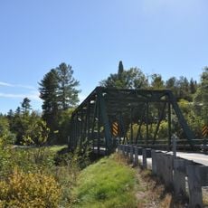
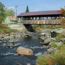
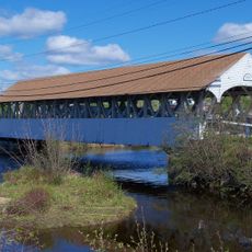
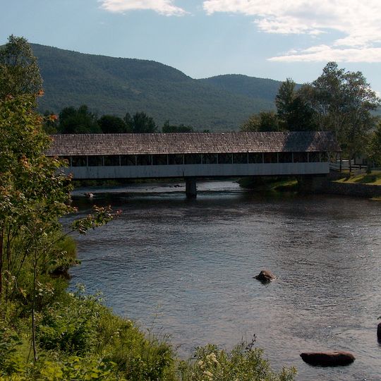
Stark Covered Bridge, Covered bridge in Stark, New Hampshire, US.

Stark Covered Bridge is a wooden bridge spanning the Upper Ammonoosuc River with white painted walls and walkways on each side. It connects Northside Road to New Hampshire Route 110 and accommodates both vehicle and pedestrian traffic.

Built in 1862, the bridge withstood flooding when local people used animals to retrieve and restore it to its original position. The structure was updated over time while keeping its historic character.

The structure displays 19th-century New England building methods in its wooden framework and stone supports. Visitors can observe how local craftspeople created lasting structures from simple materials.

The bridge is passable year-round for vehicles and foot traffic, though high water may limit access. Visitors should move slowly to notice the wooden construction details.

Steel reinforcements and a concrete support were added in the 1950s inside the bridge to strengthen the original wooden structure. These hidden upgrades allowed the distinctive exterior to remain unchanged.

The community of curious travelers

AroundUs brings together thousands of curated places, local tips, and hidden gems, enriched daily by 60,000 contributors worldwide.
Start exploring
Location
GPS coordinates
44.60083,-71.40833
Latest update
September 12, 2026 08:46
Around this place
Great North Woods Region
United States of America

Great North Woods Region

8.2 mi
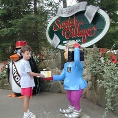
Santa's Village
United States of America

Santa's Village

12.8 mi
Jericho Mountain State Park
United States of America

Jericho Mountain State Park

10.4 mi
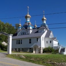
Holy Resurrection Orthodox Church
United States of America

Holy Resurrection Orthodox Church

14.1 mi
Mount Orne Covered Bridge
United States of America

Mount Orne Covered Bridge

15.5 mi
Moose Brook State Park
United States of America

Moose Brook State Park

16 mi
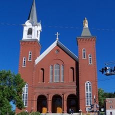
St. Anne Church
United States of America

St. Anne Church

14.4 mi
Janice Peaslee Bridge
United States of America

Janice Peaslee Bridge

8.4 mi
Weeks Estate
United States of America

Weeks Estate

13.1 mi
Maidstone State Park
United States of America

Maidstone State Park

11.9 mi
Mount Jasper Lithic Source
United States of America

Mount Jasper Lithic Source

13.2 mi
The Horn
United States of America

The Horn

5.7 mi
United States of America

Mount Kelsey

14.6 mi
Milan Hill State Park
United States of America

Milan Hill State Park

9.2 mi
Congregational Church
United States of America

Congregational Church

14.4 mi
Androscoggin Wayside Park
United States of America

Androscoggin Wayside Park

14.9 mi
Waumbek Cottages Historic District
United States of America

Waumbek Cottages Historic District

13.1 mi
Wilder-Holton House
United States of America

Wilder-Holton House

10.8 mi
William Dennis Weeks Memorial Library
United States of America

William Dennis Weeks Memorial Library

11 mi
Bloomfield-Nulhegan River Route 102 Bridge
United States of America

Bloomfield-Nulhegan River Route 102 Bridge

15.7 mi
Martin Homestead
United States of America

Martin Homestead

15 mi
Guildhall Village Historic District
United States of America

Guildhall Village Historic District

8 mi
United States of America

Saint Anne Historic District

14.4 mi
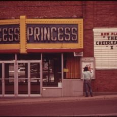
Princess Theatre
United States of America

Princess Theatre

14.4 mi
Albert Theater
United States of America

Albert Theater

14.4 mi
Mechanic Street Bridge
United States of America

Mechanic Street Bridge

11 mi
Groveton Bridge
United States of America

Groveton Bridge

5 mi
Pontook Reservoir
United States of America

Pontook Reservoir

8.2 mi
Show the full map
Reviews
Share your experience

No review yet

Discussions
Start a discussion...

No discussion yet

« Stark Covered Bridge - Covered bridge in Stark, New Hampshire, US » is provided by Around Us (aroundus.com). Images and texts are derived from Wikimedia project under a Creative Commons license. You are allowed to copy, distribute, and modify copies of this page, under the conditions set by the license, as long as this note is clearly visible.

Discover hidden gems everywhere you go!

From secret cafés to breathtaking viewpoints, skip the crowded tourist spots and find places that match your style. Our app makes it easy with voice search, smart filtering, route optimization, and insider tips from travelers worldwide. Download now for the complete mobile experience.
Around Us App Screenshot

A unique approach to discovering new places

Le Figaro

All the places worth exploring

France Info

A tailor-made excursion in just a few clicks

20 Minutes

Around Us
Travel Guide & Maps
Download

Send to your phone

QR Code
1

Open the camera app on your mobile.

2

Point at the QR code with your camera. A notification will appear.

3

Tap the notification to open the link.