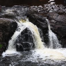
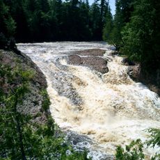
Superior Falls, Waterfall on Montreal River between Wisconsin and Michigan, United States.
Superior Falls is a waterfall on the Montreal River that divides Wisconsin and Michigan, dropping through multiple tiers in stages. The water plunges through a deep rocky gorge, creating a dramatic landscape along the state boundary.
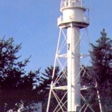
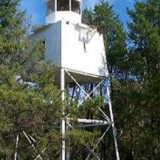
The site has been a significant landscape feature along the Montreal River for a long time. A hydroelectric facility was later constructed to manage the water flow passing over the falls.
The falls attract visitors throughout the summer months who gather to enjoy the water and the natural setting. The experience of standing at a state border while watching the river flow creates a unique sense of place.
A parking area sits near the main road, making it easy to stop and access the falls. Informal trails from there lead to different viewing spots along the gorge where you can see the water from various angles.
The water flow is controlled by a nearby power facility that maintains a steady amount passing over the rocks. This means the falls do not vary dramatically with the seasons but instead remain relatively consistent throughout the year.
Location: Wisconsin
Part of: Montreal River
GPS coordinates: 46.56275,-90.41521
Latest update: December 14, 2025 09:44
Copper Falls State Park
27.1 km
Big Bay State Park
32.9 km
Michigan Island Light
34.9 km
Ashland Harbor Breakwater Light
35.5 km
Ironwood Theatre
22.4 km
La Pointe Light
33.8 kmKakagon Sloughs
27.3 km
Great Conglomerate Falls
28.6 km
Chequamegon Point Light
35.3 km
Ironwood Memorial/Municipal Building
22.5 km
Ironwood Carnegie Library
22.3 km
Ellis School
34.9 km
Gogebic County Courthouse
29.2 km
Solomon S. Curry House
22.8 km
Annala Round Barn
25.3 km
City of Ashland
34.2 km
Security Savings Bank
36.1 km
Ashland County Courthouse
36.1 km
Old Iron County Courthouse
21.9 km
Grand Opera House
36.1 km
Chapple and MacArthur Avenues Residential Historic District
36.1 km
Mellen City Hall
32.3 km
West Second Street Historic District
36.2 km
Plummer Mine Headframe
19.8 km
Wilmarth School
35.6 km
Planter Road – Jackson Creek Bridge
34.5 km
Wakefield Hall
35.2 km
Main Street – Black River Bridge
33.2 kmVisited this place? Tap the stars to rate it and share your experience / photos with the community! Try now! You can cancel it anytime.
Discover hidden gems everywhere you go!
From secret cafés to breathtaking viewpoints, skip the crowded tourist spots and find places that match your style. Our app makes it easy with voice search, smart filtering, route optimization, and insider tips from travelers worldwide. Download now for the complete mobile experience.
A unique approach to discovering new places❞
— Le Figaro
All the places worth exploring❞
— France Info
A tailor-made excursion in just a few clicks❞
— 20 Minutes