The Cedars Natural Area Preserve

Log in to your account

AroundUs is a community-driven map of interesting places, built by curious explorers like you. It grows with every review, story, and photo you share.
Connect to save your favorite spots, contribute locations, and create personalized routes.
By continuing, you accept our Terms and Conditions and our Privacy Policy

The Cedars Natural Area Preserve

Add to collection
Map
Suggest a change
Share

The Cedars Natural Area Preserve, Protected area in Lee County, Virginia, US.

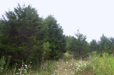
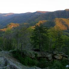
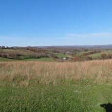
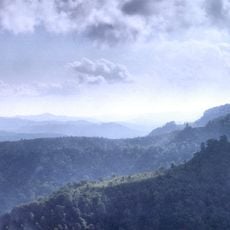
The Cedars Natural Area Preserve is a protected area in Virginia that covers limestone landscape with caves and sinkholes throughout its expanse. Specialized plant communities thrive here, having adapted to the unique conditions created by the underlying karst geology.

The Nature Conservancy acquired the first parcels in 1996, then transferred management to the Virginia Department of Conservation and Recreation in 1997. This handoff established the formal protection and professional stewardship that continues today.

Local community groups conduct education programs here, helping visitors understand the ecological importance of the karst landscape. These efforts have made the preserve a destination for people interested in learning about limestone ecosystems and their fragile communities.

You must arrange your visit in advance through a state-employed land steward, as the preserve has no public facilities or drop-in access. Planning ahead ensures you can explore the property properly and safely.

Rare plants like Wild Hyacinth and Crawe's Sedge grow nowhere else quite like they do here on the limestone soils. The endangered Lee County cave isopod, a small crustacean found only in these caves, depends entirely on this preserve for its survival.

GPS coordinates: 36.66667,-83.16667

Latest update: December 13, 2025 17:02

Photos
Around this place
United States Penitentiary
United States of America

United States Penitentiary

15.3 km
Black Mountain
United States of America

Black Mountain

36.8 km
Natural Tunnel State Park
United States of America

Natural Tunnel State Park

38 km
Hensley Settlement
United States of America

Hensley Settlement

32.3 km
United States of America

Wilderness Road State Park

32.1 km
Black Mountain Off-Road Adventure Area
United States of America

Black Mountain Off-Road Adventure Area

24.1 km
Kentucky Coal Mining Museum
United States of America

Kentucky Coal Mining Museum

38.3 km
Vardy Community School
United States of America

Vardy Community School

9.4 km
Amis House
United States of America

Amis House

33.4 km
Rogersville Historic District
United States of America

Rogersville Historic District

32.3 km
Hawkins County Courthouse
United States of America

Hawkins County Courthouse

32.3 km
United States of America

Overton Lodge

31.9 km
John Shell Cabin
United States of America

John Shell Cabin

37.5 km
St. Marks Presbyterian Church
United States of America

St. Marks Presbyterian Church

32 km
New Providence Presbyterian Church, Academy, and Cemetery
United States of America

New Providence Presbyterian Church, Academy, and Cemetery

36.1 km
Stony Point
United States of America

Stony Point

36.6 km
Jonesville Methodist Campground
United States of America

Jonesville Methodist Campground

2.7 km
Long Meadow
United States of America

Long Meadow

33.3 km
Dickinson-Milbourn House
United States of America

Dickinson-Milbourn House

4.4 km
William Sayers Homestead
United States of America

William Sayers Homestead

36.6 km
Laurel Fork
United States of America

Laurel Fork

38.8 km
Harlan Commercial District
United States of America

Harlan Commercial District

24.4 km
Benham Historic District
United States of America

Benham Historic District

38.2 km
Hale Springs Inn
United States of America

Hale Springs Inn

32.3 km
Cumberland Central Business District
United States of America

Cumberland Central Business District

37.8 km
Wilderness Road State Park
United States of America

Wilderness Road State Park

32.3 km
Kesterson-Watkins House
United States of America

Kesterson-Watkins House

35 km
Martins Fork Lake
United States of America

Martins Fork Lake

12.3 km
Show the full map
Reviews

Visited this place? Tap the stars to rate it and share your experience / photos with the community! Try now! You can cancel it anytime.

« The Cedars Natural Area Preserve - Protected area in Lee County, Virginia, US » is provided by Around Us (aroundus.com). Images and texts are derived from Wikimedia project under a Creative Commons license. You are allowed to copy, distribute, and modify copies of this page, under the conditions set by the license, as long as this note is clearly visible.

Discover hidden gems everywhere you go!

From secret cafés to breathtaking viewpoints, skip the crowded tourist spots and find places that match your style. Our app makes it easy with voice search, smart filtering, route optimization, and insider tips from travelers worldwide. Download now for the complete mobile experience.

Around Us App Screenshot

A unique approach to discovering new places

Le Figaro

All the places worth exploring

France Info

A tailor-made excursion in just a few clicks

20 Minutes