Black Mountain

Log in to your account

AroundUs is a community-driven map of interesting places, built by curious explorers like you. It grows with every review, story, and photo you share.
Connect to save your favorite spots, contribute locations, and create personalized routes.
By continuing, you accept our Terms and Conditions and our Privacy Policy
Add to collection
Map
Suggest a change
Share

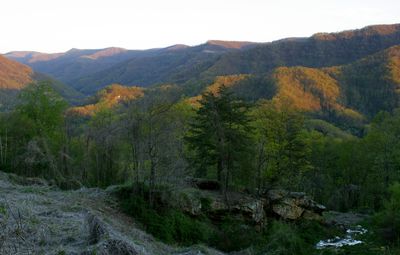
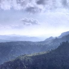
Black Mountain, Mountain peak in Harlan County, Kentucky, United States.

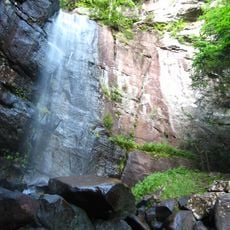
Black Mountain reaches 1,263 meters (4,145 feet), making it the tallest point in Kentucky, crowned by a metal lookout tower for fire observation. The upper slopes grow a northern hardwood forest with deciduous trees rarely found elsewhere in this region.

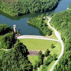
The area around the peak developed through coal mining in the early 20th century, when companies scoured the Appalachians for mineral wealth. In 1998, plans for mountaintop removal sparked public protests and debates over the future of the landscape.

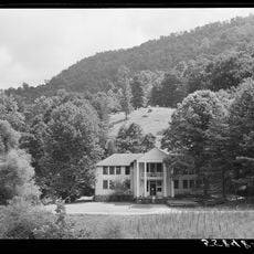
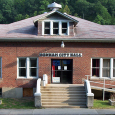
The summit sits close to Lynch, a settlement built by coal miners who once worked in some of the largest operations across the country. Travelers notice the tight connection between the peak and the families who spent generations in the mines below.

Route 160 crosses the summit, linking Lynch in Kentucky with Appalachia in Virginia, past a radar facility operated by aviation authorities. Hikers should watch for changing weather conditions at higher elevations, which can shift quickly.

The higher elevations shelter plants like red elderberry and hobblebush, which normally grow much farther north. This northern forest forms an island of cooler vegetation in the middle of the warmer Appalachians.

Location: Kentucky

Elevation above the sea: 1,263 m

GPS coordinates: 36.91433,-82.89386

Latest update: December 17, 2025 10:24

Photos
Natural areas and historical sites in Kentucky

Kentucky combines natural areas and historical places in ways that tell the story of the state. Cave systems run beneath the earth, including Mammoth Cave, one of the world's largest. Rivers cut through gorges and valleys, creating waterfalls like Cumberland Falls and rock formations that draw...

Around this place
United States Penitentiary
United States of America

United States Penitentiary

25.4 km
Natural Tunnel State Park
United States of America

Natural Tunnel State Park

27.1 km
United States of America

High Knob

23.6 km
Pine Mountain Settlement School
United States of America

Pine Mountain Settlement School

26 km
Bad Branch Falls State Nature Preserve
United States of America

Bad Branch Falls State Nature Preserve

20.2 km
Black Mountain Off-Road Adventure Area
United States of America

Black Mountain Off-Road Adventure Area

26.5 km
Kentucky Coal Mining Museum
United States of America

Kentucky Coal Mining Museum

7.5 km
Southwest Virginia Museum Historical State Park
United States of America

Southwest Virginia Museum Historical State Park

11.6 km
Wise County Courthouse
United States of America

Wise County Courthouse

28.8 km
June Tolliver House
United States of America

June Tolliver House

12 km
John Fox, Jr. House
United States of America

John Fox, Jr. House

11.6 km
E. M. Fulton House
United States of America

E. M. Fulton House

28.8 km
Terrace Park Girl Scout Cabin
United States of America

Terrace Park Girl Scout Cabin

11.5 km
Devils Fork
United States of America

Devils Fork

23.4 km
Flat Gap High School
United States of America

Flat Gap High School

26.1 km
Jonesville Methodist Campground
United States of America

Jonesville Methodist Campground

34.1 km
Tacoma School
United States of America

Tacoma School

32.3 km
Stonega Historic District
United States of America

Stonega Historic District

10.1 km
Kelly View School
United States of America

Kelly View School

13.4 km
Derby Historic District
United States of America

Derby Historic District

6.7 km
United States Post Office and Courthouse
United States of America

United States Post Office and Courthouse

11.9 km
Dickinson-Milbourn House
United States of America

Dickinson-Milbourn House

32.6 km
Laurel Fork
United States of America

Laurel Fork

19 km
North Fork of the Pound
United States of America

North Fork of the Pound

31.9 km
Benham Historic District
United States of America

Benham Historic District

7.4 km
Lynch Historic District
United States of America

Lynch Historic District

6 km
Cumberland Central Business District
United States of America

Cumberland Central Business District

11 km
Whitesburg Historic District
United States of America

Whitesburg Historic District

23.5 km
Show the full map
Reviews

Visited this place? Tap the stars to rate it and share your experience / photos with the community! Try now! You can cancel it anytime.

« Black Mountain - Mountain peak in Harlan County, Kentucky, United States » is provided by Around Us (aroundus.com). Images and texts are derived from Wikimedia project under a Creative Commons license. You are allowed to copy, distribute, and modify copies of this page, under the conditions set by the license, as long as this note is clearly visible.

Discover hidden gems everywhere you go!

From secret cafés to breathtaking viewpoints, skip the crowded tourist spots and find places that match your style. Our app makes it easy with voice search, smart filtering, route optimization, and insider tips from travelers worldwide. Download now for the complete mobile experience.

Around Us App Screenshot

A unique approach to discovering new places

Le Figaro

All the places worth exploring

France Info

A tailor-made excursion in just a few clicks

20 Minutes