Chest opened
+${chestReward.xp} XP
Explorer
NOUVEAU ×${chestReward.collectible.quantity}
tapez pour fermer
Chest locked

Open chests in the app

Around Us is built for your phone — chests unlock when you walk, explore and capture nearby places.

Enable Location

We need your location to show you interesting places around you

Discover nearby places

Find interesting locations and hidden gems around you

Precise directions

Get accurate directions and distances to places

Your location is never shared with other users. It's only used when you tap the location button.

Log in to your account

Start exploring — it's free

Trusted by 73,004 travelers worldwide

Continue with Google
Continue with Apple
or

We will send you a code to connect

By continuing, you accept our Terms and Conditions and our Privacy Policy

Check your inbox

We've sent a pincode in your inbox. Please enter the code below.

Thumb Area Bottomland Preserve
Discussion Reviews Photo
1.8k Popularity

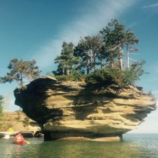
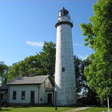
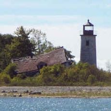
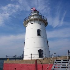
Thumb Area Bottomland Preserve, Protected area in Port Austin, Michigan, United States.

Thumb Area Bottomland Preserve is a protected area off the coast of Port Austin that spans Lake Huron waters and contains underwater limestone caves and geological formations. The lake bottom holds multiple shipwrecks from different periods, positioned at varying depths and accessible to those who explore beneath the surface.

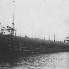
The preserve holds nineteen major shipwrecks spanning different time periods, with some sinking before federal maritime safety regulations were established in 1915. These wrecks mark various maritime events and document shipping history across the waters of Lake Huron.

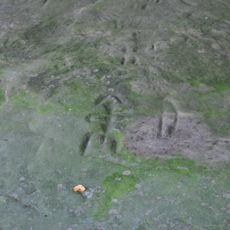
The underwater sites near Grindstone City hold abandoned grindstones left behind from former quarrying operations that shaped the local economy. These submerged remains show how industrial work once defined the region and drew people to settle in this area.

The water maintains clear conditions below the surface, which makes exploring the underwater structures easier. The best time to visit falls between spring and fall, when conditions are more stable and access is available from nearby port towns.

Visitors can observe shipwrecks underwater with remarkable clarity, making it a remarkable place for documenting maritime history. The extended visibility allows details to be seen at depth that would remain hidden in other deeper waters.

The community of curious travelers

AroundUs brings together thousands of curated places, local tips, and hidden gems, enriched daily by 60,000 contributors worldwide.

Start exploring
Location
GPS coordinates
44.02320,-82.77100
Latest update
December 14, 2025 11:20
Around this place
Turnip Rock
United States of America

Turnip Rock

15.9 km
Sanilac Petroglyphs Historic State Park
United States of America

Sanilac Petroglyphs Historic State Park

45.3 km
Port Crescent State Park
United States of America

Port Crescent State Park

22.8 km
SS Clifton
United States of America

SS Clifton

40.8 km
Pointe aux Barques Light
United States of America

Pointe aux Barques Light

1.8 km
Charity Island Light
United States of America

Charity Island Light

53.7 km
Grindstone City Historic District
United States of America

Grindstone City Historic District

10.7 km
Port Austin Light
United States of America

Port Austin Light

18.3 km
Harbor Beach Light
United States of America

Harbor Beach Light

22.7 km
St. Peter's Lutheran Church Kinde, Michigan
United States of America

St. Peter's Lutheran Church Kinde, Michigan

20.3 km
Grice House Museum
United States of America

Grice House Museum

20.9 km
Huron City Historic District
United States of America

Huron City Historic District

5 km
Charles G. Learned House
United States of America

Charles G. Learned House

18 km
Albert E. Sleeper House
United States of America

Albert E. Sleeper House

31 km
St. John's Lutheran Church
United States of America

St. John's Lutheran Church

10.1 km
Frank Murphy Birthplace
United States of America

Frank Murphy Birthplace

22.3 km
First Methodist Episcopal Church
United States of America

First Methodist Episcopal Church

10.3 km
Masonic Temple
United States of America

Masonic Temple

10.2 km
Frederick H. and Elizabeth Stafford House
United States of America

Frederick H. and Elizabeth Stafford House

10.1 km
W. R. Stafford Worker's House
United States of America

W. R. Stafford Worker's House

10.5 km
William R. Stafford House
United States of America

William R. Stafford House

10.2 km
Bay Port Historic Commercial Fishing District
United States of America

Bay Port Historic Commercial Fishing District

51.9 km
Smith-Culhane House
United States of America

Smith-Culhane House

18 km
Winsor and Snover Bank Building
United States of America

Winsor and Snover Bank Building

18 km
Isaac Leuty House
United States of America

Isaac Leuty House

10.2 km
W. R. Stafford Planing Mill Site
United States of America

W. R. Stafford Planing Mill Site

10.4 km
Caseville Harbor Light
United States of America

Caseville Harbor Light

41.7 km
Bad Axe Theatre
United States of America

Bad Axe Theatre

30.5 km
Show the full map
Reviews
Share your experience

No review yet

Discussions
Start a discussion...

No discussion yet

« Thumb Area Bottomland Preserve - Protected area in Port Austin, Michigan, United States » is provided by Around Us (aroundus.com). Images and texts are derived from Wikimedia project under a Creative Commons license. You are allowed to copy, distribute, and modify copies of this page, under the conditions set by the license, as long as this note is clearly visible.

Discover hidden gems everywhere you go!

From secret cafés to breathtaking viewpoints, skip the crowded tourist spots and find places that match your style. Our app makes it easy with voice search, smart filtering, route optimization, and insider tips from travelers worldwide. Download now for the complete mobile experience.

Around Us App Screenshot

A unique approach to discovering new places

Le Figaro

All the places worth exploring

France Info

A tailor-made excursion in just a few clicks

20 Minutes

Around Us
Travel Guide & Maps
Download

Send to your phone

QR Code
1

Open the camera app on your mobile.

2

Point at the QR code with your camera. A notification will appear.

3

Tap the notification to open the link.