Enable Location

We need your location to show you interesting places around you

Discover nearby places

Find interesting locations and hidden gems around you

Precise directions

Get accurate directions and distances to places

Your location is never shared with other users. It's only used when you tap the location button.

Theodore Wirth Park

Log in to your account

Start exploring — it's free

Trusted by 61,515 travelers worldwide

Continue with Google
Continue with Apple
or

We will send you a code to connect

By continuing, you accept our Terms and Conditions and our Privacy Policy

Check your inbox

We've sent a pincode in your inbox. Please enter the code below.

Theodore Wirth Park

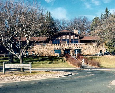
Theodore Wirth Park, Regional park in Golden Valley and Minneapolis, United States

Description

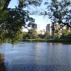
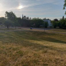
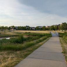
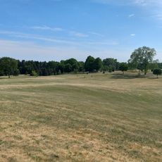
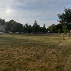
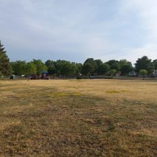
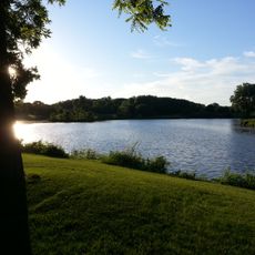
Theodore Wirth Park is a large recreational area in Golden Valley and Minneapolis featuring two golf courses, several lakes, and extensive hiking and mountain biking trails. The area covers roughly 300 acres and offers cross-country skiing paths in winter and various water and recreational activities in summer.

History

The park began in 1889 as a small green space with only about 27 acres and was later named after Theodore Wirth, an important landscape architect who led park development in Minneapolis from 1906. The site grew significantly over the decades through the addition of lakes, paths, and sports facilities.

Culture

The Eloise Butler Wildflower Garden within the park holds over 600 plant species and attracts bird watchers who can spot more than 130 different bird species throughout the grounds. The gardens are divided into distinct habitat zones, allowing visitors to explore different ecosystems on short walking paths.

Practical

The park is usable differently depending on the season, with golf courses in summer and cross-country skiing paths in winter, accessible by foot, bicycle, or car. Visitors should note that some areas close earlier than others and conditions vary depending on weather.

Did you know?

Within the park, a geographic marker indicates the 45 degrees latitude line, marking the exact midpoint between the equator and the North Pole. This invisible line connects the park to a larger global reference system that cartographers and geography enthusiasts have used for centuries.

Location
Location
Inception
1899
GPS coordinates
44.99000,-93.32300
Latest update
December 10, 2025 16:27

AroundUs brings together thousands of curated places, local tips, and hidden gems, enriched daily by 60,000 contributors worldwide. Discover all places nearby (Golden Valley).

Around this place
Walker Art Center
United States of America

Walker Art Center

3.6 km
Spoonbridge and Cherry
United States of America

Spoonbridge and Cherry

3.5 km
Minneapolis Sculpture Garden
United States of America

Minneapolis Sculpture Garden

3.4 km
United States of America

Minneapolis Sculpture Garden

3.5 km
Loring Park
United States of America

Loring Park

3.8 km
Frieda and Henry J. Neils House
United States of America

Frieda and Henry J. Neils House

3.6 km
Paul Olfelt House
United States of America

Paul Olfelt House

3.3 km
North Regional Library
United States of America

North Regional Library

3.3 km
Sumner Library
United States of America

Sumner Library

2.3 km
Northwestern Knitting Company Factory building
United States of America

Northwestern Knitting Company Factory building

2.9 km
H. Alden Smith House
United States of America

H. Alden Smith House

3.8 km
Charles J. Martin House
United States of America

Charles J. Martin House

3.3 km
Swinford Townhouses and Apartments
United States of America

Swinford Townhouses and Apartments

3.6 km
Lawrence A. and Mary Fournier House
United States of America

Lawrence A. and Mary Fournier House

3.3 km
Minneapolis Public Library, North Branch
United States of America

Minneapolis Public Library, North Branch

2.5 km
Elizabeth C. Quinlan House
United States of America

Elizabeth C. Quinlan House

3.4 km
亨内平大道卫理公会教堂
United States of America

亨内平大道卫理公会教堂

3.8 km
Kenwood Park Water Tower
United States of America

Kenwood Park Water Tower

2.8 km
Hall Park
United States of America

Hall Park

3 km
Sumner Field Park
United States of America

Sumner Field Park

2.4 km
North Commons Park
United States of America

North Commons Park

1.8 km
John Lohmar House
United States of America

John Lohmar House

2.5 km
Valley View Park
United States of America

Valley View Park

1.6 km
Cottage Park
United States of America

Cottage Park

1.9 km
Glen Gale Park
United States of America

Glen Gale Park

2.4 km
Jordan Park
United States of America

Jordan Park

2.9 km
Bassett Creek Park
United States of America

Bassett Creek Park

3.6 km
Kenwood Park
United States of America

Kenwood Park

3.1 km
Show the full map
« Theodore Wirth Park - Regional park in Golden Valley and Minneapolis, United States » is provided by Around Us (aroundus.com). Images and texts are derived from Wikimedia project under a Creative Commons license. You are allowed to copy, distribute, and modify copies of this page, under the conditions set by the license, as long as this note is clearly visible.

Discover hidden gems everywhere you go!

From secret cafés to breathtaking viewpoints, skip the crowded tourist spots and find places that match your style. Our app makes it easy with voice search, smart filtering, route optimization, and insider tips from travelers worldwide. Download now for the complete mobile experience.

Around Us App Screenshot

A unique approach to discovering new places

Le Figaro

All the places worth exploring

France Info

A tailor-made excursion in just a few clicks

20 Minutes

Around Us
Travel Guide & Maps
Download

Send to your phone

QR Code
1

Open the camera app on your mobile.

2

Point at the QR code with your camera. A notification will appear.

3

Tap the notification to open the link.