Enable Location

We need your location to show you interesting places around you

Discover nearby places

Find interesting locations and hidden gems around you

Precise directions

Get accurate directions and distances to places

Your location is never shared with other users. It's only used when you tap the location button.

Log in to your account

Start exploring — it's free

Trusted by 63,024 travelers worldwide

Continue with Google
Continue with Apple
or

We will send you a code to connect

By continuing, you accept our Terms and Conditions and our Privacy Policy

Check your inbox

We've sent a pincode in your inbox. Please enter the code below.

Discussion Reviews 1 Photos
3k Popularity

Tinkers Creek, Natural landmark and river in northeastern Ohio, United States.

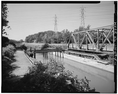
Tinkers Creek is a river system that flows across multiple counties in northeastern Ohio and serves as the principal tributary of the Cuyahoga River. The waterway drains from eight major creeks that originate in communities across the region, creating an interconnected network of streams and valleys.

The creek was named after a boatman who played a key role in a late 18th-century surveying expedition through the area. This early connection to regional exploration is reflected in the waterway's name, which has endured for over two centuries.

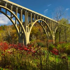
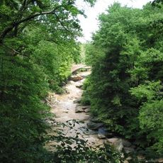
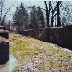
The gorge is named after a local historical figure and serves as a natural corridor for residents to connect with the landscape through hiking and wildlife watching. Today, the waterway represents a commitment to preserving natural spaces rather than converting them into artificial reservoirs for recreation.

The best time to explore is during warmer months when water levels are stable and the gorge banks are more accessible for walking. The terrain can be slippery, so sturdy footwear and careful footing are important when navigating the steep slopes and rocky areas.

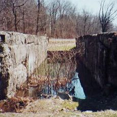
At one striking location, the creek plunges over a significant waterfall that exposes distinct layers of rock to view. This natural formation reveals how water has carved through different mineral layers over time, creating an open window into the geology beneath.

The community of curious travelers

AroundUs brings together thousands of curated places, local tips, and hidden gems, enriched daily by 60,000 contributors worldwide.

Start exploring
Location
GPS coordinates
41.36500,-81.60970
Latest update
December 8, 2025 21:05
Around this place
Ohio and Erie Canal
United States of America

Ohio and Erie Canal

1.6 km
Valley View Bridge
United States of America

Valley View Bridge

5.3 km
Tinkers Creek Aqueduct
United States of America

Tinkers Creek Aqueduct

81 m
St. Josaphat's Ukrainian Catholic Cathedral
United States of America

St. Josaphat's Ukrainian Catholic Cathedral

9.7 km
Brecksville-Northfield High Level Bridge
United States of America

Brecksville-Northfield High Level Bridge

5.2 km
Brecksville Reservation
United States of America

Brecksville Reservation

6 km
Jaite Mill Historic District
United States of America

Jaite Mill Historic District

9.8 km
Cathedral of St. John the Baptist
United States of America

Cathedral of St. John the Baptist

8.2 km
Station Road Bridge
United States of America

Station Road Bridge

5.4 km
Independence Slab
United States of America

Independence Slab

3.3 km
St. Michael Byzantine Catholic Church Toledo
United States of America

St. Michael Byzantine Catholic Church Toledo

8.2 km
Edmund Gleason Farm
United States of America

Edmund Gleason Farm

262 m
Bedford Baptist Church
United States of America

Bedford Baptist Church

6.9 km
Independence Presbyterian Church
United States of America

Independence Presbyterian Church

3.3 km
St. Joseph Convent and Academy Complex
United States of America

St. Joseph Convent and Academy Complex

6.2 km
Wilson Feed Mill
United States of America

Wilson Feed Mill

1.5 km
William Knapp House
United States of America

William Knapp House

863 m
Abraham Ulyatt House
United States of America

Abraham Ulyatt House

2.5 km
Lock Tender's House and Inn
United States of America

Lock Tender's House and Inn

892 m
Charles B. Rich House
United States of America

Charles B. Rich House

6.6 km
South Park Site
United States of America

South Park Site

1.8 km
Terra Vista Archeological District
United States of America

Terra Vista Archeological District

374 m
Vaughn Site
United States of America

Vaughn Site

9 km
Lock No. 35
United States of America

Lock No. 35

1.4 km
Stephen Frazee House
United States of America

Stephen Frazee House

2 km
Lock No. 34
United States of America

Lock No. 34

9.2 km
Miles Park Historic District
United States of America

Miles Park Historic District

9.1 km
Bedford Historic Business District
United States of America

Bedford Historic Business District

6.9 km
Show the full map
Reviews
Share your experience

No review yet

Discussions
Start a discussion...

No discussion yet

« Tinkers Creek - Natural landmark and river in northeastern Ohio, United States » is provided by Around Us (aroundus.com). Images and texts are derived from Wikimedia project under a Creative Commons license. You are allowed to copy, distribute, and modify copies of this page, under the conditions set by the license, as long as this note is clearly visible.

Discover hidden gems everywhere you go!

From secret cafés to breathtaking viewpoints, skip the crowded tourist spots and find places that match your style. Our app makes it easy with voice search, smart filtering, route optimization, and insider tips from travelers worldwide. Download now for the complete mobile experience.

Around Us App Screenshot

A unique approach to discovering new places

Le Figaro

All the places worth exploring

France Info

A tailor-made excursion in just a few clicks

20 Minutes

Around Us
Travel Guide & Maps
Download

Send to your phone

QR Code
1

Open the camera app on your mobile.

2

Point at the QR code with your camera. A notification will appear.

3

Tap the notification to open the link.