Ohio and Erie Canal

Log in to your account

AroundUs is a community-driven map of interesting places, built by curious explorers like you. It grows with every review, story, and photo you share.
Connect to save your favorite spots, contribute locations, and create personalized routes.
Continue with Google
Continue with Apple
Continue with X
Continue with Facebook
Continue with email
By continuing, you accept our Terms and Conditions and our Privacy Policy
Create an account

Ohio and Erie Canal

Add to collection
Map
Suggest a change
Share

Ohio and Erie Canal, Transportation canal in Cuyahoga County, United States

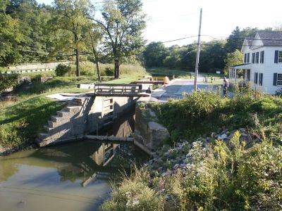
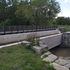
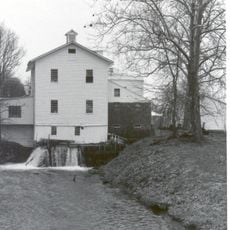
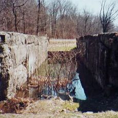
The Ohio and Erie Canal is a waterway stretching through Ohio that connects Lake Erie at Cleveland with the Ohio River at Portsmouth. The system includes multiple locks built into the ground to help boats navigate changes in elevation.

Construction began in 1825 when Irish and German immigrants hand-dug the waterway, connecting Cleveland to Akron by 1827. This project represented one of the largest infrastructure undertakings of its time in America.

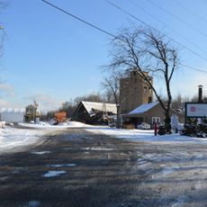
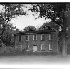
The canal shaped surrounding communities by enabling local farmers to sell their goods at distant markets and revitalized regional commerce. Its arrival in different towns marked the beginning of new economic opportunities for residents.

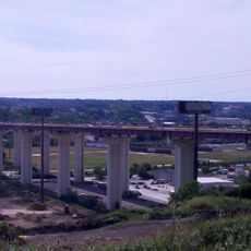
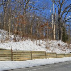
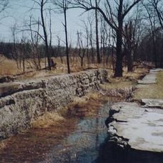
The canal can be explored on foot or by bicycle along paths that run alongside the water. Many sections are easily accessible with multiple entry points for visitors of different abilities.

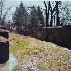
The locks were engineering marvels of their time, allowing boats to overcome elevation changes of dozens of feet. Some of these original structures still stand and demonstrate the durability of the early engineering work.

Location: Cuyahoga County

GPS coordinates: 41.35549,-81.59608

Latest update: December 17, 2025 08:18

Photos
Around this place
Valley View Bridge
United States of America

Valley View Bridge

6.7 km
Brandywine Falls
United States of America

Brandywine Falls

10 km
Tinkers Creek Aqueduct
United States of America

Tinkers Creek Aqueduct

1.5 km
Brecksville-Northfield High Level Bridge
United States of America

Brecksville-Northfield High Level Bridge

3.9 km
Brecksville Reservation
United States of America

Brecksville Reservation

5.1 km
Jaite Mill Historic District
United States of America

Jaite Mill Historic District

8.4 km
Cathedral of St. John the Baptist
United States of America

Cathedral of St. John the Baptist

9.7 km
Station Road Bridge
United States of America

Station Road Bridge

4.1 km
Independence Slab
United States of America

Independence Slab

4.8 km
St. Michael Byzantine Catholic Church Toledo
United States of America

St. Michael Byzantine Catholic Church Toledo

9.7 km
Edmund Gleason Farm
United States of America

Edmund Gleason Farm

1.8 km
Bedford Baptist Church
United States of America

Bedford Baptist Church

6.4 km
Independence Presbyterian Church
United States of America

Independence Presbyterian Church

4.8 km
St. Joseph Convent and Academy Complex
United States of America

St. Joseph Convent and Academy Complex

7.2 km
Wilson Feed Mill
United States of America

Wilson Feed Mill

113 m
William Knapp House
United States of America

William Knapp House

2.3 km
Coonrad Ranger Station
United States of America

Coonrad Ranger Station

8.6 km
Abraham Ulyatt House
United States of America

Abraham Ulyatt House

3.9 km
Lock Tender's House and Inn
United States of America

Lock Tender's House and Inn

2.4 km
Charles B. Rich House
United States of America

Charles B. Rich House

6 km
South Park Site
United States of America

South Park Site

3.4 km
Terra Vista Archeological District
United States of America

Terra Vista Archeological District

1.9 km
Vaughn Site
United States of America

Vaughn Site

7.7 km
Lock No. 35
United States of America

Lock No. 35

166 m
Stephen Frazee House
United States of America

Stephen Frazee House

428 m
Lock No. 34
United States of America

Lock No. 34

7.8 km
Lock No. 33
United States of America

Lock No. 33

9.3 km
Miles Park Historic District
United States of America

Miles Park Historic District

9.8 km
Show the full map
Reviews

Visited this place? Tap the stars to rate it and share your experience / photos with the community! Try now! You can cancel it anytime.

« Ohio and Erie Canal - Transportation canal in Cuyahoga County, United States » is provided by Around Us (aroundus.com). Images and texts are derived from Wikimedia project under a Creative Commons license. You are allowed to copy, distribute, and modify copies of this page, under the conditions set by the license, as long as this note is clearly visible.

Discover hidden gems everywhere you go!

From secret cafés to breathtaking viewpoints, skip the crowded tourist spots and find places that match your style. Our app makes it easy with voice search, smart filtering, route optimization, and insider tips from travelers worldwide. Download now for the complete mobile experience.

Around Us App Screenshot

A unique approach to discovering new places

Le Figaro

All the places worth exploring

France Info

A tailor-made excursion in just a few clicks

20 Minutes