Tippecanoe River State Park

Log in to your account

AroundUs is a community-driven map of interesting places, built by curious explorers like you. It grows with every review, story, and photo you share.
Connect to save your favorite spots, contribute locations, and create personalized routes.
Continue with Google
Continue with Apple
Continue with X
Continue with Facebook
Continue with email
By continuing, you accept our Terms and Conditions and our Privacy Policy
Create an account

Tippecanoe River State Park

Add to collection
Map
Suggest a change
Share

Tippecanoe River State Park, Indiana state park in Pulaski County, US.

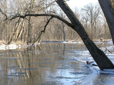
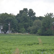
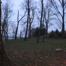
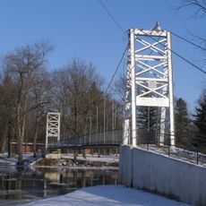
Tippecanoe River State Park is a natural area of over 2,700 acres that stretches along the Tippecanoe River, with 23 miles of trails connecting different landscapes. Oak forests, prairie areas, river bluffs, and sandy terrain make up the varied environment throughout the park.

The land was originally developed as a Recreational Demonstration Area by the National Park Service and transferred to Indiana's Department of Conservation in 1943. This transfer established it as a state park under local management.

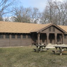
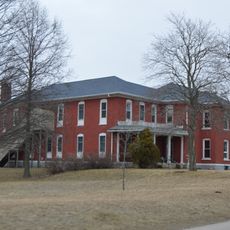
The Tepicon Recreation Hall, listed on the National Register of Historic Places, continues to serve as a community gathering space for events and celebrations today. Visitors can see how this building reflects the park's long role in bringing people together.

The park offers a range of overnight options including primitive tent sites, electric hookup areas, cabin accommodations, horse camping, and designated youth group camping zones. Visitors should contact the park office for guidance on which option suits their needs and preferred season.

A fire observation tower standing 90 feet high was built in the 1930s as part of the Works Project Administration program. Climbing this structure offers visitors an unusual perspective on the surrounding countryside from a historic vantage point.

Location: Indiana

Inception: 1943

Website: http://in.gov/dnr/parklake/2965.htm

GPS coordinates: 41.12230,-86.58300

Latest update: December 10, 2025 20:00

Photos
Around this place
Fulton County Courthouse
United States of America

Fulton County Courthouse

31.5 km
Rochester Downtown Historic District
United States of America

Rochester Downtown Historic District

30.5 km
Chief Menominee Memorial Site
United States of America

Chief Menominee Memorial Site

26.7 km
Plymouth Downtown Historic District
United States of America

Plymouth Downtown Historic District

33.4 km
Starke County Courthouse
United States of America

Starke County Courthouse

19.9 km
Bert Leedy Round Barn
United States of America

Bert Leedy Round Barn

28.8 km
Marshall County Courthouse
United States of America

Marshall County Courthouse

33.5 km
Argos Downtown Historic District
United States of America

Argos Downtown Historic District

31 km
Hoham-Klinghammer-Weckerle House and Brewery Site
United States of America

Hoham-Klinghammer-Weckerle House and Brewery Site

31.9 km
Tepicon Hall
United States of America

Tepicon Hall

3.1 km
John W. Smith House
United States of America

John W. Smith House

31.1 km
Pulaski County Courthouse
United States of America

Pulaski County Courthouse

8.1 km
East Shore Historic District
United States of America

East Shore Historic District

18.4 km
Dr. George W. Thompson House
United States of America

Dr. George W. Thompson House

7.9 km
Lyman M. Brackett House
United States of America

Lyman M. Brackett House

31.2 km
Starke County Bridge No. 39
United States of America

Starke County Bridge No. 39

20.1 km
Independence Methodist Church
United States of America

Independence Methodist Church

31.4 km
Monterey Bandstand
United States of America

Monterey Bandstand

9.5 km
Pulaski County Home
United States of America

Pulaski County Home

8.9 km
Norris Farm-Maxinkuckee Orchard
United States of America

Norris Farm-Maxinkuckee Orchard

20.5 km
Lewis and Sarah Boggs House
United States of America

Lewis and Sarah Boggs House

33.2 km
Forest Place Historic District
United States of America

Forest Place Historic District

17.7 km
Woodbank
United States of America

Woodbank

17.6 km
John Haimbaugh Round Barn
United States of America

John Haimbaugh Round Barn

33.3 km
Hoosier Valley Railroad Museum
United States of America

Hoosier Valley Railroad Museum

19.3 km
Dog Face Bridge
United States of America

Dog Face Bridge

30.6 km
Starke County Bridge 700E
United States of America

Starke County Bridge 700E

18.7 km
Memorial Bridge
United States of America

Memorial Bridge

7.9 km
Show the full map
Reviews

Visited this place? Tap the stars to rate it and share your experience / photos with the community! Try now! You can cancel it anytime.

« Tippecanoe River State Park - Indiana state park in Pulaski County, US » is provided by Around Us (aroundus.com). Images and texts are derived from Wikimedia project under a Creative Commons license. You are allowed to copy, distribute, and modify copies of this page, under the conditions set by the license, as long as this note is clearly visible.

Discover hidden gems everywhere you go!

From secret cafés to breathtaking viewpoints, skip the crowded tourist spots and find places that match your style. Our app makes it easy with voice search, smart filtering, route optimization, and insider tips from travelers worldwide. Download now for the complete mobile experience.

Around Us App Screenshot

A unique approach to discovering new places

Le Figaro

All the places worth exploring

France Info

A tailor-made excursion in just a few clicks

20 Minutes