Enable Location

We need your location to show you interesting places around you

Discover nearby places

Find interesting locations and hidden gems around you

Precise directions

Get accurate directions and distances to places

Your location is never shared with other users. It's only used when you tap the location button.

Trapps Mountain Hamlet Historic District

Log in to your account

Start exploring — it's free

Trusted by 63,002 travelers worldwide

Continue with Google
Continue with Apple
or

We will send you a code to connect

By continuing, you accept our Terms and Conditions and our Privacy Policy

Check your inbox

We've sent a pincode in your inbox. Please enter the code below.

Trapps Mountain Hamlet Historic District
Discussion Reviews 1 Photos
3k Popularity

Trapps Mountain Hamlet Historic District, human settlement in New York, United States of America

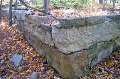
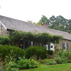
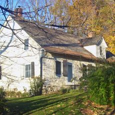
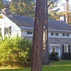
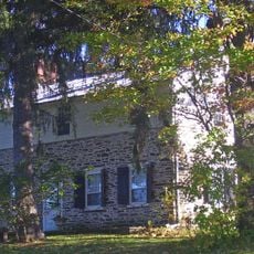
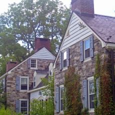
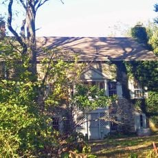
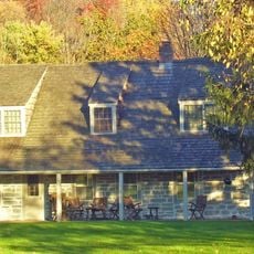
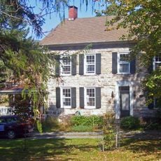
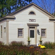
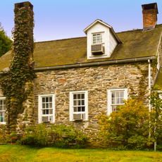
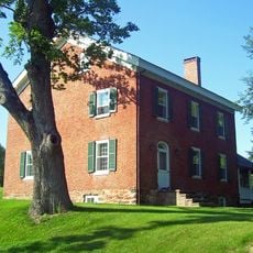
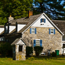
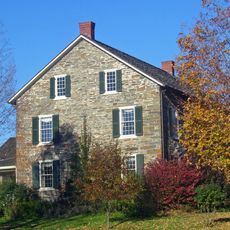
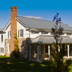
Trapps Mountain Hamlet Historic District is an abandoned settlement on the Shawangunk Ridge that was home to residents from the late 1700s to the mid-1900s. Today, stone foundations, six surviving structures including a restored cabin built around 1889, millstone quarry remains, and old burial grounds are visible across the overgrown site.

The settlement was established in the late 1700s by settlers of Dutch and English descent who lived by farming, timber work, and stone quarrying. The community declined in the 1900s due to transportation changes and economic shifts, with the last resident dying in 1956.

The settlement name comes from the rocky terrain where residents built their homes. Visitors can see how people lived closely tied to the land, farming small plots, raising livestock, and gathering forest resources for their livelihood.

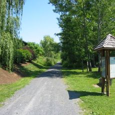
The site is located within Mohonk Preserve and Minnewaska State Park Preserve, accessible by hiking trails that pass through the wooded ruins. The restored Van Leuven Cabin is sometimes open for visitors, and marked paths lead to buried building remains, burial grounds, and the old millstone quarry.

The last resident, Eli Van Leuven, lived without electricity or running water and stayed in complete isolation until his death in 1956. His small restored cabin from 1889 now stands as a silent testament to a vanished way of life.

The community of curious travelers

AroundUs brings together thousands of curated places, local tips, and hidden gems, enriched daily by 60,000 contributors worldwide.

Start exploring
Location
GPS coordinates
41.73333,-74.21417
Latest update
February 9, 2026 08:23
Around this place
Mohonk Mountain House
United States of America

Mohonk Mountain House

6.3 km
United States of America

Minnewaska State Park Preserve

6 km
Wallkill Valley Rail Trail
United States of America

Wallkill Valley Rail Trail

9.7 km
Stony Kill Falls
United States of America

Stony Kill Falls

7.3 km
Tuthilltown Gristmill
United States of America

Tuthilltown Gristmill

6.1 km
Alligerville Historic District
United States of America

Alligerville Historic District

7.1 km
The Locusts
United States of America

The Locusts

9.3 km
Bevier House
United States of America

Bevier House

6.4 km
Congregation Tifereth Yehuda Veyisroel
United States of America

Congregation Tifereth Yehuda Veyisroel

8.1 km
Gardiner Town Hall
United States of America

Gardiner Town Hall

8.1 km
Jenkins-DuBois Farm
United States of America

Jenkins-DuBois Farm

9.3 km
Abraham and Maria LeFevre House
United States of America

Abraham and Maria LeFevre House

8 km
Tuthilltown Bridge
United States of America

Tuthilltown Bridge

6.5 km
Ephriam DuPuy Stone House
United States of America

Ephriam DuPuy Stone House

9.6 km
John A. Lafevre House and School
United States of America

John A. Lafevre House and School

8.8 km
Dirck Westbrook Stone House
United States of America

Dirck Westbrook Stone House

8.1 km
J. Dupuy Stone House
United States of America

J. Dupuy Stone House

9.4 km
Brykill Farms
United States of America

Brykill Farms

7.5 km
C. K. Schoonmaker Stone House
United States of America

C. K. Schoonmaker Stone House

9.6 km
Hornbeck Stone House
United States of America

Hornbeck Stone House

9.3 km
Pearl Street Schoolhouse
United States of America

Pearl Street Schoolhouse

10 km
Johannes Jansen House
United States of America

Johannes Jansen House

9 km
Bruynswick School No. 8
United States of America

Bruynswick School No. 8

8.3 km
Sahler Stone House
United States of America

Sahler Stone House

9.8 km
Hendrikus DuBois House
United States of America

Hendrikus DuBois House

7.5 km
Jacobus Van Wagenen Stone House
United States of America

Jacobus Van Wagenen Stone House

8.5 km
Jacob Hoornbeck Stone House
United States of America

Jacob Hoornbeck Stone House

9.5 km
Stilwill-Westbrook Stone House
United States of America

Stilwill-Westbrook Stone House

8.3 km
Show the full map
Reviews
Share your experience

No review yet

Discussions
Start a discussion...

No discussion yet

« Trapps Mountain Hamlet Historic District - human settlement in New York, United States of America » is provided by Around Us (aroundus.com). Images and texts are derived from Wikimedia project under a Creative Commons license. You are allowed to copy, distribute, and modify copies of this page, under the conditions set by the license, as long as this note is clearly visible.

Discover hidden gems everywhere you go!

From secret cafés to breathtaking viewpoints, skip the crowded tourist spots and find places that match your style. Our app makes it easy with voice search, smart filtering, route optimization, and insider tips from travelers worldwide. Download now for the complete mobile experience.

Around Us App Screenshot

A unique approach to discovering new places

Le Figaro

All the places worth exploring

France Info

A tailor-made excursion in just a few clicks

20 Minutes

Around Us
Travel Guide & Maps
Download

Send to your phone

QR Code
1

Open the camera app on your mobile.

2

Point at the QR code with your camera. A notification will appear.

3

Tap the notification to open the link.