United States Navy Seabees Bridge

Log in to your account

AroundUs is a community-driven map of interesting places, built by curious explorers like you. It grows with every review, story, and photo you share.
Connect to save your favorite spots, contribute locations, and create personalized routes.
Continue with Google
Continue with Apple
Continue with X
Continue with Facebook
Continue with email
By continuing, you accept our Terms and Conditions and our Privacy Policy
Create an account

United States Navy Seabees Bridge

Add to collection
Map
Suggest a change
Share

United States Navy Seabees Bridge, Steel arch bridge between Chesterfield and Brattleboro, United States

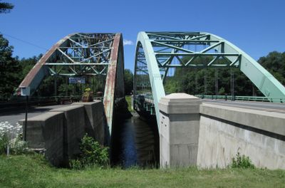
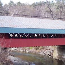
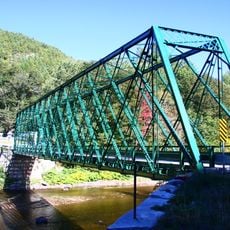
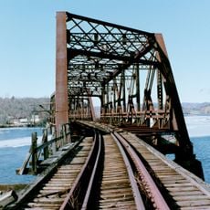
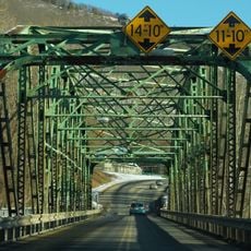
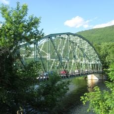
The United States Navy Seabees Bridge is a steel arch bridge spanning the Connecticut River, connecting New Hampshire Route 9 to Vermont Route 9. The structure consists of two separate constructions: the 1937 steel arch bridge alongside a 2003 replacement featuring greater load capacity and wider deck space.

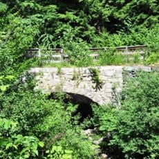
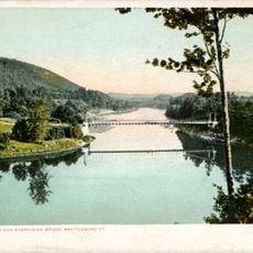
An original suspension bridge built in 1888 was destroyed by flooding in 1936, leading to the construction of a steel arch bridge in 1937. Nearly 70 years later, a second bridge with modern design was added in 2003 to accommodate growing traffic demands.

The bridge is named after the Navy Seabees, a specialized military unit known for their construction expertise. This naming reflects the historical connection between military engineering and civilian infrastructure development in the area.

The older and newer bridges sit side by side, allowing pedestrians and cyclists to use the less-traveled 1937 structure. The crossing connects two small communities and serves as part of the regional road network, making it convenient for travelers moving through the area.

Divers have documented remnants of the original suspension bridge from 1888 on the river bed below, providing a direct connection to the site's past. These underwater discoveries offer a surprising view of how the crossing has evolved over time.

Location: New Hampshire

Location: Vermont

Official opening: 1888

GPS coordinates: 42.88390,-72.55190

Latest update: December 12, 2025 14:20

Photos
Around this place
Naulakha
United States of America

Naulakha

1.9 km
Fort Dummer
United States of America

Fort Dummer

5.9 km
West Dummerston Covered Bridge
United States of America

West Dummerston Covered Bridge

7.7 km
Creamery Covered Bridge
United States of America

Creamery Covered Bridge

4.8 km
Brooks Memorial Library
United States of America

Brooks Memorial Library

3.3 km
Brattleboro Museum and Art Center
United States of America

Brattleboro Museum and Art Center

3.7 km
Latchis Hotel and Theatre
United States of America

Latchis Hotel and Theatre

3.7 km
Sacketts Brook Stone Arch Bridge
United States of America

Sacketts Brook Stone Arch Bridge

10.5 km
Deacon John Holbrook House
United States of America

Deacon John Holbrook House

3.1 km
Putney Village Historic District
United States of America

Putney Village Historic District

10.4 km
Rice Farm Road Bridge
United States of America

Rice Farm Road Bridge

6.2 km
William Harris House
United States of America

William Harris House

4.8 km
Brattleboro Downtown Historic District
United States of America

Brattleboro Downtown Historic District

3.4 km
Canal Street–Clark Street Neighborhood Historic District
United States of America

Canal Street–Clark Street Neighborhood Historic District

3.9 km
Todd Block
United States of America

Todd Block

11.9 km
Lewis Grout House
United States of America

Lewis Grout House

5.2 km
Arthur D. and Emma J. Wyatt House
United States of America

Arthur D. and Emma J. Wyatt House

2.8 km
Dickinson Estate Historic District
United States of America

Dickinson Estate Historic District

1.4 km
Tontine Building
United States of America

Tontine Building

6.7 km
West Brattleboro Green Historic District
United States of America

West Brattleboro Green Historic District

5.3 km
Homestead-Horton Neighborhood Historic District
United States of America

Homestead-Horton Neighborhood Historic District

4.2 km
Brattleboro Museum and Art Center
United States of America

Brattleboro Museum and Art Center

3.7 km
Madame Sherri's Castle
United States of America

Madame Sherri's Castle

3.4 km
B&M Connecticut River Bridge
United States of America

B&M Connecticut River Bridge

5.1 km
Municipal Center
United States of America

Municipal Center

3.3 km
Charles Dana Bridge
United States of America

Charles Dana Bridge

3.7 km
Anna Hunt Marsh Bridge
United States of America

Anna Hunt Marsh Bridge

3.6 km
Brattleboro Suspension Bridge
United States of America

Brattleboro Suspension Bridge

192 m
Show the full map
Reviews

Visited this place? Tap the stars to rate it and share your experience / photos with the community! Try now! You can cancel it anytime.

« United States Navy Seabees Bridge - Steel arch bridge between Chesterfield and Brattleboro, United States » is provided by Around Us (aroundus.com). Images and texts are derived from Wikimedia project under a Creative Commons license. You are allowed to copy, distribute, and modify copies of this page, under the conditions set by the license, as long as this note is clearly visible.

Discover hidden gems everywhere you go!

From secret cafés to breathtaking viewpoints, skip the crowded tourist spots and find places that match your style. Our app makes it easy with voice search, smart filtering, route optimization, and insider tips from travelers worldwide. Download now for the complete mobile experience.

Around Us App Screenshot

A unique approach to discovering new places

Le Figaro

All the places worth exploring

France Info

A tailor-made excursion in just a few clicks

20 Minutes