Chest opened
+${chestReward.xp} XP
Explorer
NOUVEAU ×${chestReward.collectible.quantity}
tapez pour fermer
Chest locked

Open chests in the app

Around Us is built for your phone — chests unlock when you walk, explore and capture nearby places.

Enable Location

We need your location to show you interesting places around you

Discover nearby places

Find interesting locations and hidden gems around you

Precise directions

Get accurate directions and distances to places

Your location is never shared with other users. It's only used when you tap the location button.

Ivy City

Log in to your account

Start exploring — it's free

Trusted by 72,878 travelers worldwide

Continue with Google
Continue with Apple
or

We will send you a code to connect

By continuing, you accept our Terms and Conditions and our Privacy Policy

Check your inbox

We've sent a pincode in your inbox. Please enter the code below.

Discussion Reviews 1 Photos
13.5k Popularity

Ivy City, Industrial neighborhood in Northeast Washington, D.C., United States.

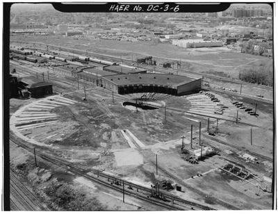
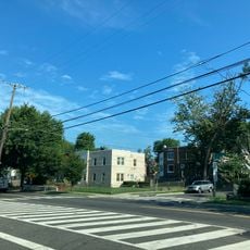
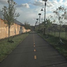
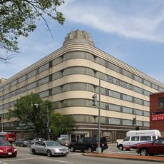
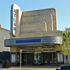
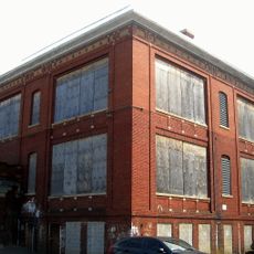
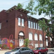
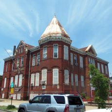
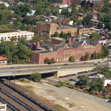
Ivy City is a neighborhood in Northeast Washington, D.C., characterized by former factory buildings and modern warehouses. The area now houses distilleries and breweries alongside a railroad maintenance yard used by Amtrak.

The neighborhood emerged in 1873 as the site of the National Fair Grounds, which featured a horse racing track. This early purpose shaped the area's infrastructure for many decades to come.

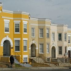
The neighborhood's name comes from ivy plants that once covered the old industrial buildings. Today, the repurposed factory spaces still reflect this green past while housing contemporary businesses.

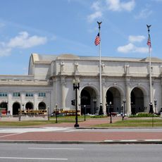
The neighborhood sits along New York Avenue NE with convenient connections to downtown. The nearby U.S. National Arboretum with its extensive gardens is easily accessible on foot or by car.

Distilleries and breweries have repurposed old industrial buildings into production facilities that now draw visitors interested in local beverage making. The conversion shows how raw factory architecture blends with contemporary operations.

The community of curious travelers

AroundUs brings together thousands of curated places, local tips, and hidden gems, enriched daily by 60,000 contributors worldwide.

Start exploring
Location
Inception
1873
Elevation above the sea
23 m
Shares border with
Brentwood
GPS coordinates
38.91111,-76.98472
Latest update
December 7, 2025 20:40
Around this place
Washington Union Station
United States of America

Washington Union Station

2.3 km
Northeast
United States of America

Northeast

785 m
Eckington
United States of America

Eckington

1.5 km
Thurgood Marshall Federal Judiciary Building
United States of America

Thurgood Marshall Federal Judiciary Building

2.3 km
Goshin
United States of America

Goshin

1.8 km
St. Aloysius Church
United States of America

St. Aloysius Church

2.4 km
Edgewood
United States of America

Edgewood

2.1 km
Metropolitan Branch Trail
United States of America

Metropolitan Branch Trail

1.7 km
Glenwood Cemetery
United States of America

Glenwood Cemetery

2.3 km
Hecht Company Warehouse
United States of America

Hecht Company Warehouse

372 m
Atlas Performing Arts Center
United States of America

Atlas Performing Arts Center

1.3 km
Chesapeake and Potomac Telephone Company Warehouse and Repair Facility
United States of America

Chesapeake and Potomac Telephone Company Warehouse and Repair Facility

2.2 km
Woodward & Lothrop Service Warehouse
United States of America

Woodward & Lothrop Service Warehouse

1.8 km
Truck House No. 13
United States of America

Truck House No. 13

1.1 km
Alexander Crummell School
United States of America

Alexander Crummell School

303 m
Benjamin C. Grenup Monument
United States of America

Benjamin C. Grenup Monument

2.2 km
United States of America

National Deaf Life Museum

1 km
H Street Playhouse
United States of America

H Street Playhouse

1 km
Gallaudet College Historic District
United States of America

Gallaudet College Historic District

1.1 km
John Mercer Langston School
United States of America

John Mercer Langston School

2.2 km
John Fox Slater Elementary School
United States of America

John Fox Slater Elementary School

2.2 km
Dahlgreen Courts
United States of America

Dahlgreen Courts

1.5 km
Home for the Aged Men and Women
United States of America

Home for the Aged Men and Women

2 km
Northeast Neighborhood Library
United States of America

Northeast Neighborhood Library

2.1 km
President's House, Gallaudet College
United States of America

President's House, Gallaudet College

1.2 km
Roosevelt Apartment Building
United States of America

Roosevelt Apartment Building

1.6 km
Rosedale Neighborhood Library
United States of America

Rosedale Neighborhood Library

1.6 km
Armstrong Manual Training School
United States of America

Armstrong Manual Training School

2.5 km
Show the full map
Reviews
Share your experience

No review yet

Discussions
Start a discussion...

No discussion yet

« Ivy City - Industrial neighborhood in Northeast Washington, D.C., United States » is provided by Around Us (aroundus.com). Images and texts are derived from Wikimedia project under a Creative Commons license. You are allowed to copy, distribute, and modify copies of this page, under the conditions set by the license, as long as this note is clearly visible.

Discover hidden gems everywhere you go!

From secret cafés to breathtaking viewpoints, skip the crowded tourist spots and find places that match your style. Our app makes it easy with voice search, smart filtering, route optimization, and insider tips from travelers worldwide. Download now for the complete mobile experience.

Around Us App Screenshot

A unique approach to discovering new places

Le Figaro

All the places worth exploring

France Info

A tailor-made excursion in just a few clicks

20 Minutes

Around Us
Travel Guide & Maps
Download

Send to your phone

QR Code
1

Open the camera app on your mobile.

2

Point at the QR code with your camera. A notification will appear.

3

Tap the notification to open the link.