Enable Location

We need your location to show you interesting places around you

Discover nearby places

Find interesting locations and hidden gems around you

Precise directions

Get accurate directions and distances to places

Your location is never shared with other users. It's only used when you tap the location button.

Northeast

Log in to your account

Start exploring — it's free

Trusted by 61,666 travelers worldwide

Continue with Google
Continue with Apple
or

We will send you a code to connect

By continuing, you accept our Terms and Conditions and our Privacy Policy

Check your inbox

We've sent a pincode in your inbox. Please enter the code below.

Northeast, Administrative quadrant in Washington, D.C., United States

Description

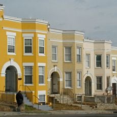
Northeast lies north of East Capitol Street and east of North Capitol Street, encompassing around 35 residential neighborhoods throughout the area. The region is divided into distinct communities, each with its own character and street layout.

History

The quadrant was established in 1791 as part of Washington's original city plan, with the Capitol building serving as the central reference point. This foundational division shaped how the city developed and organized itself over the following centuries.

Culture

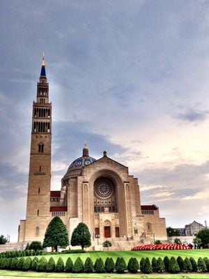
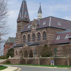
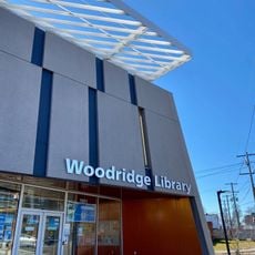
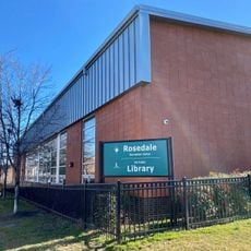
Gallaudet University and Catholic University of America are major institutions here that shape education and community life in the area. Religious buildings and facilities are scattered throughout, serving as gathering places for residents.

Practical

Washington Union Station serves as the main transportation hub, offering connections across multiple rail and transit services. From there, you can easily reach other parts of the city and surrounding areas.

Did you know?

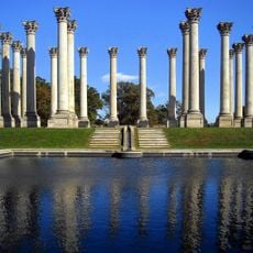
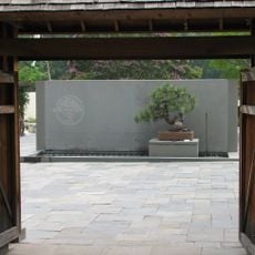
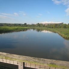
The U.S. National Arboretum and Kenilworth Aquatic Gardens preserve around 446 acres of green space amid the urban setting. These two natural areas offer visitors access to gardens, plants, and open grounds rarely found in such an urban location.

Location
Shares border with
Northwest, Southeast, Southwest
GPS coordinates
38.91250,-76.97583
Latest update
December 7, 2025 20:49

AroundUs brings together thousands of curated places, local tips, and hidden gems, enriched daily by 60,000 contributors worldwide. Discover all places nearby (Washington, D.C.).

Around this place
United States National Arboretum
United States of America

United States National Arboretum

878 m
National Capitol Columns
United States of America

National Capitol Columns

761 m
Ariel Rios Federal Building
United States of America

Ariel Rios Federal Building

2.5 km
Eckington
United States of America

Eckington

2.2 km
Goshin
United States of America

Goshin

1 km
Kingman Island
United States of America

Kingman Island

1.8 km
Metropolitan Branch Trail
United States of America

Metropolitan Branch Trail

2.5 km
Langston Golf Course
United States of America

Langston Golf Course

1.3 km
Langston Terrace Dwellings
United States of America

Langston Terrace Dwellings

1.5 km
Hecht Company Warehouse
United States of America

Hecht Company Warehouse

823 m
Atlas Performing Arts Center
United States of America

Atlas Performing Arts Center

1.7 km
Ethel Kennedy Bridge
United States of America

Ethel Kennedy Bridge

2 km
Slowe-Burrill House
United States of America

Slowe-Burrill House

2.3 km
Holy Redeemer College
United States of America

Holy Redeemer College

2.6 km
Fort Saratoga
United States of America

Fort Saratoga

1.9 km
Alexander Crummell School
United States of America

Alexander Crummell School

899 m
United States of America

National Deaf Life Museum

1.8 km
H Street Playhouse
United States of America

H Street Playhouse

1.5 km
Ralph Bunche House
United States of America

Ralph Bunche House

2 km
Gallaudet College Historic District
United States of America

Gallaudet College Historic District

1.9 km
Dahlgreen Courts
United States of America

Dahlgreen Courts

1.9 km
President's House, Gallaudet College
United States of America

President's House, Gallaudet College

1.9 km
Woodridge Neighborhood Library
United States of America

Woodridge Neighborhood Library

1.7 km
Roosevelt Apartment Building
United States of America

Roosevelt Apartment Building

2.1 km
Rosedale Neighborhood Library
United States of America

Rosedale Neighborhood Library

1.7 km
National Bonsai and Penjing Museum
United States of America

National Bonsai and Penjing Museum

597 m
Lucy Diggs Slowe Elementary School
United States of America

Lucy Diggs Slowe Elementary School

2.1 km
Kingman Lake
United States of America

Kingman Lake

2 km
Show the full map
« Northeast - Administrative quadrant in Washington, D.C., United States » is provided by Around Us (aroundus.com). Images and texts are derived from Wikimedia project under a Creative Commons license. You are allowed to copy, distribute, and modify copies of this page, under the conditions set by the license, as long as this note is clearly visible.

Discover hidden gems everywhere you go!

From secret cafés to breathtaking viewpoints, skip the crowded tourist spots and find places that match your style. Our app makes it easy with voice search, smart filtering, route optimization, and insider tips from travelers worldwide. Download now for the complete mobile experience.

Around Us App Screenshot

A unique approach to discovering new places

Le Figaro

All the places worth exploring

France Info

A tailor-made excursion in just a few clicks

20 Minutes

Around Us
Travel Guide & Maps
Download

Send to your phone

QR Code
1

Open the camera app on your mobile.

2

Point at the QR code with your camera. A notification will appear.

3

Tap the notification to open the link.