Enable Location

We need your location to show you interesting places around you

Discover nearby places

Find interesting locations and hidden gems around you

Precise directions

Get accurate directions and distances to places

Your location is never shared with other users. It's only used when you tap the location button.

William Miller Chapel and Ascension Rock

Log in to your account

Start exploring — it's free

Trusted by 63,093 travelers worldwide

Continue with Google
Continue with Apple
or

We will send you a code to connect

By continuing, you accept our Terms and Conditions and our Privacy Policy

Check your inbox

We've sent a pincode in your inbox. Please enter the code below.

William Miller Chapel and Ascension Rock
Discussion Reviews 1 Photos
1.6k Popularity

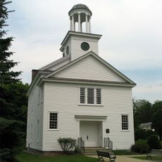
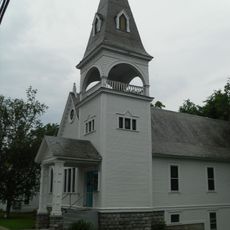
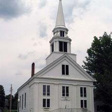
William Miller Chapel and Ascension Rock, Religious historic district in Hampton, US.

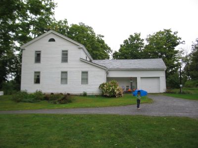
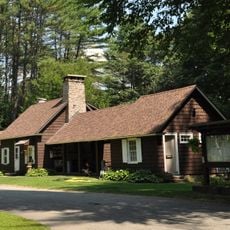
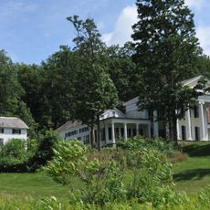
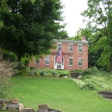
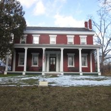
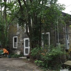
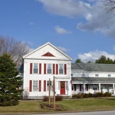
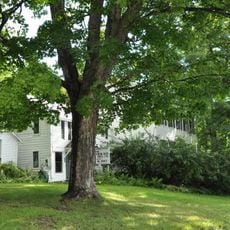
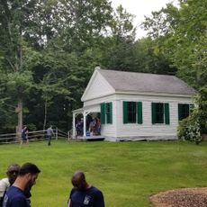
William Miller Chapel occupies a 147-acre property in New York that includes a natural limestone outcropping called Ascension Rock. The site contains a farmhouse built in 1815 and other historic structures arranged across the grounds in a rural setting.

The site gained recognition on the National Register of Historic Places in 1975, with its district boundaries expanded in 1994 to include more of the property. It served as a central location for a 19th-century religious movement that influenced the development of several church organizations.

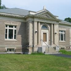
The chapel represents a pivotal moment in American religious history when followers gathered to practice their faith on this remote property far from cities.

The grounds are generally accessible to visitors during daylight hours, though conditions are best during warmer months when the landscape is fully visible. Wear sturdy footwear as you may encounter uneven terrain while exploring the property.

Visitors can see Ascension Rock, the limestone formation where followers gathered for significant religious gatherings that drew people from surrounding regions. The rock's prominent location on the property makes it a natural focal point for anyone exploring the site.

The community of curious travelers

AroundUs brings together thousands of curated places, local tips, and hidden gems, enriched daily by 60,000 contributors worldwide.

Start exploring
Location
GPS coordinates
43.59500,-73.31250
Latest update
December 14, 2025 14:23
Around this place
Wilson Castle
United States of America

Wilson Castle

22.9 km
Vermont Marble Museum
United States of America

Vermont Marble Museum

23.6 km
Skene Manor
United States of America

Skene Manor

8.3 km
Castleton Medical College Building
United States of America

Castleton Medical College Building

10.9 km
Half Moon Pond State Park
United States of America

Half Moon Pond State Park

13.6 km
Wilgus State Park
United States of America

Wilgus State Park

15.5 km
Main Street Historic District
United States of America

Main Street Historic District

8.4 km
Marble Bridge
United States of America

Marble Bridge

23.6 km
Wilcox-Cutts House
United States of America

Wilcox-Cutts House

21.1 km
Fort Warren
United States of America

Fort Warren

12 km
South Street Bridge
United States of America

South Street Bridge

11.1 km
First Congregational Church
United States of America

First Congregational Church

23.3 km
West Haven Baptist Church
United States of America

West Haven Baptist Church

6.8 km
West Rutland Town Hall
United States of America

West Rutland Town Hall

21.3 km
Dayton-Williams House
United States of America

Dayton-Williams House

18.1 km
Home Farm
United States of America

Home Farm

6.6 km
Chipman's Point
United States of America

Chipman's Point

23.3 km
Fair Haven Green Historic District
United States of America

Fair Haven Green Historic District

3.8 km
Asahel Kidder House
United States of America

Asahel Kidder House

4.6 km
Pember Library and Museum
United States of America

Pember Library and Museum

21.4 km
Hydeville School
United States of America

Hydeville School

6.7 km
East Poultney Historic District
United States of America

East Poultney Historic District

11.5 km
Simeon Smith House
United States of America

Simeon Smith House

4.7 km
Marble Street Historic District
United States of America

Marble Street Historic District

21.2 km
Hiram Congdon House
United States of America

Hiram Congdon House

15 km
Poultney Main Street Historic District
United States of America

Poultney Main Street Historic District

10.7 km
Middletown Springs Historic District
United States of America

Middletown Springs Historic District

19.9 km
William Miller Home
United States of America

William Miller Home

202 m
Show the full map
Reviews
Share your experience

No review yet

Discussions
Start a discussion...

No discussion yet

« William Miller Chapel and Ascension Rock - Religious historic district in Hampton, US » is provided by Around Us (aroundus.com). Images and texts are derived from Wikimedia project under a Creative Commons license. You are allowed to copy, distribute, and modify copies of this page, under the conditions set by the license, as long as this note is clearly visible.

Discover hidden gems everywhere you go!

From secret cafés to breathtaking viewpoints, skip the crowded tourist spots and find places that match your style. Our app makes it easy with voice search, smart filtering, route optimization, and insider tips from travelers worldwide. Download now for the complete mobile experience.

Around Us App Screenshot

A unique approach to discovering new places

Le Figaro

All the places worth exploring

France Info

A tailor-made excursion in just a few clicks

20 Minutes

Around Us
Travel Guide & Maps
Download

Send to your phone

QR Code
1

Open the camera app on your mobile.

2

Point at the QR code with your camera. A notification will appear.

3

Tap the notification to open the link.