Enable Location

We need your location to show you interesting places around you

Discover nearby places

Find interesting locations and hidden gems around you

Precise directions

Get accurate directions and distances to places

Your location is never shared with other users. It's only used when you tap the location button.

Brookside Farm and Mill

Log in to your account

Start exploring — it's free

Trusted by 62,555 travelers worldwide

Continue with Google
Continue with Apple
or

We will send you a code to connect

By continuing, you accept our Terms and Conditions and our Privacy Policy

Check your inbox

We've sent a pincode in your inbox. Please enter the code below.

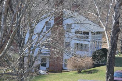
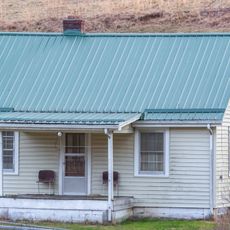
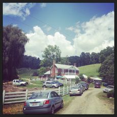
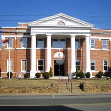
Brookside Farm and Mill, building in Virginia, United States

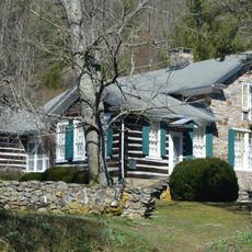
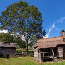
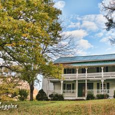
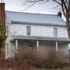
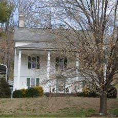
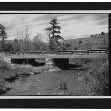
Brookside Farm and Mill is a historic property in Virginia with multiple buildings, including a three-story timber grain mill built in 1876, a two-story wood farmhouse, and various outbuildings. The site features a springhouse, smokehouse, corn crib, hen house, miller's cottage, and a service station garage added in 1918, along with a concrete dam and water channel that supplied the mill.

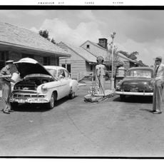
The estate was established in the 1870s when the mill was built in 1876 and the main house in 1877. Additional structures were added over the early 20th century, including a service station garage in 1918 that reflects the property's adaptation to automobile use.

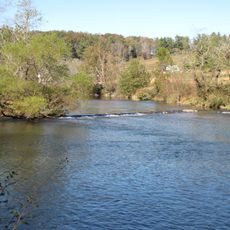
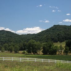
The name comes from the brook that flows through the property and powered the mill. The layout of buildings shows how a rural community was organized around the mill as the center of activity, with homes and outbuildings arranged nearby.

Many of the buildings are privately owned, so visitors should respect the owners' property and not enter. Parts of the structures can be viewed from public roads or paths, offering glimpses of the historic site without trespassing on private land.

The 1914 concrete dam represents an early application of concrete construction for water control and shows how new building technologies were quickly adopted on rural properties. The 1918 service station is an early example of farms adapting to serve automobile owners.

The community of curious travelers

AroundUs brings together thousands of curated places, local tips, and hidden gems, enriched daily by 60,000 contributors worldwide.

Start exploring
Location
GPS coordinates
36.61830,-81.22530
Latest update
February 9, 2026 07:43
Around this place
Grayson Highlands State Park
United States of America

Grayson Highlands State Park

25.9 km
Stone Mountain State Park
United States of America

Stone Mountain State Park

28.5 km
New River State Park
United States of America

New River State Park

26.8 km
United States of America

Doughton Park

24.6 km
Ripshin Farm
United States of America

Ripshin Farm

18.5 km
Brinegar Cabin
United States of America

Brinegar Cabin

23.4 km
Little Dry Run Wilderness
United States of America

Little Dry Run Wilderness

18.7 km
United States of America

Mount Rogers Crest Zone

25 km
Grayson County Courthouse
United States of America

Grayson County Courthouse

6.6 km
Ashe Metamorphic Suite
United States of America

Ashe Metamorphic Suite

14.2 km
Samuel Cox House
United States of America

Samuel Cox House

17.9 km
Dr. Virgil Cox House
United States of America

Dr. Virgil Cox House

26.8 km
Zion Evangelical Lutheran Church Cemetery
United States of America

Zion Evangelical Lutheran Church Cemetery

24.8 km
Gordon C. Felts House
United States of America

Gordon C. Felts House

27 km
Galax Commercial Historic District
United States of America

Galax Commercial Historic District

27.7 km
Old Grayson County Courthouse and Clerk's Office
United States of America

Old Grayson County Courthouse and Clerk's Office

24 km
Stephen G. Bourne House
United States of America

Stephen G. Bourne House

18.3 km
William Waddell House
United States of America

William Waddell House

19.8 km
Alleghany County Courthouse
United States of America

Alleghany County Courthouse

15.6 km
William Weaver House
United States of America

William Weaver House

15.6 km
Bower-Cox House
United States of America

Bower-Cox House

22.9 km
Fries Boarding Houses
United States of America

Fries Boarding Houses

24.6 km
Blue Ridge Parkway
United States of America

Blue Ridge Parkway

14 km
John M. Pierce House
United States of America

John M. Pierce House

14.7 km
Elbert Crouse Farmstead
United States of America

Elbert Crouse Farmstead

23.4 km
Bluff Mountain Overlook
United States of America

Bluff Mountain Overlook

23.5 km
Doughton Park Visitor Center
United States of America

Doughton Park Visitor Center

21 km
Big Pine Creek Bridge #6
United States of America

Big Pine Creek Bridge #6

26.7 km
Show the full map
« Brookside Farm and Mill - building in Virginia, United States » is provided by Around Us (aroundus.com). Images and texts are derived from Wikimedia project under a Creative Commons license. You are allowed to copy, distribute, and modify copies of this page, under the conditions set by the license, as long as this note is clearly visible.

Discover hidden gems everywhere you go!

From secret cafés to breathtaking viewpoints, skip the crowded tourist spots and find places that match your style. Our app makes it easy with voice search, smart filtering, route optimization, and insider tips from travelers worldwide. Download now for the complete mobile experience.

Around Us App Screenshot

A unique approach to discovering new places

Le Figaro

All the places worth exploring

France Info

A tailor-made excursion in just a few clicks

20 Minutes

Around Us
Travel Guide & Maps
Download

Send to your phone

QR Code
1

Open the camera app on your mobile.

2

Point at the QR code with your camera. A notification will appear.

3

Tap the notification to open the link.