Enable Location

We need your location to show you interesting places around you

Discover nearby places

Find interesting locations and hidden gems around you

Precise directions

Get accurate directions and distances to places

Your location is never shared with other users. It's only used when you tap the location button.

Log in to your account

Start exploring — it's free

Trusted by 61,524 travelers worldwide

Continue with Google
Continue with Apple
or

We will send you a code to connect

By continuing, you accept our Terms and Conditions and our Privacy Policy

Check your inbox

We've sent a pincode in your inbox. Please enter the code below.

Mount Storm Park

Mount Storm Park, Municipal park in Cincinnati, United States

Description

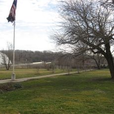
Mount Storm Park is a 57-acre green space on the western slope of a hill with views toward the Mill Creek Valley and Cincinnati skyline. The grounds feature walking paths, a playground, sledding areas in winter, and a stone shelter built in 1935 for public gatherings.

History

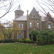
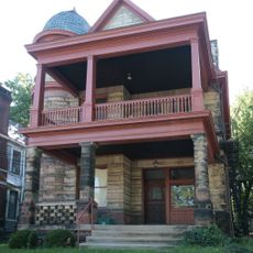
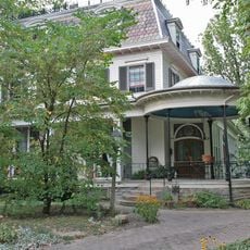
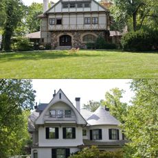
The land originally belonged to Robert Bowler, a dry goods merchant and former Clifton mayor, who built his Victorian mansion there in 1846. The estate later became public parkland while retaining its architectural features from that era.

Culture

The Temple of Love gazebo sits at the heart of the grounds and reflects the design principles Adolph Strauch brought from Vienna's Imperial Gardens. Visitors can observe European garden architecture preserved within this American park setting.

Practical

The park is most accessible in good weather and offers different activities depending on the season. Visitors should wear comfortable shoes for the walking paths and be aware of the steep slopes, particularly when visiting with children.

Did you know?

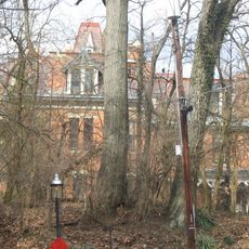
The white Corinthian columns of the pergola were constructed over a reservoir that originally supplied water to the estate's greenhouses and gardens. This hidden infrastructure reveals how elaborate the original landscape design was planned.

Location
Location
GPS coordinates
39.15560,-84.53330
Latest update
December 13, 2025 17:06

AroundUs brings together thousands of curated places, local tips, and hidden gems, enriched daily by 60,000 contributors worldwide. Discover all places nearby (Ohio).

Around this place
Spring Grove Cemetery
United States of America

Spring Grove Cemetery

1.4 km
Cedric G. and Patricia Neils Boulter House
United States of America

Cedric G. and Patricia Neils Boulter House

979 m
Crosley Building
United States of America

Crosley Building

1.3 km
Scarlet Oaks
United States of America

Scarlet Oaks

685 m
St. Pius X Catholic Church
United States of America

St. Pius X Catholic Church

954 m
Henry Probasco House
United States of America

Henry Probasco House

868 m
American Can Company Building
United States of America

American Can Company Building

622 m
Probasco Fountain
United States of America

Probasco Fountain

1.4 km
Northside United Methodist Church
United States of America

Northside United Methodist Church

1.2 km
Spring Grove Cemetery Chapel
United States of America

Spring Grove Cemetery Chapel

1.2 km
Balch House
United States of America

Balch House

1.4 km
John Uri Lloyd House
United States of America

John Uri Lloyd House

1.3 km
Hoffner Historic District
United States of America

Hoffner Historic District

766 m
Rawson House
United States of America

Rawson House

1.3 km
Morrison House
United States of America

Morrison House

1 km
George Hummel House
United States of America

George Hummel House

1.5 km
William Resor House
United States of America

William Resor House

1.5 km
Clifton Avenue Historic District
United States of America

Clifton Avenue Historic District

1.4 km
Hulbert House and McAlpin Bridal Cottage
United States of America

Hulbert House and McAlpin Bridal Cottage

1.1 km
Moses Goldsmith Building
United States of America

Moses Goldsmith Building

1.5 km
Hewson-Gutting House
United States of America

Hewson-Gutting House

579 m
United States of America

Ludlow Monument

673 m
Oesterlein Machine Company-Fashion Frocks, Inc. Complex
United States of America

Oesterlein Machine Company-Fashion Frocks, Inc. Complex

1.4 km
Cincinnati Work House and Hospital
United States of America

Cincinnati Work House and Hospital

1.5 km
United States of America

Temple of Love

199 m
United States of America

Clifton Performance Theatre

1.6 km
United States of America

Work of art

592 m
United States of America

Scenic viewpoint

94 m
Show the full map
« Mount Storm Park - Municipal park in Cincinnati, United States » is provided by Around Us (aroundus.com). Images and texts are derived from Wikimedia project under a Creative Commons license. You are allowed to copy, distribute, and modify copies of this page, under the conditions set by the license, as long as this note is clearly visible.

Discover hidden gems everywhere you go!

From secret cafés to breathtaking viewpoints, skip the crowded tourist spots and find places that match your style. Our app makes it easy with voice search, smart filtering, route optimization, and insider tips from travelers worldwide. Download now for the complete mobile experience.

Around Us App Screenshot

A unique approach to discovering new places

Le Figaro

All the places worth exploring

France Info

A tailor-made excursion in just a few clicks

20 Minutes

Around Us
Travel Guide & Maps
Download

Send to your phone

QR Code
1

Open the camera app on your mobile.

2

Point at the QR code with your camera. A notification will appear.

3

Tap the notification to open the link.