Enable Location

We need your location to show you interesting places around you

Discover nearby places

Find interesting locations and hidden gems around you

Precise directions

Get accurate directions and distances to places

Your location is never shared with other users. It's only used when you tap the location button.

Chelsea Commercial Historic District

Log in to your account

Start exploring — it's free

Trusted by 62,845 travelers worldwide

Continue with Google
Continue with Apple
or

We will send you a code to connect

By continuing, you accept our Terms and Conditions and our Privacy Policy

Check your inbox

We've sent a pincode in your inbox. Please enter the code below.

Chelsea Commercial Historic District, Historic commercial district in Chelsea, Michigan, United States

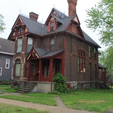
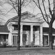
The Chelsea Commercial Historic District is a commercial core that lines Main Street from Orchard to North Street with 61 buildings combining shops, houses of worship, and homes. The structures display architectural styles that developed as the town grew and changed over many decades.

Brothers Elisha and James Congdon settled the area in the 1830s, establishing the foundation for village growth. The arrival of the Michigan Central Railroad spurred rapid commercial expansion that shaped the district into a regional trading hub.

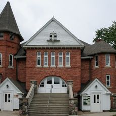
The district reflects how people gathered and shopped in a close-knit community, with the library and churches still serving as social gathering spots. Today visitors can experience the same streetscape where residents have conducted daily life for nearly two centuries.

The district is easy to explore on foot, with parking and visitor information available throughout the area. Most shops, restaurants, and sites of interest are clustered along the same street, making a walking tour convenient.

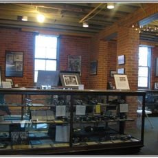
The Glazier Stove Company Warehouse stands as a three-story Jacobethan Revival structure with a prominent clock tower, recognized as a Michigan State Historic Site in 1997. This striking building hints at the town's manufacturing past and remains one of the most recognizable structures in the district.

The community of curious travelers

AroundUs brings together thousands of curated places, local tips, and hidden gems, enriched daily by 60,000 contributors worldwide.

Start exploring
Location
GPS coordinates
42.31810,-84.02030
Latest update
December 14, 2025 14:26
Around this place
Purple Rose Theatre Company
United States of America

Purple Rose Theatre Company

157 m
Waterloo State Recreation Area
United States of America

Waterloo State Recreation Area

14.8 km
Blind Pig Cafe
United States of America

Blind Pig Cafe

22.5 km
Pinckney State Recreation Area
United States of America

Pinckney State Recreation Area

12.7 km
Delhi Bridge
United States of America

Delhi Bridge

17.5 km
Hudson Mills Metropark
United States of America

Hudson Mills Metropark

11.9 km
Mike Levine Lakelands Trail State Park
United States of America

Mike Levine Lakelands Trail State Park

16.7 km
Gordon Hall
United States of America

Gordon Hall

10.3 km
Peach Mountain Observatory
United States of America

Peach Mountain Observatory

11.4 km
Argus Museum
United States of America

Argus Museum

22.3 km
Ann Arbor Bus Depot
United States of America

Ann Arbor Bus Depot

22.7 km
St. Patrick's Parish Complex
United States of America

St. Patrick's Parish Complex

22.7 km
Delhi Metropark
United States of America

Delhi Metropark

17.5 km
Bell Road Bridge
United States of America

Bell Road Bridge

13.1 km
Dexter–Huron Metropark
United States of America

Dexter–Huron Metropark

13.3 km
Saint Mary's School
United States of America

Saint Mary's School

390 m
George W. Palmer House
United States of America

George W. Palmer House

116 m
Stockbridge Town Hall
United States of America

Stockbridge Town Hall

19.7 km
James Litchfield House
United States of America

James Litchfield House

11.6 km
Waterloo Farm Museum
United States of America

Waterloo Farm Museum

14.8 km
Fountain-Bessac House
United States of America

Fountain-Bessac House

18.9 km
Thomas Earl House
United States of America

Thomas Earl House

22.7 km
Sidney T. Smith House
United States of America

Sidney T. Smith House

14.7 km
Gerald E. Eddy Discovery Center
United States of America

Gerald E. Eddy Discovery Center

5.5 km
Zion Lutheran Church Historical Marker
United States of America

Zion Lutheran Church Historical Marker

9.6 km
Zion Lutheran Church
United States of America

Zion Lutheran Church

9.6 km
Barton Pond
United States of America

Barton Pond

20.3 km
Saint Patrick's Church Historical Marker
United States of America

Saint Patrick's Church Historical Marker

22.6 km
Show the full map
« Chelsea Commercial Historic District - Historic commercial district in Chelsea, Michigan, United States » is provided by Around Us (aroundus.com). Images and texts are derived from Wikimedia project under a Creative Commons license. You are allowed to copy, distribute, and modify copies of this page, under the conditions set by the license, as long as this note is clearly visible.

Discover hidden gems everywhere you go!

From secret cafés to breathtaking viewpoints, skip the crowded tourist spots and find places that match your style. Our app makes it easy with voice search, smart filtering, route optimization, and insider tips from travelers worldwide. Download now for the complete mobile experience.

Around Us App Screenshot

A unique approach to discovering new places

Le Figaro

All the places worth exploring

France Info

A tailor-made excursion in just a few clicks

20 Minutes

Around Us
Travel Guide & Maps
Download

Send to your phone

QR Code
1

Open the camera app on your mobile.

2

Point at the QR code with your camera. A notification will appear.

3

Tap the notification to open the link.