Enable Location

We need your location to show you interesting places around you

Discover nearby places

Find interesting locations and hidden gems around you

Precise directions

Get accurate directions and distances to places

Your location is never shared with other users. It's only used when you tap the location button.

Detroit Air Defense Sector

Log in to your account

Start exploring — it's free

Trusted by 61,628 travelers worldwide

Continue with Google
Continue with Apple
or

We will send you a code to connect

By continuing, you accept our Terms and Conditions and our Privacy Policy

Check your inbox

We've sent a pincode in your inbox. Please enter the code below.

Detroit Air Defense Sector

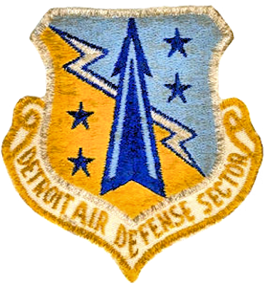
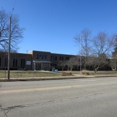
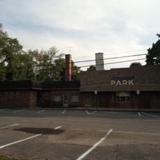
Detroit Air Defense Sector, Military defense installation in Battle Creek, Michigan.

Description

The Detroit Air Defense Sector was a military installation near Battle Creek, Michigan, that operated advanced radar systems and coordinated aircraft operations from its command center. The facility used specialized computers to process radar information and direct defensive responses across multiple military units.

History

The facility was established in 1957 and monitored airspace over Michigan, northeast Indiana, and Ohio until 1966 during Cold War tensions. During this period, it played a key role in regional air defense against potential Soviet threats.

Culture

The installation represented the integration of military personnel with local communities through employment opportunities and regional defense coordination programs.

Practical

Visitors should note that this former military installation is no longer in operation and access may be restricted. It is recommended to check ahead about which parts of the site are accessible and what current restrictions apply.

Did you know?

The facility was known for managing multiple fighter squadrons with different aircraft types, including F-86 Sabre, F-89 Scorpion, and F-106 Delta Dart interceptors. This variety of modern fighters enabled fast and flexible responses to potential air threats.

Location
GPS coordinates
42.32170,-85.26670
Latest update
December 12, 2025 09:03

AroundUs brings together thousands of curated places, local tips, and hidden gems, enriched daily by 60,000 contributors worldwide. Discover all places nearby (Michigan).

Around this place
Binder Park Zoo
United States of America

Binder Park Zoo

12.4 km
Fort Custer National Cemetery
United States of America

Fort Custer National Cemetery

4.4 km
Fort Custer Recreation Area
United States of America

Fort Custer Recreation Area

6.5 km
W. K. Kellogg House
United States of America

W. K. Kellogg House

7.2 km
Leila Arboretum
United States of America

Leila Arboretum

4.8 km
Kingman Museum
United States of America

Kingman Museum

4.9 km
Dime Tabernacle
United States of America

Dime Tabernacle

6.3 km
Battle Creek Tower
United States of America

Battle Creek Tower

6.8 km
Heritage Tower
United States of America

Heritage Tower

6.9 km
Penniman Castle
United States of America

Penniman Castle

8.2 km
Battle Creek City Hall
United States of America

Battle Creek City Hall

7.2 km
Maple Street Historic District
United States of America

Maple Street Historic District

7.7 km
City Hall Historic District
United States of America

City Hall Historic District

7.2 km
Merritt Woods Historic District
United States of America

Merritt Woods Historic District

7.9 km
Van Buren Street Historic District
United States of America

Van Buren Street Historic District

7.1 km
Frank and Dorothy Ward House
United States of America

Frank and Dorothy Ward House

5.5 km
Climax Post Office Building
United States of America

Climax Post Office Building

10.9 km
United States of America

Hickory Corners Masonic Temple

16.1 km
Richard and Mary Woodward Gregory House
United States of America

Richard and Mary Woodward Gregory House

6.8 km
Urbandale Elementary
United States of America

Urbandale Elementary

4.1 km
First Baptist Church Historical Marker
United States of America

First Baptist Church Historical Marker

7.1 km
Battle Creek Regional History Museum
United States of America

Battle Creek Regional History Museum

6.1 km
Park Theatre
United States of America

Park Theatre

7.1 km
Park Theatre Historical Marker
United States of America

Park Theatre Historical Marker

7.1 km
Saint Thomas Episcopal Church Historical Marker
United States of America

Saint Thomas Episcopal Church Historical Marker

7.1 km
W K Kellogg House Historical Marker
United States of America

W K Kellogg House Historical Marker

14.7 km
Ward Mill Site Historical Marker
United States of America

Ward Mill Site Historical Marker

7 km
Willard Library
United States of America

Willard Library

7.1 km
Show the full map
« Detroit Air Defense Sector - Military defense installation in Battle Creek, Michigan » is provided by Around Us (aroundus.com). Images and texts are derived from Wikimedia project under a Creative Commons license. You are allowed to copy, distribute, and modify copies of this page, under the conditions set by the license, as long as this note is clearly visible.

Discover hidden gems everywhere you go!

From secret cafés to breathtaking viewpoints, skip the crowded tourist spots and find places that match your style. Our app makes it easy with voice search, smart filtering, route optimization, and insider tips from travelers worldwide. Download now for the complete mobile experience.

Around Us App Screenshot

A unique approach to discovering new places

Le Figaro

All the places worth exploring

France Info

A tailor-made excursion in just a few clicks

20 Minutes

Around Us
Travel Guide & Maps
Download

Send to your phone

QR Code
1

Open the camera app on your mobile.

2

Point at the QR code with your camera. A notification will appear.

3

Tap the notification to open the link.