Enable Location

We need your location to show you interesting places around you

Discover nearby places

Find interesting locations and hidden gems around you

Precise directions

Get accurate directions and distances to places

Your location is never shared with other users. It's only used when you tap the location button.

Brookfield Center Historic District

Log in to your account

Start exploring — it's free

Trusted by 61,575 travelers worldwide

Continue with Google
Continue with Apple
or

We will send you a code to connect

By continuing, you accept our Terms and Conditions and our Privacy Policy

Check your inbox

We've sent a pincode in your inbox. Please enter the code below.

Brookfield Center Historic District, National historic district in Brookfield, United States.

Description

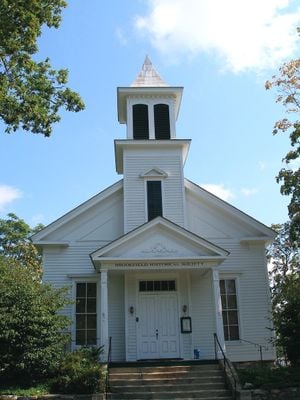
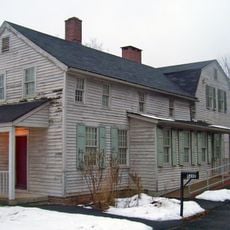
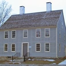
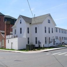
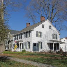
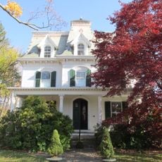
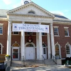
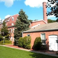
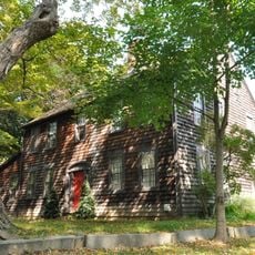
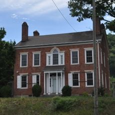
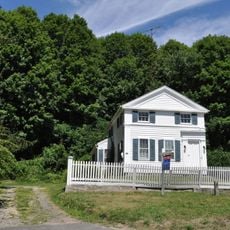
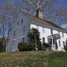
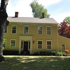
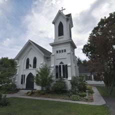
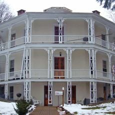
Brookfield Center Historic District contains 67 buildings across 43 acres at the junction of Route 133 and Route 25, forming the town's original core. The site includes the former town hall, two churches, a schoolhouse, and numerous homes built over 2 centuries in different styles and periods.

History

Settlement began around 1700, with the area gaining parish status in 1754 through the addition of lands from neighboring communities. Throughout the 1800s, the town grew with the construction of civic buildings and homes that supported its role as a local center.

Culture

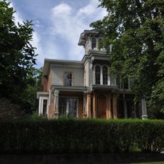
The buildings reflect different architectural choices made over generations, with Greek Revival farmhouses standing alongside Victorian homes and modest cottage designs. Visitors can observe how local residents have maintained these structures as part of their community identity.

Practical

Walking through the area is the best way to explore, as buildings are distributed across a walkable area with sightlines to the main structures. The two churches and town hall serve as helpful reference points for orienting yourself and understanding the layout of the historic center.

Did you know?

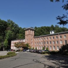
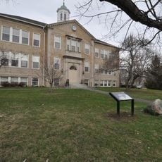
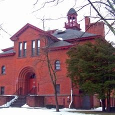
The Curtis School gymnasium built in 1907 now operates as the Brookfield Theatre for the Arts, retaining its distinctive Rustic Style architecture. This transformation shows how the community adapted an old educational building to serve new cultural purposes.

Location
GPS coordinates
41.46778,-73.38806
Latest update
December 14, 2025 18:15

AroundUs brings together thousands of curated places, local tips, and hidden gems, enriched daily by 60,000 contributors worldwide. Discover all places nearby (Brookfield).

Around this place
Southbury Training School
United States of America

Southbury Training School

9.6 km
Lovers Leap State Park
United States of America

Lovers Leap State Park

8.7 km
Squantz Pond State Park
United States of America

Squantz Pond State Park

8.8 km
Main Street Historic District
United States of America

Main Street Historic District

9.8 km
Charles Ives House
United States of America

Charles Ives House

10.7 km
Lillinonah Trail
United States of America

Lillinonah Trail

6.6 km
Danbury Museum and Historical Society
United States of America

Danbury Museum and Historical Society

10.1 km
Pootatuck State Forest
United States of America

Pootatuck State Forest

10.6 km
Kohanza Reservoir
United States of America

Kohanza Reservoir

10.1 km
John Rider House
United States of America

John Rider House

10.1 km
New York Belting and Packing Co.
United States of America

New York Belting and Packing Co.

10 km
Ball and Roller Bearing Company
United States of America

Ball and Roller Bearing Company

9.4 km
Caleb Baldwin Tavern
United States of America

Caleb Baldwin Tavern

9 km
Glover House
United States of America

Glover House

8.8 km
Newtown Borough Historic District
United States of America

Newtown Borough Historic District

9.1 km
P. Robinson Fur Cutting Company
United States of America

P. Robinson Fur Cutting Company

10.7 km
John Glover House
United States of America

John Glover House

7 km
John Glover Noble House
United States of America

John Glover Noble House

4.9 km
Camps Nos. 10 and 41 of Rochambeau's Army
United States of America

Camps Nos. 10 and 41 of Rochambeau's Army

9.3 km
Joseph W. Pepin Memorial Building
United States of America

Joseph W. Pepin Memorial Building

8.6 km
Cosier-Murphy House
United States of America

Cosier-Murphy House

7.2 km
Rev. John Ely House
United States of America

Rev. John Ely House

10.4 km
Williams House
United States of America

Williams House

8.8 km
Bridgewater Center Historic District
United States of America

Bridgewater Center Historic District

7.7 km
Frederick S. Sanford House
United States of America

Frederick S. Sanford House

7.6 km
Danbury Railway Museum
United States of America

Danbury Railway Museum

9.4 km
Lover's Leap Bridge
United States of America

Lover's Leap Bridge

8.7 km
Octagon House
United States of America

Octagon House

10.1 km
Show the full map
« Brookfield Center Historic District - National historic district in Brookfield, United States » is provided by Around Us (aroundus.com). Images and texts are derived from Wikimedia project under a Creative Commons license. You are allowed to copy, distribute, and modify copies of this page, under the conditions set by the license, as long as this note is clearly visible.

Discover hidden gems everywhere you go!

From secret cafés to breathtaking viewpoints, skip the crowded tourist spots and find places that match your style. Our app makes it easy with voice search, smart filtering, route optimization, and insider tips from travelers worldwide. Download now for the complete mobile experience.

Around Us App Screenshot

A unique approach to discovering new places

Le Figaro

All the places worth exploring

France Info

A tailor-made excursion in just a few clicks

20 Minutes

Around Us
Travel Guide & Maps
Download

Send to your phone

QR Code
1

Open the camera app on your mobile.

2

Point at the QR code with your camera. A notification will appear.

3

Tap the notification to open the link.