Enable Location

We need your location to show you interesting places around you

Discover nearby places

Find interesting locations and hidden gems around you

Precise directions

Get accurate directions and distances to places

Your location is never shared with other users. It's only used when you tap the location button.

Centennial Watershed State Forest

Log in to your account

Start exploring — it's free

Trusted by 61,864 travelers worldwide

Continue with Google
Continue with Apple
or

We will send you a code to connect

By continuing, you accept our Terms and Conditions and our Privacy Policy

Check your inbox

We've sent a pincode in your inbox. Please enter the code below.

Centennial Watershed State Forest

Centennial Watershed State Forest, State forest in Easton, Newtown, Redding, and Weston, Connecticut, United States.

Description

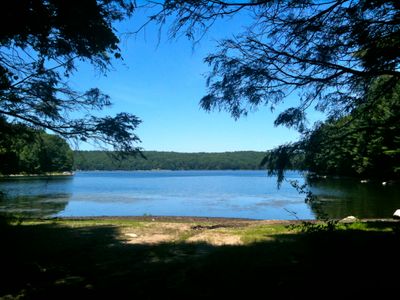
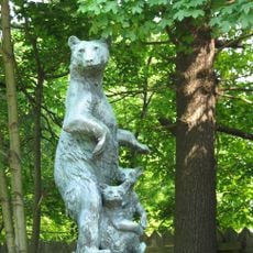
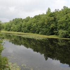
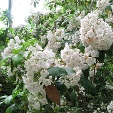
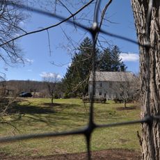
Centennial Watershed State Forest spreads across Easton, Newtown, Redding, and Weston, encompassing rolling terrain, wetlands, flowing streams, and several reservoirs. The property offers a network of trails and outdoor areas suitable for different visitor interests and abilities.

History

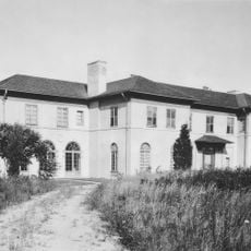
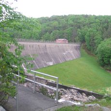
The forest area developed as a water supply system protecting resources for multiple Connecticut communities over time. Management practices evolved to maintain balance between water provision and environmental protection across the landscape.

Culture

The forest grounds provide opportunities for environmental education, research activities, and the study of local ecosystems throughout different seasons.

Practical

Access to the forest is available year-round, though many activities like hiking, fishing, and hunting require special permits. Visitors should check information at entry points or with the managing agency before planning specific activities.

Did you know?

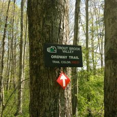
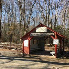
The Saugatuck Universal Access Trail allows wheelchair users to explore the forest as part of a 17-mile trail network. This accessible route demonstrates how protected natural areas can welcome visitors of different abilities.

Location
GPS coordinates
41.26722,-73.36667
Latest update
December 14, 2025 18:42

AroundUs brings together thousands of curated places, local tips, and hidden gems, enriched daily by 60,000 contributors worldwide. Discover all places nearby (Connecticut).

Around this place
Stormfield
United States of America

Stormfield

3.9 km
Saugatuck Reservoir
United States of America

Saugatuck Reservoir

284 m
Putnam Memorial State Park
United States of America

Putnam Memorial State Park

8.2 km
Collis P. Huntington State Park
United States of America

Collis P. Huntington State Park

9.3 km
Ida Tarbell House
United States of America

Ida Tarbell House

5.3 km
Trout Brook Valley State Park Reserve
United States of America

Trout Brook Valley State Park Reserve

3.2 km
Thomas Hawley House
United States of America

Thomas Hawley House

10.4 km
Christ the King Church
United States of America

Christ the King Church

10.2 km
Cannondale Historic District
United States of America

Cannondale Historic District

7 km
Bradley-Hubbell House
United States of America

Bradley-Hubbell House

4.6 km
Georgetown Historic District
United States of America

Georgetown Historic District

5.6 km
Connecticut Audubon Society Center at Fairfield
United States of America

Connecticut Audubon Society Center at Fairfield

9.6 km
Redding Center Historic District
United States of America

Redding Center Historic District

4.3 km
Woodcock Nature Center
United States of America

Woodcock Nature Center

9.2 km
Wilton Center Historic District
United States of America

Wilton Center Historic District

10 km
Highstead Arboretum
United States of America

Highstead Arboretum

6.7 km
Hurlbutt Street School
United States of America

Hurlbutt Street School

8.2 km
Norfield Historic District
United States of America

Norfield Historic District

7.4 km
Benedict House and Shop
United States of America

Benedict House and Shop

10.5 km
Aaron Barlow House
United States of America

Aaron Barlow House

7.7 km
Marvin Tavern
United States of America

Marvin Tavern

8.3 km
David Mallett Jr. House
United States of America

David Mallett Jr. House

9.1 km
Hugh Cain Fulling Mill and Elias Glover Woolen Mill Archeological Site
United States of America

Hugh Cain Fulling Mill and Elias Glover Woolen Mill Archeological Site

8.3 km
Bradley Edge Tool Company Historic District
United States of America

Bradley Edge Tool Company Historic District

7.8 km
Kettle Creek Historic District
United States of America

Kettle Creek Historic District

9 km
Sloan-Raymond-Fitch House
United States of America

Sloan-Raymond-Fitch House

10.1 km
Daniel and Esther Bartlett House
United States of America

Daniel and Esther Bartlett House

5.1 km
Branchville Railroad Tenement
United States of America

Branchville Railroad Tenement

6.1 km
Show the full map
« Centennial Watershed State Forest - State forest in Easton, Newtown, Redding, and Weston, Connecticut, United States » is provided by Around Us (aroundus.com). Images and texts are derived from Wikimedia project under a Creative Commons license. You are allowed to copy, distribute, and modify copies of this page, under the conditions set by the license, as long as this note is clearly visible.

Discover hidden gems everywhere you go!

From secret cafés to breathtaking viewpoints, skip the crowded tourist spots and find places that match your style. Our app makes it easy with voice search, smart filtering, route optimization, and insider tips from travelers worldwide. Download now for the complete mobile experience.

Around Us App Screenshot

A unique approach to discovering new places

Le Figaro

All the places worth exploring

France Info

A tailor-made excursion in just a few clicks

20 Minutes

Around Us
Travel Guide & Maps
Download

Send to your phone

QR Code
1

Open the camera app on your mobile.

2

Point at the QR code with your camera. A notification will appear.

3

Tap the notification to open the link.