Redding Center Historic District

Log in to your account

AroundUs is a community-driven map of interesting places, built by curious explorers like you. It grows with every review, story, and photo you share.
Connect to save your favorite spots, contribute locations, and create personalized routes.
Continue with Google
Continue with Apple
Continue with X
Continue with Facebook
Continue with email
By continuing, you accept our Terms and Conditions and our Privacy Policy
Create an account
Add to collection
Map
Suggest a change
Share

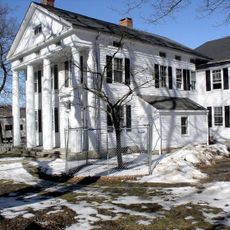
Redding Center Historic District, Historic district in Redding, Connecticut.

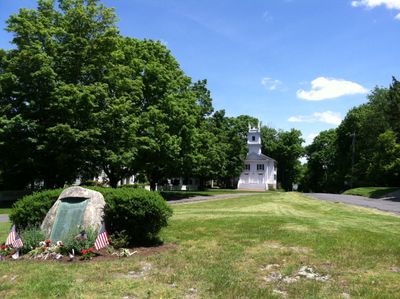
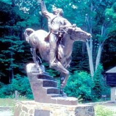
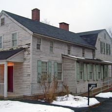
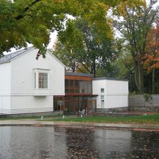
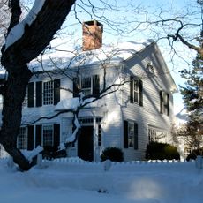
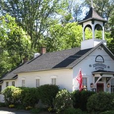
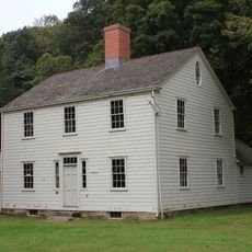
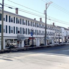
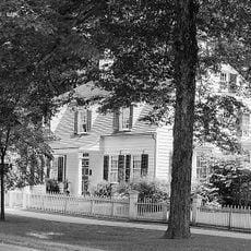
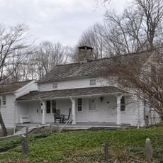
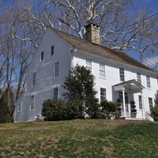
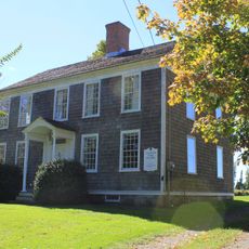
Redding Center Historic District spans approximately 55 acres and contains 46 historic buildings including town halls, the First Church of Christ, a cemetery, residential homes, and barns positioned at the junction of major routes. The structures showcase Greek Revival and Renaissance Revival architectural styles that characterize the district's appearance.

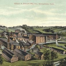
The area originated from colonial land grants in 1671 when it was still part of Fairfield, then evolved into an established farming community. Over time, public buildings and religious institutions were added to create the organized civic center visible today.

The First Church of Christ with its Greek Revival facade has been a gathering place for the community since 1837. Visitors can see how this building continues to shape the religious and social life of the area today.

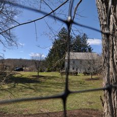
The district is walkable and easily accessed from nearby roads, with major buildings located near the central intersection for convenient viewing. Visitors should allow time for a leisurely stroll to observe the different architectural styles and how the buildings relate to one another.

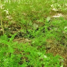
Read Cemetery preserves headstones dating from 1786 to 1860 that document the lives of early settlers in the region. These grave markers offer a direct connection to the names and lifespans of the people who built the community.

Location: Connecticut

Architectural style: Greek Revival architecture, Renaissance Revival architecture

GPS coordinates: 41.30389,-73.38194

Latest update: December 14, 2025 18:01

Photos
Around this place
Stormfield
United States of America

Stormfield

2.1 km
Hearthstone Castle
United States of America

Hearthstone Castle

10 km
Saugatuck Reservoir
United States of America

Saugatuck Reservoir

4.6 km
Putnam Memorial State Park
United States of America

Putnam Memorial State Park

4 km
Collis P. Huntington State Park
United States of America

Collis P. Huntington State Park

5.6 km
Charles Ives House
United States of America

Charles Ives House

10.1 km
Aldrich Contemporary Art Museum
United States of America

Aldrich Contemporary Art Museum

10.1 km
Ida Tarbell House
United States of America

Ida Tarbell House

4.2 km
Trout Brook Valley State Park Reserve
United States of America

Trout Brook Valley State Park Reserve

7.3 km
Seth Low Pierrepont State Park Reserve
United States of America

Seth Low Pierrepont State Park Reserve

10.1 km
Wooster Mountain State Park
United States of America

Wooster Mountain State Park

9 km
Cannondale Historic District
United States of America

Cannondale Historic District

9.8 km
Bradley-Hubbell House
United States of America

Bradley-Hubbell House

8.3 km
Georgetown Historic District
United States of America

Georgetown Historic District

6.8 km
Bennett's Pond State Park
United States of America

Bennett's Pond State Park

8.8 km
Phineas Chapman Lounsbury House
United States of America

Phineas Chapman Lounsbury House

10.1 km
Woodcock Nature Center
United States of America

Woodcock Nature Center

9.9 km
Centennial Watershed State Forest
United States of America

Centennial Watershed State Forest

4.3 km
Greenwood Avenue Historic District
United States of America

Greenwood Avenue Historic District

7.9 km
Ridgefield Center Historic District
United States of America

Ridgefield Center Historic District

10.2 km
Highstead Arboretum
United States of America

Highstead Arboretum

2.4 km
Benedict House and Shop
United States of America

Benedict House and Shop

9.9 km
Aaron Barlow House
United States of America

Aaron Barlow House

4.1 km
Hugh Cain Fulling Mill and Elias Glover Woolen Mill Archeological Site
United States of America

Hugh Cain Fulling Mill and Elias Glover Woolen Mill Archeological Site

6.2 km
Seth Seelye House
United States of America

Seth Seelye House

8 km
Rev. John Ely House
United States of America

Rev. John Ely House

8.1 km
Daniel and Esther Bartlett House
United States of America

Daniel and Esther Bartlett House

867 m
Branchville Railroad Tenement
United States of America

Branchville Railroad Tenement

6.4 km
Show the full map
Reviews

Visited this place? Tap the stars to rate it and share your experience / photos with the community! Try now! You can cancel it anytime.

« Redding Center Historic District - Historic district in Redding, Connecticut » is provided by Around Us (aroundus.com). Images and texts are derived from Wikimedia project under a Creative Commons license. You are allowed to copy, distribute, and modify copies of this page, under the conditions set by the license, as long as this note is clearly visible.

Discover hidden gems everywhere you go!

From secret cafés to breathtaking viewpoints, skip the crowded tourist spots and find places that match your style. Our app makes it easy with voice search, smart filtering, route optimization, and insider tips from travelers worldwide. Download now for the complete mobile experience.

Around Us App Screenshot

A unique approach to discovering new places

Le Figaro

All the places worth exploring

France Info

A tailor-made excursion in just a few clicks

20 Minutes