Enable Location

We need your location to show you interesting places around you

Discover nearby places

Find interesting locations and hidden gems around you

Precise directions

Get accurate directions and distances to places

Your location is never shared with other users. It's only used when you tap the location button.

Enders State Forest

Log in to your account

Start exploring — it's free

Trusted by 64,086 travelers worldwide

Continue with Google
Continue with Apple
or

We will send you a code to connect

By continuing, you accept our Terms and Conditions and our Privacy Policy

Check your inbox

We've sent a pincode in your inbox. Please enter the code below.

Enders State Forest
Discussion Reviews 1 Photos 1 Collections
2.3k Popularity

Enders State Forest, State forest in Granby, Connecticut.

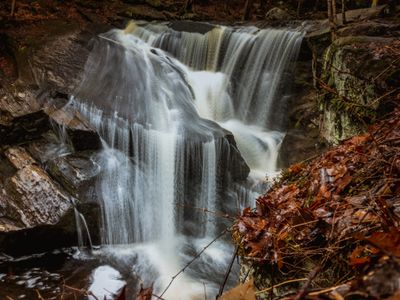
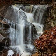
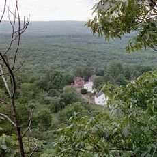
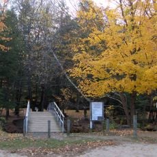
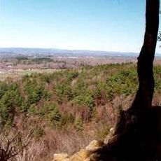
Enders State Forest is a state forest spanning over 2,000 acres across Granby and Barkhamsted, featuring dense woodlands and several waterfalls. The terrain offers multiple hiking trails through varied landscapes with changing elevations.

The forest was established in 1970 when the four children of John and Harriet Enders donated approximately 1,500 acres of woodland to Connecticut. This major gift formed the foundation of the state forest that exists today.

The forest forms part of a larger protected area alongside the McLean Game Refuge, preserving Connecticut's woodland heritage for visitors to experience. This network of protected lands shapes the region's identity as a forested landscape.

A marked trail with purple blazes leads to the waterfalls and can be completed in less than an hour. Swimming is not permitted for safety reasons, but visitors should wear good hiking shoes and be prepared for uneven terrain.

The forest relies on elevation changes between 900 and 1,100 feet to create a network of streams flowing eastward toward the west branch of the Salmon River. This topography makes the terrain varied and creates the conditions for the multiple waterfalls visitors discover.

The community of curious travelers

AroundUs brings together thousands of curated places, local tips, and hidden gems, enriched daily by 60,000 contributors worldwide.

Start exploring
Location
Elevation above the sea
277 m
GPS coordinates
41.96194,-72.71222
Latest update
December 6, 2025 17:44
What to see in Connecticut: natural spots, historic sites, and must-see places

From spectacular waterfalls to old houses, Connecticut shows its natural and historic sites through parks, gardens, and coastal forts.

Around this place
Show the full map
Reviews
Share your experience

No review yet

Discussions
Start a discussion...

No discussion yet

« Enders State Forest - State forest in Granby, Connecticut » is provided by Around Us (aroundus.com). Images and texts are derived from Wikimedia project under a Creative Commons license. You are allowed to copy, distribute, and modify copies of this page, under the conditions set by the license, as long as this note is clearly visible.

Discover hidden gems everywhere you go!

From secret cafés to breathtaking viewpoints, skip the crowded tourist spots and find places that match your style. Our app makes it easy with voice search, smart filtering, route optimization, and insider tips from travelers worldwide. Download now for the complete mobile experience.

Around Us App Screenshot

A unique approach to discovering new places

Le Figaro

All the places worth exploring

France Info

A tailor-made excursion in just a few clicks

20 Minutes

Around Us
Travel Guide & Maps
Download

Send to your phone

QR Code
1

Open the camera app on your mobile.

2

Point at the QR code with your camera. A notification will appear.

3

Tap the notification to open the link.