Enable Location

We need your location to show you interesting places around you

Discover nearby places

Find interesting locations and hidden gems around you

Precise directions

Get accurate directions and distances to places

Your location is never shared with other users. It's only used when you tap the location button.

Mound Hill Archaeological Site

Log in to your account

Start exploring — it's free

Trusted by 62,818 travelers worldwide

Continue with Google
Continue with Apple
or

We will send you a code to connect

By continuing, you accept our Terms and Conditions and our Privacy Policy

Check your inbox

We've sent a pincode in your inbox. Please enter the code below.

Mound Hill Archaeological Site, Archaeological site in Clark County, Kentucky.

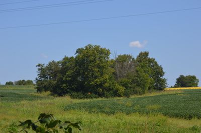
Mound Hill Archaeological Site is a prehistoric Native American site in Kentucky featuring a large earthen mound rising roughly 20 feet high with a base circumference of about 240 feet. The 18-acre property sits between two small waterways and contains multiple stone burial structures within and around the main earthwork.

The mound was built by the Adena culture during prehistoric times in the Ohio Valley region. This ancient civilization constructed thousands of similar earthworks across the landscape before eventually declining.

The mound served as a burial ground and sacred place where ancient communities performed rituals and honored their dead. Today visitors can sense the spiritual significance these people placed on this landscape.

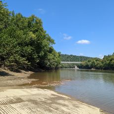
The site lies north of Winchester and can be reached by traveling west from Devil's Backbone ridge. Visitors should expect grassy terrain and should wear appropriate footwear since the ground near the creeks can be soft or muddy.

The mound displays an unusual elongated shape with a central depression that may result from natural weathering or represent multiple ancient structures built on top of each other. This feature intrigues researchers studying how the Adena people modified the landscape.

The community of curious travelers

AroundUs brings together thousands of curated places, local tips, and hidden gems, enriched daily by 60,000 contributors worldwide.

Start exploring
Location
GPS coordinates
38.09694,-84.13361
Latest update
December 14, 2025 18:05
Around this place
Fort Boonesborough State Park
United States of America

Fort Boonesborough State Park

24.8 km
Cane Ridge
United States of America

Cane Ridge

13.2 km
Goshen Primitive Baptist Church
United States of America

Goshen Primitive Baptist Church

10.3 km
Fort Boonesborough State Park
United States of America

Fort Boonesborough State Park

25.1 km
The Grange
United States of America

The Grange

18.3 km
Bluegrass Heritage Museum
United States of America

Bluegrass Heritage Museum

12.6 km
Colville Covered Bridge
United States of America

Colville Covered Bridge

26 km
Old Providence Church
United States of America

Old Providence Church

20.3 km
Confederate Monument of Mt. Sterling
United States of America

Confederate Monument of Mt. Sterling

18.2 km
Clark Mansion
United States of America

Clark Mansion

12.9 km
Clark County Court House
United States of America

Clark County Court House

12.2 km
KEAS Tabernacle Christian Methodist Episcopal Church
United States of America

KEAS Tabernacle Christian Methodist Episcopal Church

17.7 km
Leeds Center for the Arts
United States of America

Leeds Center for the Arts

12 km
Enoch Smith House
United States of America

Enoch Smith House

15.9 km
William Hickman House
United States of America

William Hickman House

12.5 km
United States of America

Bourbon County Courthouse

16.5 km
Methodist Episcopal Church South
United States of America

Methodist Episcopal Church South

17.4 km
Church of the Ascension
United States of America

Church of the Ascension

17.3 km
Walker Buckner House
United States of America

Walker Buckner House

11.4 km
Corinth Christian Methodist Episcopal Church
United States of America

Corinth Christian Methodist Episcopal Church

12.8 km
Snow Hill
United States of America

Snow Hill

13.8 km
Stone Barn on Brushy Creek
United States of America

Stone Barn on Brushy Creek

26.7 km
Paris Courthouse Square Historic District
United States of America

Paris Courthouse Square Historic District

16.5 km
Bybee House
United States of America

Bybee House

20.7 km
William Mathers House
United States of America

William Mathers House

25.2 km
Erasmus Riggs House
United States of America

Erasmus Riggs House

20 km
Thomas A. Dorsey Farmhouse
United States of America

Thomas A. Dorsey Farmhouse

25.7 km
McKee-Vimont Row Houses
United States of America

McKee-Vimont Row Houses

22.6 km
Show the full map
« Mound Hill Archaeological Site - Archaeological site in Clark County, Kentucky » is provided by Around Us (aroundus.com). Images and texts are derived from Wikimedia project under a Creative Commons license. You are allowed to copy, distribute, and modify copies of this page, under the conditions set by the license, as long as this note is clearly visible.

Discover hidden gems everywhere you go!

From secret cafés to breathtaking viewpoints, skip the crowded tourist spots and find places that match your style. Our app makes it easy with voice search, smart filtering, route optimization, and insider tips from travelers worldwide. Download now for the complete mobile experience.

Around Us App Screenshot

A unique approach to discovering new places

Le Figaro

All the places worth exploring

France Info

A tailor-made excursion in just a few clicks

20 Minutes

Around Us
Travel Guide & Maps
Download

Send to your phone

QR Code
1

Open the camera app on your mobile.

2

Point at the QR code with your camera. A notification will appear.

3

Tap the notification to open the link.