Enable Location

We need your location to show you interesting places around you

Discover nearby places

Find interesting locations and hidden gems around you

Precise directions

Get accurate directions and distances to places

Your location is never shared with other users. It's only used when you tap the location button.

Burleigh Brae and Webster Boathouse

Log in to your account

Start exploring — it's free

Trusted by 61,364 travelers worldwide

Continue with Google
Continue with Apple
or

We will send you a code to connect

By continuing, you accept our Terms and Conditions and our Privacy Policy

Check your inbox

We've sent a pincode in your inbox. Please enter the code below.

Burleigh Brae and Webster Boathouse

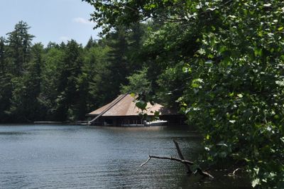
Burleigh Brae and Webster Boathouse, Historic estate and boathouse on Squam Lake in Holderness, United States.

Description

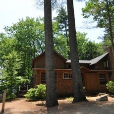
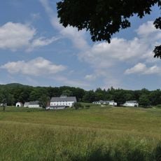
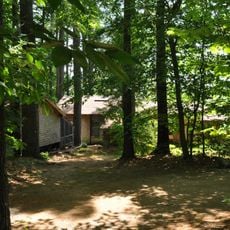
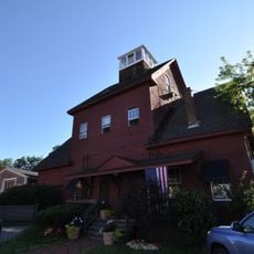
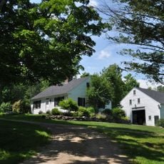
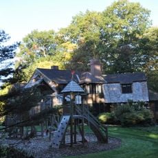
Burleigh Brae is a summer residence with an attached boathouse situated on Squam Lake in New Hampshire, located near Carns Cove along Route 113. The buildings display Craftsman architectural features and were designed as a seasonal retreat in the early 1900s.

History

The estate was designed in 1911 by architects Chapman & Foster for Edwin S. Webster, with the lakeside boathouse added approximately two years later. This development was part of a broader trend of wealthy families building summer retreats in the region.

Culture

The property reflects how wealthy families established summer homes along the lake in the early 1900s, transforming the region into a retreat destination. The Craftsman style and waterfront setting show the era's preference for seasonal residences connected to nature.

Practical

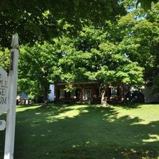
The property is private, so viewing is possible from the public road and water, but access to the structures themselves is limited. The best vantage points are from Route 113 or from the lake itself, where you can see the buildings and their architecture.

Did you know?

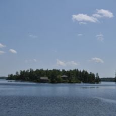
The estate is part of one of the largest watershed-wide National Register listings in New Hampshire, encompassing multiple historic properties across 1200 acres. This regional preservation approach is uncommon and makes the area a significant conservation zone for early 20th-century architecture.

Location
GPS coordinates
43.76194,-71.56111
Latest update
December 14, 2025 18:14

AroundUs brings together thousands of curated places, local tips, and hidden gems, enriched daily by 60,000 contributors worldwide. Discover all places nearby (Holderness).

Around this place
Blair Bridge
United States of America

Blair Bridge

9.9 km
Rockywold-Deephaven Camps
United States of America

Rockywold-Deephaven Camps

2.2 km
Webster Estate
United States of America

Webster Estate

321 m
Whipple House
United States of America

Whipple House

9.4 km
True Farm
United States of America

True Farm

222 m
First Free Will Baptist Church and Vestry
United States of America

First Free Will Baptist Church and Vestry

9.4 km
Camp Carnes
United States of America

Camp Carnes

329 m
Meredith Public Library
United States of America

Meredith Public Library

12.8 km
Chapel of the Holy Cross
United States of America

Chapel of the Holy Cross

9.2 km
Holderness Free Library
United States of America

Holderness Free Library

4 km
Camp Ossipee
United States of America

Camp Ossipee

2.2 km
Ashland Gristmill and Dam
United States of America

Ashland Gristmill and Dam

9.3 km
Old Grafton County Courthouse
United States of America

Old Grafton County Courthouse

10.3 km
Boulderwood
United States of America

Boulderwood

2.2 km
Town Hall
United States of America

Town Hall

11.1 km
Beede Farm
United States of America

Beede Farm

7.6 km
Ashland Town Hall
United States of America

Ashland Town Hall

9.3 km
Shepard Hill Historic District
United States of America

Shepard Hill Historic District

4.1 km
Plymouth Historic District
United States of America

Plymouth Historic District

10.2 km
Centre Harbor Village Historic District
United States of America

Centre Harbor Village Historic District

9.9 km
High, Church and Gould Streets Historic District
United States of America

High, Church and Gould Streets Historic District

12.7 km
North Holderness Freewill Baptist Church-Holderness Historical Society Building
United States of America

North Holderness Freewill Baptist Church-Holderness Historical Society Building

4.6 km
Pointfield
United States of America

Pointfield

6.9 km
Hansen's Annex
United States of America

Hansen's Annex

11 km
Lower Corner Historic District
United States of America

Lower Corner Historic District

12.3 km
Ashland
United States of America

Ashland

9.9 km
Center Sandwich Historic District
United States of America

Center Sandwich Historic District

11 km
Beede Falls
United States of America

Beede Falls

9.1 km
Show the full map
« Burleigh Brae and Webster Boathouse - Historic estate and boathouse on Squam Lake in Holderness, United States » is provided by Around Us (aroundus.com). Images and texts are derived from Wikimedia project under a Creative Commons license. You are allowed to copy, distribute, and modify copies of this page, under the conditions set by the license, as long as this note is clearly visible.

Discover hidden gems everywhere you go!

From secret cafés to breathtaking viewpoints, skip the crowded tourist spots and find places that match your style. Our app makes it easy with voice search, smart filtering, route optimization, and insider tips from travelers worldwide. Download now for the complete mobile experience.

Around Us App Screenshot

A unique approach to discovering new places

Le Figaro

All the places worth exploring

France Info

A tailor-made excursion in just a few clicks

20 Minutes

Around Us
Travel Guide & Maps
Download

Send to your phone

QR Code
1

Open the camera app on your mobile.

2

Point at the QR code with your camera. A notification will appear.

3

Tap the notification to open the link.