Chest opened
+${chestReward.xp} XP
Explorer
NOUVEAU ×${chestReward.collectible.quantity}
tapez pour fermer
Chest locked

Open chests in the app

Around Us is built for your phone — chests unlock when you walk, explore and capture nearby places.

Enable Location

We need your location to show you interesting places around you

Discover nearby places

Find interesting locations and hidden gems around you

Precise directions

Get accurate directions and distances to places

Your location is never shared with other users. It's only used when you tap the location button.

Log in to your account

Start exploring — it's free

Trusted by 72,882 travelers worldwide

Continue with Google
Continue with Apple
or

We will send you a code to connect

By continuing, you accept our Terms and Conditions and our Privacy Policy

Check your inbox

We've sent a pincode in your inbox. Please enter the code below.

Deer Island
Discussion Reviews Photo
1.8k Popularity

Deer Island, River island in Amesbury, United States

Deer Island is a river island situated within the Merrimack River in Amesbury, covering roughly 5 acres that expand during low tide. The eastern portion operates as protected conservation land with trails and natural habitat, while the western side contains a few private homes.

The eastern section gained protection in 1984 through a state conservation grant that preserved its natural environment. This designation marked an important moment in protecting the river's landscape and resources.

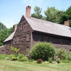
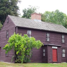
The island was home to author Harriet Elizabeth Prescott Spofford, whose literary work shaped connections to this Merrimack River location during the 19th century. Her residence here reflected the appeal of this place to creative people seeking inspiration from natural surroundings.

Access to the island is via Main Street or Merrill Street leading to the Derek S Hines Memorial Bridge with parking on the far side. The terrain is best explored on foot, especially using the marked paths on the eastern section.

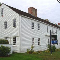
Only two private homes occupy the western portion while the eastern side offers an extensive network of walking trails for nature exploration. This contrast between private residence and public conservation space creates an unusual character.

The community of curious travelers

AroundUs brings together thousands of curated places, local tips, and hidden gems, enriched daily by 60,000 contributors worldwide.

Start exploring
Location
GPS coordinates
42.83500,-70.90640
Latest update
December 21, 2025 16:05
Around this place
Maudslay State Park
United States of America

Maudslay State Park

2.2 km
Coffin House
United States of America

Coffin House

5.3 km
Chain Bridge
United States of America

Chain Bridge

147 m
United States of America

Newburyport Public Library

3.4 km
Dalton House
United States of America

Dalton House

4.1 km
Macy-Colby House
United States of America

Macy-Colby House

2.2 km
John Greenleaf Whittier House
United States of America

John Greenleaf Whittier House

3.3 km
Cushing House Museum and Garden
United States of America

Cushing House Museum and Garden

4.3 km
Superior Courthouse and Bartlett Mall
United States of America

Superior Courthouse and Bartlett Mall

4.5 km
Bartlett Museum, Inc.
United States of America

Bartlett Museum, Inc.

2.2 km
United States Customhouse
United States of America

United States Customhouse

4 km
Amesbury Friends Meeting House
United States of America

Amesbury Friends Meeting House

3.4 km
Rocky Hill Meeting House
United States of America

Rocky Hill Meeting House

1.8 km
Newburyport Harbor Rear Range Light
United States of America

Newburyport Harbor Rear Range Light

4.2 km
Market Square Historic District
United States of America

Market Square Historic District

4 km
Newburyport Harbor Front Range Light
United States of America

Newburyport Harbor Front Range Light

4.3 km
Newburyport Historic District
United States of America

Newburyport Historic District

3.5 km
Swett-Ilsley House
United States of America

Swett-Ilsley House

5.3 km
Amesbury and Salisbury Mills Village Historic District
United States of America

Amesbury and Salisbury Mills Village Historic District

3.2 km
Brown Square House
United States of America

Brown Square House

3.7 km
Rev. John Tufts House
United States of America

Rev. John Tufts House

5.1 km
United States Post Office–Newburyport Main
United States of America

United States Post Office–Newburyport Main

3.9 km
Dodge Building
United States of America

Dodge Building

3.5 km
Union Congregational Church
United States of America

Union Congregational Church

1.6 km
Benjamin Coker House
United States of America

Benjamin Coker House

4.5 km
John Greenleaf Whittier Bridge
United States of America

John Greenleaf Whittier Bridge

385 m
Custom House Maritime Museum
United States of America

Custom House Maritime Museum

4 km
Lowell's Boat Shop
United States of America

Lowell's Boat Shop

1 km
Show the full map
Reviews
Share your experience

No review yet

Discussions
Start a discussion...

No discussion yet

« Deer Island - River island in Amesbury, United States » is provided by Around Us (aroundus.com). Images and texts are derived from Wikimedia project under a Creative Commons license. You are allowed to copy, distribute, and modify copies of this page, under the conditions set by the license, as long as this note is clearly visible.

Discover hidden gems everywhere you go!

From secret cafés to breathtaking viewpoints, skip the crowded tourist spots and find places that match your style. Our app makes it easy with voice search, smart filtering, route optimization, and insider tips from travelers worldwide. Download now for the complete mobile experience.

Around Us App Screenshot

A unique approach to discovering new places

Le Figaro

All the places worth exploring

France Info

A tailor-made excursion in just a few clicks

20 Minutes

Around Us
Travel Guide & Maps
Download

Send to your phone

QR Code
1

Open the camera app on your mobile.

2

Point at the QR code with your camera. A notification will appear.

3

Tap the notification to open the link.