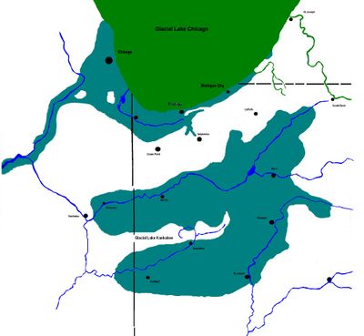
Lake Kankakee, Glacial lake in Northwestern Indiana, United States.
Lake Kankakee was a large glacial lake that stretched across portions of Indiana and Illinois and was divided by the Iroquois Moraine into two separate water bodies. The water level sat approximately 40 feet (12 meters) higher than the modern river level, with overflow occurring near Morris in Illinois.
The water body formed approximately 14,000 years ago from the meltwater of three glacial lobes: Michigan, Saginaw, and Huron-Erie during the Wisconsin glaciation. Over time, the lake gradually vanished as the climate warmed and glacial retreat continued.
F.H. Bradley named Lake Kankakee in 1840 after discovering sand deposits outside the marsh that indicated the previous existence of the water body.
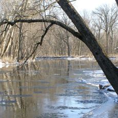
The former lake site is difficult to visit directly today since the water has long vanished and the original landscape has been altered by erosion and land use. Visitors interested in understanding the lake's extent can explore the surrounding terrain and moraine formations across the region.
Strong westerly winds shaped the landscape in ways similar to Lake Michigan, creating sand dunes along the southern and eastern shoreline during the melting period. These dune formations remain visible in the landscape today as evidence of the wind's power across this region.
The community of curious travelers
AroundUs brings together thousands of curated places, local tips, and hidden gems, enriched daily by 60,000 contributors worldwide.