Chest opened
+${chestReward.xp} XP
Explorer
NOUVEAU ×${chestReward.collectible.quantity}
tapez pour fermer
Chest locked

Open chests in the app

Around Us is built for your phone — chests unlock when you walk, explore and capture nearby places.

Enable Location

We need your location to show you interesting places around you

Discover nearby places

Find interesting locations and hidden gems around you

Precise directions

Get accurate directions and distances to places

Your location is never shared with other users. It's only used when you tap the location button.

Log in to your account

Start exploring — it's free

Trusted by 73,048 travelers worldwide

Continue with Google
Continue with Apple
or

We will send you a code to connect

By continuing, you accept our Terms and Conditions and our Privacy Policy

Check your inbox

We've sent a pincode in your inbox. Please enter the code below.

Beaver Islands State Wildlife Research Area
Discussion Reviews Photo
2k Popularity

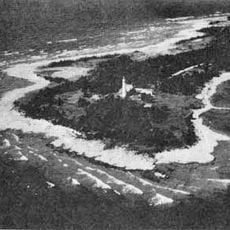
Beaver Islands State Wildlife Research Area, Protected natural area in northern Lake Michigan, United States

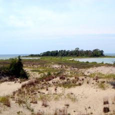
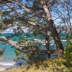
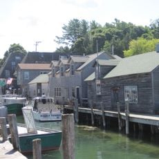
Beaver Islands State Wildlife Research Area is a protected natural area comprising over 23,000 acres spread across six islands in northern Lake Michigan. The research area includes parts of Beaver Island, Garden Island, High Island, and Hog Island, forming an interconnected island network.

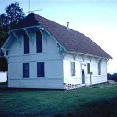
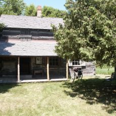
The islands were originally logged and later abandoned when property owners failed to pay taxes, allowing the state to acquire the land. Michigan then established these recovered territories as a protected research area.

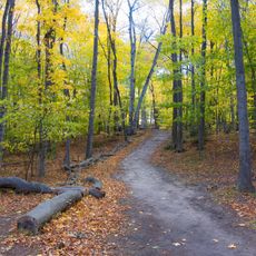
Field researchers conduct regular studies on shoreline animals, birds, and plant species across the interconnected island network in Lake Michigan.

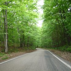
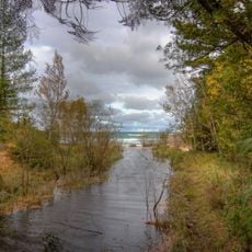
Visitors can enjoy hunting, fishing, boating, and camping while following all Michigan state regulations for the islands. Planning ahead and checking current conditions is important since the islands are remote and exposed to weather.

The area operates under a split management system where northern islands are overseen from Gaylord while the southern Fox Islands are administered from Cadillac. This divided oversight is unusual for a connected protected area.

The community of curious travelers

AroundUs brings together thousands of curated places, local tips, and hidden gems, enriched daily by 60,000 contributors worldwide.

Start exploring
Location
GPS coordinates
45.50000,-85.75000
Latest update
December 14, 2025 09:41
Around this place
Fisherman's Island State Park
United States of America

Fisherman's Island State Park

40 km
Seul Choix Light
United States of America

Seul Choix Light

48.6 km
Leelanau State Park
United States of America

Leelanau State Park

37.9 km
Squaw Island Light
United States of America

Squaw Island Light

40 km
Charlevoix South Pier Light Station
United States of America

Charlevoix South Pier Light Station

42.9 km
Grand Traverse Light
United States of America

Grand Traverse Light

35.9 km
Ile Aux Galets
United States of America

Ile Aux Galets

49.1 km
South Fox Island Light
United States of America

South Fox Island Light

15.1 km
Beaver Island Head Light
United States of America

Beaver Island Head Light

16.1 km
Leland Historic District
United States of America

Leland Historic District

53.1 km
Beaver Island Harbor Light
United States of America

Beaver Island Harbor Light

32.9 km
Lansing Shoals Light Station
United States of America

Lansing Shoals Light Station

47.3 km
US 31–Island Lake Outlet Bridge
United States of America

US 31–Island Lake Outlet Bridge

43.4 km
Mormon Print Shop
United States of America

Mormon Print Shop

32.7 km
Greensky Hill church
United States of America

Greensky Hill church

48.1 km
Grove Hill New Mission Church
United States of America

Grove Hill New Mission Church

50.9 km
North Manitou Island Lifesaving Station
United States of America

North Manitou Island Lifesaving Station

45.8 km
Feodar Protar Cabin
United States of America

Feodar Protar Cabin

26.9 km
Mt. McSauba Site
United States of America

Mt. McSauba Site

43.1 km
Tunnel of Trees
United States of America

Tunnel of Trees

50.6 km
Pine River Site
United States of America

Pine River Site

43.2 km
Omena Historic District
United States of America

Omena Historic District

51 km
O'Neill Site
United States of America

O'Neill Site

39.6 km
Ekdahl–Goudreau Site
United States of America

Ekdahl–Goudreau Site

48.2 km
Charlevoix City Park Site
United States of America

Charlevoix City Park Site

43.5 km
Beaver Island Toy Museum & Shop
United States of America

Beaver Island Toy Museum & Shop

33.2 km
Fishtown Historic District
United States of America

Fishtown Historic District

53.1 km
Earl Young Gnome Houses
United States of America

Earl Young Gnome Houses

43 km
Show the full map
Reviews
Share your experience

No review yet

Discussions
Start a discussion...

No discussion yet

« Beaver Islands State Wildlife Research Area - Protected natural area in northern Lake Michigan, United States » is provided by Around Us (aroundus.com). Images and texts are derived from Wikimedia project under a Creative Commons license. You are allowed to copy, distribute, and modify copies of this page, under the conditions set by the license, as long as this note is clearly visible.

Discover hidden gems everywhere you go!

From secret cafés to breathtaking viewpoints, skip the crowded tourist spots and find places that match your style. Our app makes it easy with voice search, smart filtering, route optimization, and insider tips from travelers worldwide. Download now for the complete mobile experience.

Around Us App Screenshot

A unique approach to discovering new places

Le Figaro

All the places worth exploring

France Info

A tailor-made excursion in just a few clicks

20 Minutes

Around Us
Travel Guide & Maps
Download

Send to your phone

QR Code
1

Open the camera app on your mobile.

2

Point at the QR code with your camera. A notification will appear.

3

Tap the notification to open the link.