Gilnockie Creek Ecological Reserve, ecological reserve in British Columbia, Canada
Location: Regional District of East Kootenay
GPS coordinates: 49.00833,-115.65278
Latest update: November 22, 2025 07:53
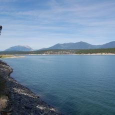
Lake Koocanusa
37.7 km
Moyie Dam
48.9 km
Kikomun Creek Provincial Park
39.2 km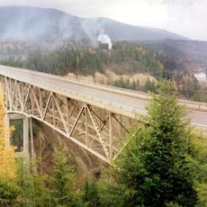
Moyie River Canyon Bridge
49.5 km
Moyie Falls
40.2 km
Yahk Provincial Park
33.3 km
Moyie Lake Provincial Park
42.7 km
Ryan Provincial Park
31.1 km
Gilnockie Provincial Park
8.8 km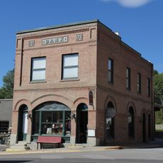
Farmers and Merchants State Bank
46.2 km
Eureka Community Hall
31.3 km
Wardner Provincial Park
48.5 km
Snyder Guard Station Historical District
40.1 km
Spokane & International Railroad Construction Camp
38.1 km
Elko Park
50.7 km
Stone Hill
36.5 km
Smith Lake
51.4 km
Will-O-Bend Golf & RV Park
49.4 km
Indian Springs Golf Course
44.9 km
Tobacco Valley Historical Village
46.3 km
Turtle Log
40.2 km
Scenic viewpoint
33.1 km
Scenic viewpoint
52.8 km
Yaak Falls
43.6 km
Moyie River overlook
49.6 km
Waterfall
50.1 km
Moyie Falls
50.6 km
Yaak Falls
43.6 kmReviews
Visited this place? Tap the stars to rate it and share your experience / photos with the community! Try now! You can cancel it anytime.
Discover hidden gems everywhere you go!
From secret cafés to breathtaking viewpoints, skip the crowded tourist spots and find places that match your style. Our app makes it easy with voice search, smart filtering, route optimization, and insider tips from travelers worldwide. Download now for the complete mobile experience.

A unique approach to discovering new places❞
— Le Figaro
All the places worth exploring❞
— France Info
A tailor-made excursion in just a few clicks❞
— 20 Minutes