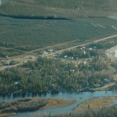
Thinahtea North Protected Area, protected area in British Columbia, Canada
Location: Northern Rockies Regional Municipality
GPS coordinates: 59.78056,-120.19944
Latest update: November 23, 2025 01:29
Sambaa K'e
93.8 km
Andy Bailey Provincial Park
189.7 km
Redknife Formation
167.9 km
Maxhamish Lake Provincial Park and Protected Area
172.3 km
Jackpine Remnant Protected Area
186.9 km
Hay-Zama Lakes Wildland Provincial Park
130.6 km
Sikanni Old Growth Provincial Park
192.3 km
Kotcho Lake Village Provincial Park
98.1 km
60th Parallel Territorial Park
181.3 km
Whittaker Falls
153.5 km
Kotcho Lake Ecological Reserve
94 km
Beaverdam Rapids
199.6 km
Fort Nelson River Ecological Reserve
159.8 km
Maxhamish Lake Protected Area
174.9 km
Parker Lake Ecological Reserve
188 km
Ekwan Lake Protected Area
143.1 km
Hay River Protected Area
121.9 km
Thinahtea South Protected Area
15.6 km
Sambaa Deh Falls Territorial Park
153 km
Table Rock Rapids
162.5 km
Liard Rapids
201 km
Coral Falls
152.2 km
Rainbow Lake Golf & Country Club
149 km
NWT Sign
181.3 km
Mozzy the Mosquito
149.3 km
Scenic viewpoint
126.2 km
Scenic viewpoint
152.3 km
Waterfall
157.6 kmReviews
Visited this place? Tap the stars to rate it and share your experience / photos with the community! Try now! You can cancel it anytime.
Discover hidden gems everywhere you go!
From secret cafés to breathtaking viewpoints, skip the crowded tourist spots and find places that match your style. Our app makes it easy with voice search, smart filtering, route optimization, and insider tips from travelers worldwide. Download now for the complete mobile experience.

A unique approach to discovering new places❞
— Le Figaro
All the places worth exploring❞
— France Info
A tailor-made excursion in just a few clicks❞
— 20 Minutes