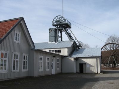
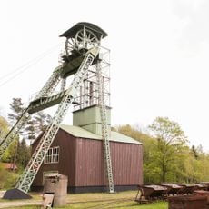
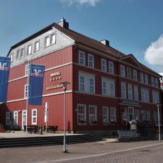
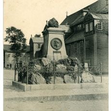
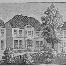
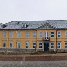
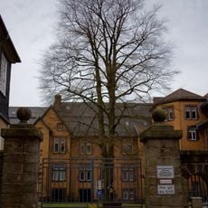
Emperor William Shaft, Mining heritage monument in Clausthal-Zellerfeld, Germany.
The Emperor William Shaft is a mining monument in Clausthal-Zellerfeld that houses the extraction infrastructure of a historic ore mine. The building displays the technical setup including a shaft tower and engine house characteristic of 19th century Harz mining operations.
The mine opened in the 1880s and extracted lead and zinc ores from the Burgstatt deposit in the Upper Harz region. The shaft operated for roughly a century until 1980, shaping the mining tradition of the area.
The shaft building stands as a testament to German industrial development, reflecting the mining traditions that shaped the local community for generations.
The monument is located near the surveying and mining institute of Clausthal University of Technology and is easily reached on foot from the town center. The site is straightforward to visit and provides informational displays about the local mining industry's past.
The shaft tower was equipped with advanced hoisting equipment that enabled rapid and safe transport of ore and workers. These machines represented cutting-edge technology for the time and reveal how sophisticated the local mining operations had become.
Location: Clausthal-Zellerfeld
GPS coordinates: 51.80420,10.34450
Latest update: December 12, 2025 17:42
Upper Harz Water Regale
1.8 km
Marktkirche zum Heiligen Geist
716 m
Upper Harz Mining Museum
1.6 km
Ottiliae-Schacht
2.2 km
St Salvatoris
1.5 km
Mittlerer Pfauenteich
1.5 km
Alte Münze zu Clausthal
890 m
Altes Primarius-Pfarrhaus und Superintendentur Zellerfeld
1.4 km
Church in Clausthal-Zellerfeld
424 m
Niedersächsisches Bergarchiv
847 m
Mines of Rammelsberg, Historic Town of Goslar and Upper Harz Water Management System
1.8 km
Stadtweger Teich
2.5 km
Unterer Eschenbacher Teich
836 m
Hotel Goldene Krone
664 m
Unterer Hausherzberger Teich
918 m
Friedrich Adolph Roemer-Denkmal
758 m
Neuer Friedhof
277 m
Townhall Clausthal-Zellerfeld
774 m
Pixhaier Teich
2 km
Robert-Koch-Haus Clausthal
618 m
Semmelwieser Teich
2.8 km
Carler Teich
1.9 km
Landesamt für Bergbau, Energie und Geologie, Bibliothek Clausthal
783 m
Oberer Flambacher Teich
2.6 km
Bergapotheke in Zellerfeld
1.5 km
ND-GS 56 (Ahorngruppe)
1.2 km
ND-GS 57 (Blutbuche)
817 m
ND-GS 58 (Alter Ahorn)
617 mVisited this place? Tap the stars to rate it and share your experience / photos with the community! Try now! You can cancel it anytime.
Discover hidden gems everywhere you go!
From secret cafés to breathtaking viewpoints, skip the crowded tourist spots and find places that match your style. Our app makes it easy with voice search, smart filtering, route optimization, and insider tips from travelers worldwide. Download now for the complete mobile experience.
A unique approach to discovering new places❞
— Le Figaro
All the places worth exploring❞
— France Info
A tailor-made excursion in just a few clicks❞
— 20 Minutes