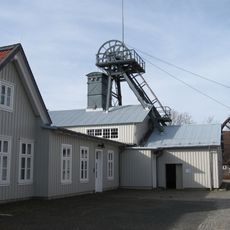
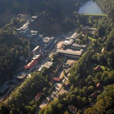
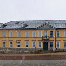
Ottiliae-Schacht, Mining shaft and architectural monument in Clausthal-Zellerfeld, Germany.
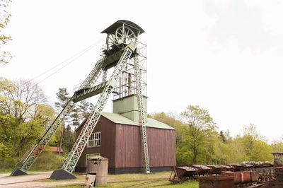
The Ottiliae-Schacht is a mining shaft featuring a distinctive iron headframe erected in 1876 in Clausthal-Zellerfeld. The steel structure, standing roughly 20 meters high, was built by the royal central forge and served as part of the Mine Rosenhof extraction system.
The shaft began operating in 1876 as an extraction facility and functioned until 1930 as a primary mining point. During this period, silver, lead, and iron ore were removed from depths reaching 594 meters.
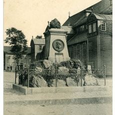
The shaft honors a Prussian mining captain whose work shaped local industry. It stands as a reminder of the mining traditions that defined life in this region for generations.
The site welcomes visitors during designated times with guided tours available to learn about its history. Wear comfortable shoes when visiting, as exploring this historical location involves walking around the grounds and viewing the structure up close.
The iron headframe ranks among the oldest of its type in Europe, reflecting the skilled craftsmanship of local forge work. Visitors can observe how 19th-century engineering was actually built and designed at this preserved location.
Location: Clausthal-Zellerfeld
Part of: Mine Rosenhof
GPS coordinates: 51.80838,10.31316
Latest update: December 12, 2025 12:03
Upper Harz Water Regale
2.3 km
Marktkirche zum Heiligen Geist
1.5 km
19-Lachter Tunnel
2.7 km
Upper Harz Mining Museum
1.8 km
St Salvatoris
1.8 km
Emperor William Shaft
2.2 km
Alte Münze zu Clausthal
1.4 km
Altes Primarius-Pfarrhaus und Superintendentur Zellerfeld
1.9 km
Church in Clausthal-Zellerfeld
1.8 km
Niedersächsisches Bergarchiv
1.4 km
Oberer Einersberger Teich
1.3 km
Mines of Rammelsberg, Historic Town of Goslar and Upper Harz Water Management System
2.3 km
Unterer Eschenbacher Teich
2.2 km
Hotel Goldene Krone
1.6 km
Friedrich Adolph Roemer-Denkmal
1.5 km
Neuer Friedhof
2 km
Townhall Clausthal-Zellerfeld
1.5 km
Robert-Koch-Haus Clausthal
1.6 km
Carler Teich
1.6 km
Landesamt für Bergbau, Energie und Geologie, Bibliothek Clausthal
1.4 km
Unterer Hahnebalzer Teich
2.7 km
Semmelwieser Teich
2.6 km
Oberer Flambacher Teich
2.3 km
Unterer Flambacher Teich
2.4 km
Bergapotheke in Zellerfeld
1.9 km
ND-GS 56 (Ahorngruppe)
1.9 km
ND-GS 57 (Blutbuche)
1.4 km
ND-GS 58 (Alter Ahorn)
2.1 kmVisited this place? Tap the stars to rate it and share your experience / photos with the community! Try now! You can cancel it anytime.
Discover hidden gems everywhere you go!
From secret cafés to breathtaking viewpoints, skip the crowded tourist spots and find places that match your style. Our app makes it easy with voice search, smart filtering, route optimization, and insider tips from travelers worldwide. Download now for the complete mobile experience.
A unique approach to discovering new places❞
— Le Figaro
All the places worth exploring❞
— France Info
A tailor-made excursion in just a few clicks❞
— 20 Minutes