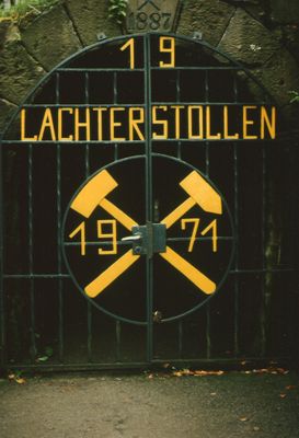
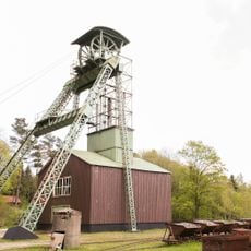
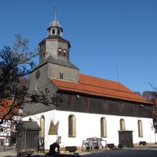
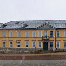
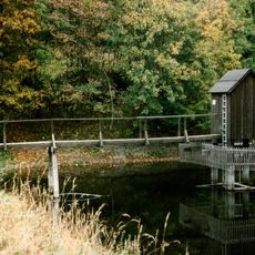
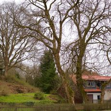
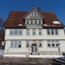
19-Lachter Tunnel, Water drainage gallery in Wildemann, Germany.
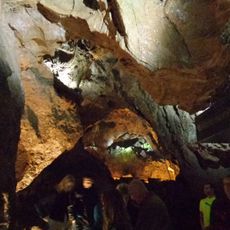
The 19-Lachter Tunnel is a water drainage gallery that runs roughly 8.8 kilometers through the Upper Harz mountains, with passages that are only about 1.4 meters high in some areas. It was built to direct water away from mining operations and portions of it remain open for visitors to explore.
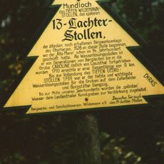
Construction of the tunnel started in 1551 but was interrupted due to difficult rock conditions and resumed in 1570. The project was finally completed in 1690 and continued operating until 1924.
The tunnel's name comes from the historical mining measurement called 'Lachter,' which reflects the traditional ways miners measured distances in the Harz region. This term shows how deeply mining shaped local language and daily work practices.
Visitors can join guided tours that explore about 500 meters of the accessible tunnel sections and show historical equipment like compressors and turbines. The low ceiling in certain areas requires careful walking, so wear comfortable shoes and clothes you do not mind getting soiled.
A steel bridge spans a vertical shaft that drops about 261 meters below, and during tours water demonstrations show the power of the system. This remarkable spot reveals both the engineering skill required and the large volume of water the tunnel needed to handle.
Location: Wildemann
Inception: 1535
Part of: Upper Harz Water Tunnels
Phone: +4953236111
Website: http://19-lachter-stollen.de
GPS coordinates: 51.82366,10.28187
Latest update: December 8, 2025 21:03
Upper Harz Water Regale
4 km
Iberg Dripstone Cave
2.1 km
Hübichenstein
3.2 km
Upper Harz Mining Museum
3.8 km
Ottiliae-Schacht
2.7 km
St Salvatoris
3.8 km
Iberg
2.2 km
Lower Grumbach Pond
3.2 km
Alte Münze zu Clausthal
4.1 km
Altes Primarius-Pfarrhaus und Superintendentur Zellerfeld
3.9 km
Maria-Magdalenen-Kirche
391 m
Uhrenmuseum Bad Grund
3.2 km
Oberer Spiegeltaler Teich
4.1 km
Niedersächsisches Bergarchiv
4.1 km
Oberer Einersberger Teich
1.5 km
Mines of Rammelsberg, Historic Town of Goslar and Upper Harz Water Management System
4 km
Saint Barbara Church (Bad Grund)
3.9 km
St. Antonius
3.5 km
Hotel Goldene Krone
4.2 km
Friedrich Adolph Roemer-Denkmal
4.2 km
Dennert-Tanne Kulk, Wildemann
619 m
Landesamt für Bergbau, Energie und Geologie, Bibliothek Clausthal
4.1 km
Unterer Hahnebalzer Teich
4.1 km
Carler Teich
3.4 km
ND-GS 57 (Blutbuche)
4.1 km
ND-GS 56 (Ahorngruppe)
4 km
Bergapotheke in Zellerfeld
3.9 km
Dennert-Tanne Mundloch des 13-Lachter-Stollen, Wildemann
519 mVisited this place? Tap the stars to rate it and share your experience / photos with the community! Try now! You can cancel it anytime.
Discover hidden gems everywhere you go!
From secret cafés to breathtaking viewpoints, skip the crowded tourist spots and find places that match your style. Our app makes it easy with voice search, smart filtering, route optimization, and insider tips from travelers worldwide. Download now for the complete mobile experience.
A unique approach to discovering new places❞
— Le Figaro
All the places worth exploring❞
— France Info
A tailor-made excursion in just a few clicks❞
— 20 Minutes