Iberg Dripstone Cave
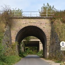
Iberg Dripstone Cave, Show cave in Bad Grund, Germany.
Iberg Dripstone Cave is a natural limestone cave extending roughly 300 meters underground, shaped by stalactites, stalagmites, and mineral deposits visible throughout. The cave sits at approximately 440 meters above sea level and displays varied geological formations.
Iron ore miners discovered the cave system by chance during the 16th century while extracting resources from the mountain. Doctor Franz Brückmann conducted the first documented exploration and scientific study of the system in 1723.
Local stories speak of Dwarf King Hubich and his people, who gave the mountain a legendary significance that persists in the region today. These tales shape how visitors and locals understand and experience the place.
Visits happen through guided tours that lead visitors through the cave safely while providing explanations about the formations. Bring sturdy footwear and be prepared for changing light levels and uneven ground throughout the experience.
The cave displays unusual upside-down water marks on its walls formed through specific mineral weathering processes. These copper-colored formations develop through chemical reactions that are particularly visible in this location.
Location: Bad Grund
Elevation above the sea: 440 m
Accessibility: Wheelchair limited access
Opening Hours: Tuesday-Sunday,Holidays,SH 10:00-17:00; December 24 off
Email: info@hoehlen-erlebnis-zentrum.de
GPS coordinates: 51.81750,10.25278
Latest update: December 8, 2025 19:45
Hübichenstein
1.3 km
19-Lachter Tunnel
2.1 km
Upper Harz Mining Museum
5.7 km
Ottiliae-Schacht
4.3 km
Iberg
511 m
Lower Grumbach Pond
4.9 km
Alte Münze zu Clausthal
5.7 km
Burg Windhausen
4.4 km
Maria-Magdalenen-Kirche
2.3 km
Uhrenmuseum Bad Grund
1.3 km
Niedersächsisches Bergarchiv
5.7 km
Oberer Einersberger Teich
3.2 km
Saint Barbara Church (Bad Grund)
1.9 km
Mauritiuskirche
5.3 km
St. Johannes
5.1 km
St. Antonius
1.4 km
Townhall Clausthal-Zellerfeld
5.8 km
Dennert-Tanne Kulk, Wildemann
2.2 km
Semmelwieser Teich
5.7 km
Carler Teich
5.3 km
Unterer Hahnebalzer Teich
4.4 km
Landesamt für Bergbau, Energie und Geologie, Bibliothek Clausthal
5.7 km
Haderbacher Teich
5.5 km
Unterer Flambacher Teich
5.5 km
Oberer Flambacher Teich
5.5 km
Eisenbahnbrücke Grundweg Gittelde
4.6 km
ND-GS 57 (Blutbuche)
5.7 km
Dennert-Tanne Mundloch des 13-Lachter-Stollen, Wildemann
2.2 kmVisited this place? Tap the stars to rate it and share your experience / photos with the community! Try now! You can cancel it anytime.
Discover hidden gems everywhere you go!
From secret cafés to breathtaking viewpoints, skip the crowded tourist spots and find places that match your style. Our app makes it easy with voice search, smart filtering, route optimization, and insider tips from travelers worldwide. Download now for the complete mobile experience.
A unique approach to discovering new places❞
— Le Figaro
All the places worth exploring❞
— France Info
A tailor-made excursion in just a few clicks❞
— 20 Minutes