Oberfrauenwald, Mountain summit in Bavarian Forest, Germany
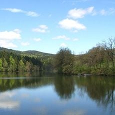
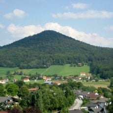
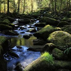
Oberfrauenwald is a mountain summit in the Bavarian Forest that rises to about 948 meters and is surrounded by thick coniferous forests. The forested slopes create a natural setting typical of this highland region, with views opening up as you approach the summit area.
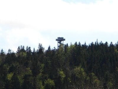
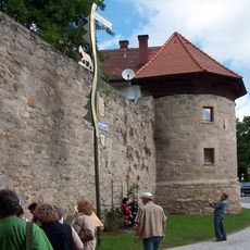
An observation tower was built on the summit in 2001 to enhance visitor access and experience. This addition transformed the location into a more popular destination for hikers across the region.
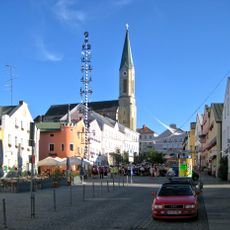
The mountain serves as a meeting point for local communities who organize traditional Bavarian festivities and outdoor gatherings throughout the year.
Several hiking trails of varying difficulty lead to the summit from different starting points. A parking area provides convenient access, and most routes take between 15 and 30 minutes from the nearest trailhead to reach the top.
A webcam installed at the summit since 2013 streams live views of the surrounding landscape online, allowing people worldwide to watch the location virtually. This technology connects distant viewers to the mountain even when they cannot visit in person.
Location: Bavaria
Elevation above the sea: 947.7 m
GPS coordinates: 48.68500,13.65805
Latest update: December 14, 2025 20:31
Erlauzwieseler See
4.1 km
Freudensee
3 km
St. Peter und Paul
6.5 km
Staffelberg
3.8 km
Station building at Waldkirchen station
6.9 km
Burg Freudensee
3.2 km
St. Vitus
4.5 km
Steinbruch Schachet beim Granitzentrum Hauzenberg
5 km
Wallfahrtskirche St. Ägidius
4.3 km
Katholische Pfarrkirche St. Maria Hilfe der Christen
7.8 km
Pfarrkirche Maria Himmelfahrt
4.8 km
St. Karl Borromäus
5.5 km
Grabenkapelle
6.2 km
Lourdes-Kapelle
5.8 km
Schutz des Freudensees und von Landschaftsteilen um den Freudensee (LSG Freudensee)
2.9 km
Ortskapelle
7.7 km
Saußbachleite
5.3 km
Granitmuseum Bayerischer Wald
5 km
Erlau
7.6 km
Mariensäule
6.5 km
Ortskapelle
4.5 km
Ehemalige Marktbefestigung
6.5 km
Ensemble Marktplatz
6.6 km
Waldkirchener Radabweiser - Die steinerne Gretl
6.7 km
Wegkapelle St. Magdalena
6.7 km
Ehem. Gasthaus
7.6 km
Saußbachleite S von Waldkirchen
5.3 km
Rathaus Waldkirchen
6.3 kmVisited this place? Tap the stars to rate it and share your experience / photos with the community! Try now! You can cancel it anytime.
Discover hidden gems everywhere you go!
From secret cafés to breathtaking viewpoints, skip the crowded tourist spots and find places that match your style. Our app makes it easy with voice search, smart filtering, route optimization, and insider tips from travelers worldwide. Download now for the complete mobile experience.
A unique approach to discovering new places❞
— Le Figaro
All the places worth exploring❞
— France Info
A tailor-made excursion in just a few clicks❞
— 20 Minutes