Chest opened
+${chestReward.xp} XP
Explorer
NOUVEAU ×${chestReward.collectible.quantity}
tapez pour fermer
Chest locked

Open chests in the app

Around Us is built for your phone — chests unlock when you walk, explore and capture nearby places.

Enable Location

We need your location to show you interesting places around you

Discover nearby places

Find interesting locations and hidden gems around you

Precise directions

Get accurate directions and distances to places

Your location is never shared with other users. It's only used when you tap the location button.

Metropolitan Borough of St Marylebone

Log in to your account

Start exploring — it's free

Trusted by 73,106 travelers worldwide

Continue with Google
Continue with Apple
or

We will send you a code to connect

By continuing, you accept our Terms and Conditions and our Privacy Policy

Check your inbox

We've sent a pincode in your inbox. Please enter the code below.

Metropolitan Borough of St Marylebone
Discussion Reviews 1 Photos
6.9k Popularity

Metropolitan Borough of St Marylebone, Former metropolitan borough in the County of London, England

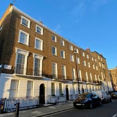
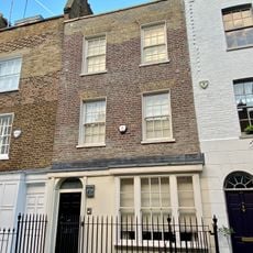
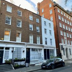
The Metropolitan Borough of St Marylebone was an administrative district within the County of London, covering areas such as Marylebone, Regent's Park, St John's Wood, and part of Fitzrovia. It sat north of Oxford Street and was made up of wide streets lined with stone terraces and large open green spaces.

The area was recorded in the Domesday Book of 1086 as a small settlement near the river Tyburn, and its name shifted over time from Tyburn to St Marylebone after a church dedicated to St Mary was built there. The borough itself was formally created in 1900 and was dissolved in 1965 when London's administrative boundaries were reorganised.

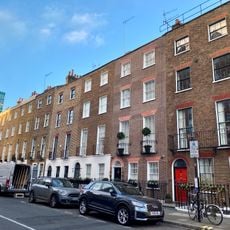
Harley Street is known across Britain as the address for private medical practices, a reputation built over many generations. Walking through it today, visitors still see the brass plates and quiet doorways that signal this long-standing role.

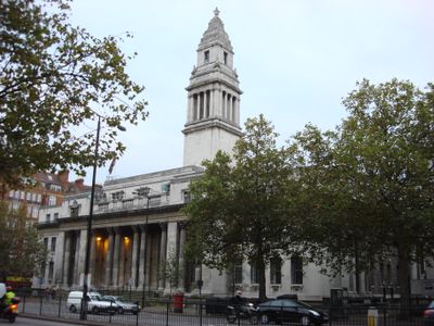
The area is easy to explore on foot, with Marylebone Road and the streets around Baker Street giving a good sense of how the district was laid out. The town hall on Marylebone Road, built in the early 20th century, is a useful landmark for orienting yourself.

The borough's coat of arms featured waves to represent the river Tyburn and flowers referencing a legend about lilies and roses found in the Virgin Mary's tomb. The church that gave the borough its name was originally founded by monks from Barking Abbey.

The community of curious travelers

AroundUs brings together thousands of curated places, local tips, and hidden gems, enriched daily by 60,000 contributors worldwide.

Start exploring
Location
Location
Inception
1900
GPS coordinates
51.52130,-0.16010
Latest update
March 6, 2026 06:52
Reviews
Share your experience

No review yet

Discussions
Start a discussion...

No discussion yet

« Metropolitan Borough of St Marylebone - Former metropolitan borough in the County of London, England » is provided by Around Us (aroundus.com). Images and texts are derived from Wikimedia project under a Creative Commons license. You are allowed to copy, distribute, and modify copies of this page, under the conditions set by the license, as long as this note is clearly visible.

Discover hidden gems everywhere you go!

From secret cafés to breathtaking viewpoints, skip the crowded tourist spots and find places that match your style. Our app makes it easy with voice search, smart filtering, route optimization, and insider tips from travelers worldwide. Download now for the complete mobile experience.

Around Us App Screenshot

A unique approach to discovering new places

Le Figaro

All the places worth exploring

France Info

A tailor-made excursion in just a few clicks

20 Minutes

Around Us
Travel Guide & Maps
Download

Send to your phone

QR Code
1

Open the camera app on your mobile.

2

Point at the QR code with your camera. A notification will appear.

3

Tap the notification to open the link.